Vyšné nad Hronom
Vyšné nad Hronom
Nagyod | |
|---|---|
 Reformed church in Vyšné nad Hronom | |
 Flag | |
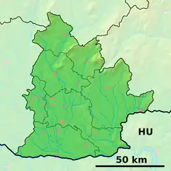  Vyšné nad Hronom Location of Vyšné nad Hronom in the Nitra Region  Vyšné nad Hronom Location of Vyšné nad Hronom in Slovakia | |
| Coordinates: 48°10′N 18°35′E / 48.17°N 18.58°E | |
| Country |  Slovakia |
| Region |  Nitra Region |
| District | Levice District |
| First mentioned | 1264 |
| Area | |
• Total | 6.47 km2 (2.50 sq mi) |
| Elevation | 153 m (502 ft) |
| Population | |
• Total | 175 |
| Time zone | UTC+1 (CET) |
| • Summer (DST) | UTC+2 (CEST) |
| Postal code | 935 31[2] |
| Area code | +421 36[2] |
| Vehicle registration plate (until 2022) | LV |
| Website | www |
Vyšné nad Hronom (Hungarian: Nagyod) is a village and municipality in the Levice District in the Nitra Region of Slovakia.
History
In historical records the village was first mentioned in 1264.
Geography
The municipality lies at an altitude of 153 metres (502 ft)[2] and covers an area of 6.47 km2 (2.50 sq mi) (2025).[1]
Population
| Year | 1995 | 2005 | 2015 | 2025 |
|---|---|---|---|---|
| Count | 192 | 184 | 185 | 175 |
| Difference | −4.16% | +0.54% | −5.40% |
| Year | 2024 | 2025 |
|---|---|---|
| Count | 176 | 175 |
| Difference | −0.56% |
It has a population of 175 people (31 December 2025).[5]
Ethnicity
| Ethnicity | Number | Fraction |
|---|---|---|
| Slovak | 92 | 52.57% |
| Hungarian | 78 | 44.57% |
| Not found out | 14 | 8% |
| Romani | 2 | 1.14% |
| Total | 175 |
In year 2021 was 175 people by ethnicity 92 as Slovak, 78 as Hungarian, 14 as Not found out and 2 as Romani.
Note on population: The difference values of population numbers in the table "Population statistic" and in the sections "Ethnicity" & "Religion" is caused by the use of various statistical methods.
Religion
| Religion | Number | Fraction |
|---|---|---|
| None | 56 | 32% |
| Roman Catholic Church | 55 | 31.43% |
| Calvinist Church | 48 | 27.43% |
| Not found out | 12 | 6.86% |
| Evangelical Church | 3 | 1.71% |
| Total | 175 |
In year 2021 was 175 people by religion 56 from None, 55 from Roman Catholic Church, 48 from Calvinist Church, 12 from Not found out, 3 from Evangelical Church and 1 from Church of the Brethren.
Facilities
The village has a public library and football pitch.
References
- 1 2 "Hustota obyvateľstva - obce [om7014rr_obc=AREAS_SK, v_om7014rr_ukaz=Rozloha (Štvorcový meter)]". Statistical Office of the Slovak Republic. 2026-03-31. Retrieved 2026-03-31.
- 1 2 3 4 "Základná charakteristika". www.statistics.sk (in Slovak). Statistical Office of the Slovak Republic. 2015-04-17. Retrieved 2022-03-31.
- ↑ "Počet obyvateľov podľa pohlavia - obce (ročne) [om7101rr_obce=AREAS_SK]". Statistical Office of the Slovak Republic. 2026-03-31. Retrieved 2026-03-31.
- 1 2 "Počet obyvateľov podľa pohlavia - obce (ročne) [om7101rr_obce=AREAS_SK]". Statistical Office of the Slovak Republic. 2026-03-31. Retrieved 2026-03-31.
- ↑ "Počet obyvateľov podľa pohlavia - obce (ročne) [om7101rr_obce=AREAS_SK]". Statistical Office of the Slovak Republic. 2026-03-31. Retrieved 2026-03-31.
- ↑ "Population - Basic results". www.scitanie.sk. Statistical Office of the Slovak republic. Retrieved 2025-11-03.
- ↑ "Population - Basic results". www.scitanie.sk. Statistical Office of the Slovak republic. Retrieved 2025-11-03.
- ↑ "Population - Basic results". www.scitanie.sk. Statistical Office of the Slovak republic. Retrieved 2025-11-03.