Pavlová
Pavlová
Garampáld | |
|---|---|
 | |
 Flag  Coat of arms | |
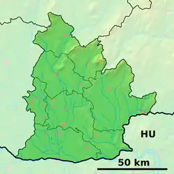  Pavlová Location of Pavlová in the Nitra Region  Pavlová Location of Pavlová in Slovakia | |
| Coordinates: 47°54′N 18°40′E / 47.90°N 18.67°E | |
| Country |  Slovakia |
| Region |  Nitra Region |
| District | Nové Zámky District |
| First mentioned | 1135 |
| Area | |
• Total | 7.61 km2 (2.94 sq mi) |
| Elevation | 126 m (413 ft) |
| Population | |
• Total | 200 |
| Time zone | UTC+1 (CET) |
| • Summer (DST) | UTC+2 (CEST) |
| Postal code | 943 59[2] |
| Area code | +421 36[2] |
| Vehicle registration plate (until 2022) | NZ |
| Website | www |
Pavlová (Hungarian: Garampáld) is a village and municipality in the Nové Zámky District in the Nitra Region of south-west Slovakia.
History
In historical records the village was first mentioned in 1135, under the name Pauli.[4]
Geography
The municipality lies at an altitude of 126 metres (413 ft)[2] and covers an area of 7.61 km2 (2.94 sq mi) (2025).[1]
Population
| Year | 1995 | 2005 | 2015 | 2025 |
|---|---|---|---|---|
| Count | 317 | 264 | 231 | 200 |
| Difference | −16.71% | −12.5% | −13.41% |
| Year | 2024 | 2025 |
|---|---|---|
| Count | 205 | 200 |
| Difference | −2.43% |
It has a population of 200 people (31 December 2025).[6]
Ethnicity
| Ethnicity | Number | Fraction |
|---|---|---|
| Hungarian | 191 | 89.67% |
| Slovak | 22 | 10.32% |
| Not found out | 10 | 4.69% |
| Total | 213 |
In year 2021 was 213 people by ethnicity 191 as Hungarian, 22 as Slovak, 10 as Not found out, 1 as Czech, 1 as Romani and 1 as Polish.
Note on population: The difference values of population numbers in the table "Population statistic" and in the sections "Ethnicity" & "Religion" is caused by the use of various statistical methods.
Religion
| Religion | Number | Fraction |
|---|---|---|
| Roman Catholic Church | 190 | 89.2% |
| None | 13 | 6.1% |
| Not found out | 6 | 2.82% |
| Total | 213 |
In year 2021 was 213 people by religion 190 from Roman Catholic Church, 13 from None, 6 from Not found out, 2 from Christian Congregations in Slovakia, 1 from Calvinist Church and 1 from Evangelical Church.
Facilities
The village has a small public library and a football pitch. The Roman Catholic church of St. Lawrence was founded in the village in 1810.[4]
References
- 1 2 "Hustota obyvateľstva - obce [om7014rr_obc=AREAS_SK, v_om7014rr_ukaz=Rozloha (Štvorcový meter)]". Statistical Office of the Slovak Republic. 2026-03-31. Retrieved 2026-03-31.
- 1 2 3 4 "Základná charakteristika". www.statistics.sk (in Slovak). Statistical Office of the Slovak Republic. 2015-04-17. Retrieved 2022-03-31.
- ↑ "Počet obyvateľov podľa pohlavia - obce (ročne) [om7101rr_obce=AREAS_SK]". Statistical Office of the Slovak Republic. 2026-03-31. Retrieved 2026-03-31.
- 1 2 Milan Paprčka; Simona Nádašiová (2016). Hont z neba. Banská Bystrica: CBS spol. ISBN 978-80-8144-109-7.
- 1 2 "Počet obyvateľov podľa pohlavia - obce (ročne) [om7101rr_obce=AREAS_SK]". Statistical Office of the Slovak Republic. 2026-03-31. Retrieved 2026-03-31.
- ↑ "Počet obyvateľov podľa pohlavia - obce (ročne) [om7101rr_obce=AREAS_SK]". Statistical Office of the Slovak Republic. 2026-03-31. Retrieved 2026-03-31.
- ↑ "Population - Basic results". www.scitanie.sk. Statistical Office of the Slovak republic. Retrieved 2025-11-03.
- ↑ "Population - Basic results". www.scitanie.sk. Statistical Office of the Slovak republic. Retrieved 2025-11-03.
- ↑ "Population - Basic results". www.scitanie.sk. Statistical Office of the Slovak republic. Retrieved 2025-11-03.