Montesquieu, Hérault
Montesquieu | |
|---|---|
 | |
 Coat of arms | |
Location of Montesquieu | |
  Montesquieu Location within France  Montesquieu Location within Occitanie | |
| Coordinates: 43°33′45″N 3°16′36″E / 43.5625°N 3.2767°E | |
| Country | France |
| Region | Occitania |
| Department | Hérault |
| Arrondissement | Béziers |
| Canton | Cazouls-lès-Béziers |
| Intercommunality | CC Les Avant-Monts |
| Government | |
| • Mayor (2020–2026) | Francis Castan[1] |
Area 1 | 14.47 km2 (5.59 sq mi) |
| Population (2023)[2] | 75 |
| • Density | 5.2/km2 (13/sq mi) |
| Time zone | UTC+01:00 (CET) |
| • Summer (DST) | UTC+02:00 (CEST) |
| INSEE/Postal code | 34168 /34320 |
| Elevation | 140–467 m (459–1,532 ft) (avg. 150 m or 490 ft) |
| 1 French Land Register data, which excludes lakes, ponds, glaciers > 1 km2 (0.386 sq mi or 247 acres) and river estuaries. | |
Montesquieu (French pronunciation: [mɔ̃tɛskjø]; Languedocien: Montesquiu) is a commune in the Hérault department in the Occitanie region in southern France.
Geography
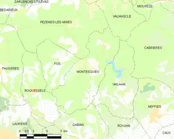
The original village of Montesquieu is in ruins. The commune has a number of hamlets: Mas Rolland, which has the town hall and the old school, Paders, near the valley of the Peyne, Fournols to the north of the commune and Valuzières towards the middle.
Population
| Year | Pop. | ±% p.a. |
|---|---|---|
| 1968 | 53 | — |
| 1975 | 35 | −5.76% |
| 1982 | 38 | +1.18% |
| 1990 | 47 | +2.69% |
| 1999 | 47 | +0.00% |
| 2007 | 58 | +2.66% |
| 2012 | 65 | +2.31% |
| 2017 | 70 | +1.49% |
| 2023 | 75 | +1.16% |
| Source: INSEE[3] | ||
See also
References
- ↑ "Répertoire national des élus: les maires". data.gouv.fr, Plateforme ouverte des données publiques françaises (in French). 9 August 2021.
- ↑ "Populations de référence 2023" (in French). National Institute of Statistics and Economic Studies. 18 December 2025.
- ↑ Population municipale entre 1968 et 2023, INSEE

Wikimedia Commons has media related to Montesquieu (Hérault).

Categories: