Faugères, Hérault
Faugères | |
|---|---|
 Faugères with vineyards in the foreground | |
 Coat of arms | |
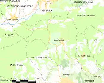
Location of Faugères | |
  Faugères Location within France  Faugères Location within Occitanie | |
| Coordinates: 43°33′59″N 3°11′24″E / 43.5664°N 3.19°E | |
| Country | France |
| Region | Occitania |
| Department | Hérault |
| Arrondissement | Béziers |
| Canton | Cazouls-lès-Béziers |
| Intercommunality | CC Les Avant-Monts |
| Government | |
| • Mayor (2020–2026) | Philippe Bouche[1] |
Area 1 | 26.06 km2 (10.06 sq mi) |
| Population (2023)[2] | 548 |
| • Density | 21.0/km2 (54.5/sq mi) |
| Time zone | UTC+01:00 (CET) |
| • Summer (DST) | UTC+02:00 (CEST) |
| INSEE/Postal code | 34096 /34600 |
| Elevation | 170–544 m (558–1,785 ft) (avg. 250 m or 820 ft) |
| 1 French Land Register data, which excludes lakes, ponds, glaciers > 1 km2 (0.386 sq mi or 247 acres) and river estuaries. | |
Faugères (French pronunciation: [foʒɛʁ] ⓘ; Languedocien: Faugièiras) is a commune in the Hérault department in southern France.
Faugères is known for its wine, Faugères AOC.
Faugères is also known for the old windmills that overlook the village from a nearby hill to the north. One of the windmills has now been restored using ancient techniques and may be seen in operation between June and September.
History
The castle of Faugères dates back to at least 1030AD, but it was heavily damaged during the Wars of Religion and today only small sections of the keep, the watch tower and castle wall remain.
Four Protestant churches have existed in Faugères over time and two remain today. The most recently built church dates from 1837 and was built with stones taken from the old castle ruins.
In the hills around Faugères are many capitelles, round dry-stone shelters with vaulted roofs, built to protect shepherds and farmers from the elements. These are many centuries old.
Population
| Year | Pop. | ±% p.a. |
|---|---|---|
| 1968 | 380 | — |
| 1975 | 359 | −0.81% |
| 1982 | 366 | +0.28% |
| 1990 | 360 | −0.21% |
| 1999 | 438 | +2.20% |
| 2007 | 467 | +0.80% |
| 2012 | 542 | +3.02% |
| 2017 | 515 | −1.02% |
| 2023 | 548 | +1.04% |
| Source: INSEE[3] | ||
Personalities
See also
References
- ↑ "Répertoire national des élus: les maires" (in French). data.gouv.fr, Plateforme ouverte des données publiques françaises. 13 September 2022.
- ↑ "Populations de référence 2023" (in French). National Institute of Statistics and Economic Studies. 18 December 2025.
- ↑ Population municipale entre 1968 et 2023, INSEE

