Portal:Cumbria

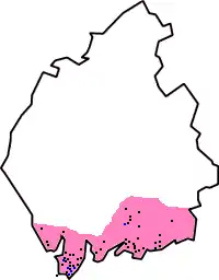
The Cumbria Portal Cumbria (/ˈkʌmbriə/ KUM-bree-ə) is a ceremonial county in North West England. It borders the Scottish council areas of Dumfries and Galloway and Scottish Borders to the north; the English ceremonial counties of Northumberland and County Durham to the east, North Yorkshire to the south-east, and Lancashire to the south; and the Irish Sea to the west. Its largest settlement is the city of Carlisle. Cumbria is predominantly rural, with an area of 6,769 km2 (2,614 sq mi) and an estimated population of 510,680 in 2024. Carlisle is in the north of the county; the towns of Workington and Whitehaven lie on the west coast, Barrow-in-Furness on the south coast, and Penrith and Kendal in the east. For local government purposes the county comprises two unitary authority areas, Westmorland and Furness and Cumberland, the councils of which collaborate through the Cumbria Combined Authority. Cumbria was created in 1974 from the historic counties of Cumberland and Westmorland, the Furness area of Lancashire, and a small part of Yorkshire. The interior of Cumbria contains several upland areas. Together they fringe the Vale of Eden, the wide valley of the River Eden, which runs south-east to north-west across the county and broadens into the Solway Plain near Carlisle. To the north-east are part of the Border Moors, and to the east part of the North Pennines; the latter have been designated a national landscape. South of the vale are the Orton Fells, Howgill Fells, and part of the Yorkshire Dales, which are all within the Yorkshire Dales national park. The south-west contains the Lake District, a large upland area which has been designated a national park and UNESCO World Heritage Site. It includes England's highest mountain, Scafell Pike; its longest and largest lake, Windermere; and its deepest lake, Wast Water. The county has a long coast to the west which is bordered by a plain for most of its length. The north-west coast is part of the Solway Firth, a national landscape, and the south coast includes the Cartmel and Furness peninsulas. East of the peninsulas, the county contains part of Arnside and Silverdale, another national landscape. (Full article...) Selected article -Barrow-in-Furness, commonly known as Barrow, is an industrial port town and civil parish in Westmorland and Furness, Cumbria, England. Historically in Lancashire, Barrow is at the tip of the Furness peninsula, 24 miles (39 km) south-west of Kendal and 18 miles (29 km) west of Lancaster. It is bordered by Morecambe Bay to the east, the Duddon Estuary to the west, and the Irish Sea to the south. In 2021, Barrow's population was 55,489, making it the second-largest urban area in Cumbria after Carlisle and the largest in Westmorland and Furness. In the Middle Ages, Barrow was a small hamlet, with its economy controlled by Furness Abbey. In the 19th century, iron prospector Henry Schneider, among other investors, opened the Furness Railway to transport iron ore and slate from local mines to the coast, which led to the construction of docks, now the Royal Port of Barrow. The discovery of hematite deposits allowed the steel industry to develop in the town, and for a period, its steelworks were the largest in the world. It was incorporated as a municipal borough in 1867, and the town's steel production and coastal location enabled it to develop as a centre for shipbuilding. Barrow is one of England's few planned towns and has a high level of heritage assets compared nationally. (Full article...) General imagesThe following are images from various Cumbria-related articles on Wikipedia.
Recognised content
Brougham Castle • HMS Cardiff (D108) • Norman Birkett, 1st Baron Birkett
File:Derwent Water, Keswick - June 2009.jpg • File:Helvellyn Striding Edge 360 Panorama, Lake District - June 09.jpg • File:Keswick, Cumbria Panorama 1 - June 2009.jpg • File:Keswick Panorama - Oct 2009.jpg • File:Catbells Northern Ascent, Lake District - June 2009.jpg • File:Glenridding, Cumbria, England - June 2009.jpg
Andrew Johnston (singer) • Askam and Ireleth • Brough Castle • Grayrigg derailment • Herdwick • Lady in the Lake trial • Nethermost Pike • The Story of a Fierce Bad Rabbit • The Story of Miss Moppet • The Tale of Benjamin Bunny • The Tale of Jemima Puddle-Duck • The Tale of Mr. Jeremy Fisher • The Tale of Mr. Tod • The Tale of Mrs. Tiggy-Winkle • The Tale of Mrs. Tittlemouse • The Tale of The Flopsy Bunnies • The Tale of Timmy Tiptoes Selected geographic feature -Ullswater is a glacial lake in Cumbria, England. It is part of the Lake District and is the second largest lake in the region by both area and volume, after Windermere. The lake is about 7 miles (11 km) long, 0.75 miles (1 km) wide, and has a maximum depth of 63 metres (207 ft). Its outflow is the River Eamont, which meets the River Eden at Brougham Castle before flowing into the Solway Firth. The lake historically formed part of the border between Cumberland and Westmorland. (Full article...) Subcategories Select [►] to view subcategories
WikiProjects WikiProjects related to Cumbria:
WikiProjects about things important to Cumbria:
TopicsSelected pictureRelated portalsTasks
Associated WikimediaThe following Wikimedia Foundation sister projects provide more on this subject:
Discover Wikipedia using portals
|