Peaceful Valley, Washington
Peaceful Valley | |
|---|---|
 Location of Peaceful Valley, Washington | |
| Coordinates: 48°57′02″N 122°08′54″W / 48.95056°N 122.14833°W | |
| Country | United States |
| State | Washington |
| County | Whatcom |
| Area | |
• Total | 17.0 sq mi (44.0 km2) |
| • Land | 16.9 sq mi (43.9 km2) |
| • Water | 0.039 sq mi (0.1 km2) |
| Elevation | 505 ft (154 m) |
| Population (2020) | |
• Total | 3,015 |
| • Density | 178/sq mi (68.7/km2) |
| Time zone | UTC-8 (Pacific (PST)) |
| • Summer (DST) | UTC-7 (PDT) |
| ZIP code | 98266[2] |
| Area code | 360 |
| FIPS code | 53-53800[3] |
| GNIS feature ID | 2409041[1] |
Peaceful Valley is a census-designated place (CDP) in Whatcom County, Washington, United States, near Kendall. The population was 3,015 at the 2020 census.[4]
Geography
According to the United States Census Bureau, the CDP has a total area of 17.0 square miles (44.0 km2), of which, 16.9 square miles (43.9 km2) of it is land and 0.1 square miles (0.1 km2) of it (0.29%) is water.
Demographics
| Census | Pop. | Note | %± |
|---|---|---|---|
| 2000 | 2,448 | — | |
| 2010 | 3,324 | 35.8% | |
| 2020 | 3,015 | −9.3% | |
| U.S. Decennial Census[5] 1970[6] 1980[7] 1990[8] 2000[9] 2010[10] | |||
Peaceful Valley first appeared as a census designated place in the 2000 U.S. census.[9]
Racial and ethnic composition
| Race / Ethnicity (NH = Non-Hispanic) | Pop 2000[11] | Pop 2010[12] | Pop 2020[13] | % 2000 | % 2010 | % 2020 |
|---|---|---|---|---|---|---|
| White alone (NH) | 2,214 | 2,838 | 2,233 | 90.44% | 85.38% | 74.06% |
| Black or African American alone (NH) | 7 | 18 | 14 | 0.29% | 0.54% | 0.46% |
| Native American or Alaska Native alone (NH) | 46 | 77 | 59 | 1.88% | 2.32% | 1.96% |
| Asian alone (NH) | 10 | 25 | 38 | 0.41% | 0.75% | 1.26% |
| Native Hawaiian or Pacific Islander alone (NH) | 4 | 3 | 12 | 0.16% | 0.09% | 0.40% |
| Other race alone (NH) | 3 | 5 | 10 | 0.12% | 0.15% | 0.33% |
| Mixed race or Multiracial (NH) | 60 | 104 | 283 | 2.45% | 3.13% | 9.39% |
| Hispanic or Latino (any race) | 104 | 254 | 366 | 4.25% | 7.64% | 12.14% |
| Total | 2,448 | 3,324 | 3,015 | 100.00% | 100.00% | 100.00% |
2000 census
As of the census[3] of 2000, there were 2,448 people, 787 households, and 571 families residing in the CDP. The population density was 144.5 people per square mile (55.8/km2). There were 1,156 housing units at an average density of 68.3/sq mi (26.3/km2). The racial makeup of the CDP was 92.24% White, 0.29% African American, 2.21% Native American, 0.45% Asian, 0.20% Pacific Islander, 1.18% from other races, and 3.43% from two or more races. Hispanic or Latino of any race were 4.25% of the population.
There were 787 households, out of which 45.0% had children under the age of 18 living with them, 53.9% were married couples living together, 11.4% had a female householder with no husband present, and 27.4% were non-families. 18.6% of all households were made up of individuals, and 3.2% had someone living alone who was 65 years of age or older. The average household size was 3.11 and the average family size was 3.61.
In the CDP, the age distribution of the population shows 38.1% under the age of 18, 8.8% from 18 to 24, 30.9% from 25 to 44, 16.8% from 45 to 64, and 5.4% who were 65 years of age or older. The median age was 28 years. For every 100 females, there were 105.0 males. For every 100 females age 18 and over, there were 103.6 males.
The median income for a household in the CDP was $32,357, and the median income for a family was $34,141. Males had a median income of $31,853 versus $19,833 for females. The per capita income for the CDP was $12,733. About 27.7% of families and 36.4% of the population were below the poverty line, including 52.8% of those under age 18 and none of those age 65 or over.
Since the 1990s the community has experienced a considerable influx of Russians and Russian Americans, many of whom are evangelical Christians who were granted asylum in the United States.[14] 34.7% of the children and 24% of the general population speak Russian as a first language and 12.2% of the population were born in Russia.[15]
Education
The community is served by the Mount Baker School District.[16]
References
- 1 2 U.S. Geological Survey Geographic Names Information System: Peaceful Valley, Washington
- ↑ "Peaceful Valley WA ZIP Code". zipdatamaps.com. 2023. Retrieved January 26, 2023.
- 1 2 "U.S. Census website". United States Census Bureau. Retrieved January 31, 2008.
- ↑ "Census Bureau profile: Peaceful Valley, Washington". United States Census Bureau. May 2023. Retrieved May 9, 2024.
- ↑ "Decennial Census by Decade". United States Census Bureau.
- ↑ "1970 Census of Population - Number of Inhabitants - Washington" (PDF). United States Census Bureau. Archived from the original (PDF) on March 28, 2023.
- ↑ "1980 Census of Population - Number of Inhabitants - Washington" (PDF). United States Census Bureau. Archived from the original (PDF) on December 19, 2025 – via Wayback Machine.
- ↑ "1990 Census of Population - General Population Characteristics - Washington" (PDF). United States Census Bureau. Archived from the original (PDF) on December 22, 2025 – via Wayback Machine.
- 1 2 "2000 Census of Population - Population and Housing Unit Counts - Washington" (PDF). United States Census Bureau. Archived from the original (PDF) on March 26, 2025 – via Wayback Machine.
- ↑ "2010 Census of Population - Population and Housing Unit Counts - Washington" (PDF). United States Census Bureau. Archived from the original (PDF) on April 24, 2025 – via Wayback Machine.
- ↑ "P004: Hispanic or Latino, and Not Hispanic or Latino by Race – 2000: DEC Summary File 1 – Peaceful Valley CDP, Washington". United States Census Bureau.
- ↑ "P2: Hispanic or Latino, and Not Hispanic or Latino by Race – 2010: DEC Redistricting Data (PL 94-171) – Peaceful Valley CDP, Washington". United States Census Bureau.
- ↑ "P2: Hispanic or Latino, and Not Hispanic or Latino by Race – 2020: DEC Redistricting Data (PL 94-171) – Peaceful Valley CDP, Washington". United States Census Bureau.
- ↑ Cook, Rebecca. "Russians drawn to Peaceful Valley enclave". The Seattle Times. Retrieved January 12, 2016.
- ↑ "Data Center Results". Archived from the original on June 19, 2006. Retrieved August 10, 2013.
- ↑ U.S. Census Bureau Geography Division (January 14, 2021). 2020 Census – School District Reference Map: Whatcom County, WA (PDF) (Map). 1:140,000. U.S. Census Bureau. p. 2. Retrieved March 16, 2025.
Municipalities and communities of Whatcom County, Washington, United States | ||
|---|---|---|
| Cities | 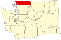 | |
| CDPs | ||
| Indian reservations | ||
| Unincorporated communities | ||
| Ghost towns | ||