Geneva, Washington
Geneva, Washington | |
|---|---|
 Location of Geneva, Washington | |
| Coordinates: 48°44′54″N 122°24′19″W / 48.74833°N 122.40528°W | |
| Country | United States |
| State | Washington |
| County | Whatcom |
| Area | |
• Total | 1.3 sq mi (3.3 km2) |
| • Land | 1.0 sq mi (2.7 km2) |
| • Water | 0.23 sq mi (0.6 km2) |
| Elevation | 476 ft (145 m) |
| Population (2020) | |
• Total | 2,652 |
| • Density | 2,500/sq mi (980/km2) |
| Time zone | UTC-8 (Pacific (PST)) |
| • Summer (DST) | UTC-7 (PDT) |
| FIPS code | 53-26420[2] |
| GNIS feature ID | 2408288[1] |
Geneva is an unincorporated area and census-designated place (CDP) in Whatcom County, Washington, United States. The population was 2,652 at the 2020 census.[3]
Based on per capita income, Geneva ranks 85th of 522 areas in the state of Washington to be ranked. It is also the highest rank achieved in Whatcom County.
Geography
According to the United States Census Bureau, the CDP has a total area of 1.3 square miles (3.3 km2), of which, 1.0 square miles (2.7 km2) of it is land and 0.2 square miles (0.6 km2) of it (18.75%) is water.
Demographics
| Census | Pop. | Note | %± |
|---|---|---|---|
| 2000 | 2,257 | — | |
| 2010 | 2,321 | 2.8% | |
| 2020 | 2,652 | 14.3% | |
| U.S. Decennial Census[4] 1970[5] 1980[6] 1990[7] 2000[8] 2010[9] | |||
Geneva first appeared as a census designated place in the 2000 U.S. census.[8]
Racial and ethnic composition
| Race / Ethnicity (NH = Non-Hispanic) | Pop 2000[10] | Pop 2010[11] | Pop 2020[12] | % 2000 | % 2010 | % 2020 |
|---|---|---|---|---|---|---|
| White alone (NH) | 2,127 | 2,087 | 2,254 | 94.24% | 89.92% | 84.99% |
| Black or African American alone (NH) | 5 | 18 | 16 | 0.22% | 0.78% | 0.60% |
| Native American or Alaska Native alone (NH) | 19 | 16 | 22 | 0.84% | 0.69% | 0.83% |
| Asian alone (NH) | 17 | 42 | 78 | 0.75% | 1.81% | 2.94% |
| Native Hawaiian or Pacific Islander alone (NH) | 1 | 0 | 4 | 0.04% | 0.00% | 0.15% |
| Other race alone (NH) | 6 | 13 | 8 | 0.27% | 0.56% | 0.30% |
| Mixed race or Multiracial (NH) | 25 | 47 | 169 | 1.11% | 2.02% | 6.37% |
| Hispanic or Latino (any race) | 57 | 98 | 101 | 2.53% | 4.22% | 3.81% |
| Total | 2,257 | 2,321 | 2,652 | 100.00% | 100.00% | 100.00% |
2000 census
As of the census[2] of 2000, there were 2,257 people, 778 households, and 655 families residing in the CDP. The population density was 2,166.6 people per square mile (837.9/km2). There were 809 housing units at an average density of 776.6/sq mi (300.3/km2). The racial makeup of the CDP was 95.92% White, 0.22% African American, 0.84% Native American, 0.75% Asian, 0.04% Pacific Islander, 0.97% from other races, and 1.24% from two or more races. Hispanic or Latino of any race were 2.53% of the population.
There were 778 households, out of which 43.6% had children under the age of 18 living with them, 73.9% were married couples living together, 6.7% had a female householder with no husband present, and 15.8% were non-families. 11.7% of all households were made up of individuals, and 3.2% had someone living alone who was 65 years of age or older. The average household size was 2.90 and the average family size was 3.11.
In the CDP, the age distribution of the population shows 29.5% under the age of 18, 6.6% from 18 to 24, 27.5% from 25 to 44, 27.9% from 45 to 64, and 8.6% who were 65 years of age or older. The median age was 38 years. For every 100 females, there were 100.4 males. For every 100 females age 18 and over, there were 96.3 males.
The median income for a household in the CDP was $65,324, and the median income for a family was $71,389. Males had a median income of $48,103 versus $40,089 for females. The per capita income for the CDP was $25,374. None of the families and 2.0% of the population were living below the poverty line, including no under eighteens and none of those over 64.
Education
The community is served by the Bellingham School District.[13]
Schools where the CDP is zoned to include:[14]
- The majority of the CDP is zoned to Geneva Elementary School. Separate parts are zoned to Carl Cozier and Silver Beach elementary schools.[15]
- Kulshan Middle School[16]
- The CDP is divided between the zones of Bellingham High School and Sehome High School.[17]
References
- 1 2 U.S. Geological Survey Geographic Names Information System: Geneva, Washington
- 1 2 "U.S. Census website". United States Census Bureau. Retrieved January 31, 2008.
- ↑ "Census Bureau profile: Geneva, Washington". United States Census Bureau. May 2023. Retrieved May 9, 2024.
- ↑ "Decennial Census by Decade". United States Census Bureau.
- ↑ "1970 Census of Population - Number of Inhabitants - Washington" (PDF). United States Census Bureau. Archived from the original (PDF) on March 28, 2023.
- ↑ "1980 Census of Population - Number of Inhabitants - Washington" (PDF). United States Census Bureau. Archived from the original (PDF) on December 19, 2025 – via Wayback Machine.
- ↑ "1990 Census of Population - General Population Characteristics - Washington" (PDF). United States Census Bureau. Archived from the original (PDF) on December 22, 2025 – via Wayback Machine.
- 1 2 "2000 Census of Population - Population and Housing Unit Counts - Washington" (PDF). United States Census Bureau. Archived from the original (PDF) on March 26, 2025 – via Wayback Machine.
- ↑ "2010 Census of Population - Population and Housing Unit Counts - Washington" (PDF). United States Census Bureau. Archived from the original (PDF) on April 24, 2025 – via Wayback Machine.
- ↑ "P004: Hispanic or Latino, and Not Hispanic or Latino by Race – 2000: DEC Summary File 1 – Geneva CDP, Washington". United States Census Bureau.
- ↑ "P2: Hispanic or Latino, and Not Hispanic or Latino by Race – 2010: DEC Redistricting Data (PL 94-171) – Geneva CDP, Washington". United States Census Bureau.
- ↑ "P2: Hispanic or Latino, and Not Hispanic or Latino by Race – 2020: DEC Redistricting Data (PL 94-171) – Geneva CDP, Washington". United States Census Bureau.
- ↑ U.S. Census Bureau Geography Division (January 14, 2021). 2020 Census – School District Reference Map: Whatcom County, WA (PDF) (Map). 1:140,000. U.S. Census Bureau. Retrieved March 16, 2025.
- ↑ "2020 CENSUS - CENSUS BLOCK MAP: Geneva CDP, WA" (PDF). U.S. Census Bureau. Retrieved March 16, 2025.
- ↑ "Elementary School Attendance Areas Effective Fall 2017" (PDF). Bellingham Public Schools. Retrieved March 16, 2025.
- ↑ "Middle School Attendance Areas Effective Fall 2017" (PDF). Bellingham Public Schools. Retrieved March 16, 2025.
- ↑ "High School Attendance Areas Effective Fall 2017" (PDF). Bellingham Public Schools. Retrieved March 16, 2025.
Municipalities and communities of Whatcom County, Washington, United States | ||
|---|---|---|
| Cities | 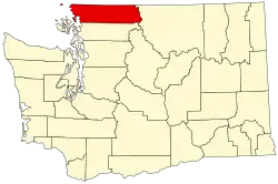 | |
| CDPs | ||
| Indian reservations | ||
| Unincorporated communities | ||
| Ghost towns | ||