Nugents Corner, Washington
Nugents Corner | |
|---|---|
Interactive map of Nugents Corner | |
| Coordinates: 48°50′36.42″N 122°17′17.57″W / 48.8434500°N 122.2882139°W | |
| Country | United States |
| State | Washington |
| County | Whatcom |
| Government | |
| • Type | Unincorporated community |
| • Body | Whatcom County |
| Elevation | 161 ft (49 m) |
| Time zone | UTC–8 (Pacific (PST)) |
| • Summer (DST) | UTC–7 (PDT) |
| ZIP Code | 98247 |
| Area codes | 360, 564 |
| GNIS feature ID | 1513944[1] |
Nugents Corner (previously North Cedarville) is an unincorporated community in Whatcom County, Washington, United States. It is located along State Route 542 where it intersects with State Route 9, along the Nooksack River.
History
Before 1991, the official name of the community was North Cedarville, after the Cedarville Shingle Company.[2] The state of Washington officially changed the name to Nugents Corner in 1991.[1][3]
There are several stories pertaining to the current name of the community. Lottie Roeder Roth's 1926 book History of Whatcom County mentions Peter Nugent, a homesteader who lived in the area in the 1870s and ran a ferry service across the Nooksack.[4]: 954 Not much is known about Peter Nugent, some sources describing him as an Irishman and others a native. Another theory attributes the name to a merchant named Henry Nugent. An immigrant from Canada of Irish descent, Nugent moved to Whatcom County in 1888, first living on Lummi Island. In 1910, he opened a store at Nugents Corner. It is unclear if the area was already called that at the time.[5]
In 1893 a plank bridge was built over the Nooksack River at Nugents Corner, which became a part of the highway from Bellingham to Mount Baker.[4]: 435 This bridge has been replaced twice since then, first with a truss bridge, and then in 1999 with a concrete bridge.[6]
Recreation
In 2004, Whatcom County Parks and Recreation acquired 14.2 acres (5.7 ha) of land in Nugents Corner and established a park. The park has 0.5 miles (0.80 km) of trails, and allows access to the river via trail or boat ramp.[7][8]
See also
- Cedarville, Whatcom County, Washington, directly across the river from Nugents Corner
- List of unincorporated communities in Washington
References
- 1 2 3 U.S. Geological Survey Geographic Names Information System: Nugents Corner, Washington
- ↑ Meany, Edmond S. (1923). Origin of Washington geographic names. Seattle: University of Washington Press. p. 41. hdl:2027/mdp.39015027074981. OCLC 1963675.
- ↑ "State panel officially names 3 county areas". The Bellingham Herald. Bellingham, Washington. September 21, 1991. p. B1. Retrieved June 17, 2026 – via newspapers.com.
- 1 2 Roth, Lottie Roeder, ed. (1926). History of Whatcom County. Vol. 1. Seattle: Pioneer Historical Publishing Company. hdl:2027/nyp.33433102027335. OCLC 48925491.
- ↑ Kahn, Dean (July 16, 2006). "Tracking down the Nugent of Nugents (or Nugent's) Corner". The Bellingham Herald. Bellingham, Washington. p. B1, B4.
- ↑ Stark, John (July 28, 2003). "Residents gather to watch span come down". The Bellingham Herald. Bellingham, Washington. pp. A1–A2.
- ↑ "Nugent's Corner River Access". www.whatcomcounty.us. Whatcom County, Washington. Retrieved June 17, 2026.
- ↑ Upper Nooksack River Recreation Plan (PDF). Upper Nooksack River Recreation Plan Advisory Committee. March 2015. p. 51. OCLC 1322220535.
Municipalities and communities of Whatcom County, Washington, United States | ||
|---|---|---|
| Cities | 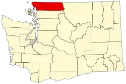 | |
| CDPs | ||
| Indian reservations | ||
| Unincorporated communities | ||
| Ghost towns | ||