Longfellow (neighborhood), Minneapolis
Longfellow | |
|---|---|
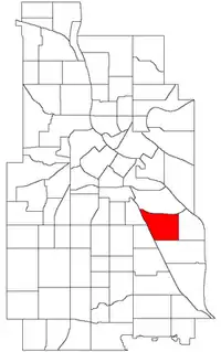 Location of Longfellow within the U.S. city of Minneapolis | |
Interactive map of Longfellow | |
| Country | United States |
| State | Minnesota |
| County | Hennepin |
| City | Minneapolis |
| Community | Longfellow |
| City Council Ward | 12 |
| Government | |
| • Council Member | Aurin Chowdhury |
| Area | |
• Total | 0.852 sq mi (2.21 km2) |
| Population (2020)[2] | |
• Total | 5,086 |
| • Density | 5,970/sq mi (2,300/km2) |
| Time zone | UTC-6 (CST) |
| • Summer (DST) | UTC-5 (CDT) |
| ZIP code | 55406 |
| Area code | 612 |
| Census | Pop. | Note | %± |
|---|---|---|---|
| 1980 | 5,078 | — | |
| 1990 | 5,023 | −1.1% | |
| 2000 | 4,972 | −1.0% | |
| 2010 | 4,895 | −1.5% | |
| 2020 | 5,086 | 3.9% |
Longfellow is a neighborhood within the larger Longfellow community in Minneapolis, United States. It is bounded by Seward to the North, Cooper to the East, Howe to the South, and Corcoran and East Phillips to the West. It is part of Minneapolis City Council Ward 12, represented by Aurin Chowdhury.[3]
History
Longfellow was named after Henry Wadsworth Longfellow, who wrote The Song of Hiawatha.
Longfellow was the center point of riots during the George Floyd protests in Minneapolis–Saint Paul in May 2020.[4]44°56′26″N 93°13′23″W / 44.9405°N 93.2231°W[5]
Neighborhood Characteristics
Longfellow is populated by a diverse, predominantly middle-class and working-class population.
Notable buildings include:
- Christ Church Lutheran, designed by Eliel Saarinen
- First Free Methodist
- East Lake Library
Demographics
In 2016, the neighborhood had a population of 5,176.[2] The neighborhood is ethnically diverse at 57.6% European American, 18.8% African American, 12.6% Hispanic or Latino, 4.4% of Two or more races, and 2.8% Asian American.[2]
| Race/ethnicity | ||||||
|---|---|---|---|---|---|---|
| 2000[7] | 2010[7] | 2020[7] | ||||
| Number | % | Number | % | Number | % | |
| White alone | 3,375 | 67.88 | 3,035 | 61.93 | 3,073 | 60.55 |
| Black alone | 525 | 10.56 | 678 | 13.83 | 756 | 14.90 |
| Hispanic or Latino (any race) | 483 | 9.71 | 686 | 14.00 | 702 | 13.83 |
| Native American alone | 196 | 3.94 | 192 | 3.92 | 106 | 2.09 |
| Asian alone | 168 | 3.38 | 87 | 1.78 | 117 | 2.31 |
| Other race alone | 21 | 0.42 | 5 | 0.10 | 27 | 0.53 |
| Pacific Islander alone | 0 | 0.00 | 4 | 0.08 | 1 | 0.02 |
| Two or more races | 204 | 4.10 | 214 | 4.37 | 296 | 5.83 |
| Total | 4,972 | 100.0 | 4,901 | 100.0 | 5,075 | 100.0 |
See also
References
- ↑ "Longfellow neighborhood in Minneapolis, Minnesota (MN), 55404, 55406 detailed profile". City-Data. 2011. Retrieved November 12, 2013.
- 1 2 3 "Longfellow neighborhood data". Minnesota Compass. Retrieved February 19, 2023.
- ↑ "Find My Ward". City of Minneapolis. Retrieved April 19, 2024.
- ↑ Bachman, Erin Ailworth and Rachel (May 29, 2020). "The Minneapolis Neighborhood at the Center of Protests Over George Floyd's Death". Wall Street Journal. ISSN 0099-9660. Retrieved April 20, 2021.
- ↑ Longfellow, Minneapolis, MN. Google Earth. Retrieved 2011-03-09.
- ↑ Longfellow, Minneapolis, MN. Google Earth. Retrieved 2011-03-09.
- 1 2 3 "2000 - 2020 Minneapolis demographic changes by neighborhood dashboard". www.minneapolismn.gov. Retrieved June 13, 2024.
External links
- The neighborhood by the falls at the Longfellow Community Council.
Places adjacent to Longfellow (neighborhood), Minneapolis | ||||||||||||||||
|---|---|---|---|---|---|---|---|---|---|---|---|---|---|---|---|---|
| ||||||||||||||||


