Jordan, Minneapolis
45°00′22″N 93°18′08″W / 45.0060°N 93.3022°W[1]
Jordan | |
|---|---|
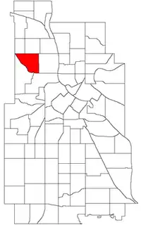 Location of Jordan within the U.S. city of Minneapolis | |
Interactive map of Jordan | |
| Country | United States |
| State | Minnesota |
| County | Hennepin |
| City | Minneapolis |
| Community | Near North |
| Founded | 1849 |
| City Council wards | 4, 5 |
| Government | |
| • Council member | LaTrisha Vetaw |
| • Council member | Pearll Warren |
| Area | |
• Total | 0.772 sq mi (2.00 km2) |
| Population (2020)[4] | |
• Total | 8,548 |
| • Density | 11,100/sq mi (4,280/km2) |
| Time zone | UTC-6 (CST) |
| • Summer (DST) | UTC-5 (CDT) |
| ZIP code | 55411 |
| Area code | 612 |
| Census | Pop. | Note | %± |
|---|---|---|---|
| 1980 | 7,861 | — | |
| 1990 | 7,737 | −1.6% | |
| 2000 | 9,149 | 18.2% | |
| 2010 | 7,360 | −19.6% | |
| 2020 | 8,548 | 16.1% |
Jordan is a neighborhood in the Near North community in Minneapolis. Its boundaries are Lowry Avenue North to the north, Emerson Avenue North to the east, and West Broadway to the south and west.
It is primarily located in city council ward 5, though a small portion west of Queen Avenue N is in ward 4.[5] In the Minnesota Legislature, Jordan is in district 59A.[6]
History
The neighborhood is named after Jordan Junior High, which in turn was named after Charles Jordan, the former superintendent of the Minneapolis Public Schools.[7] The school was built in 1922 and demolished in 1985. Jordan Park sits on the former school location.
Demographics
| Race/ethnicity | ||||||
|---|---|---|---|---|---|---|
| 2000[8] | 2010[8] | 2020[8] | ||||
| Number | % | Number | % | Number | % | |
| White alone | 2,053 | 22.44 | 1,325 | 18.00 | 1,428 | 16.71 |
| Black alone | 4,476 | 48.92 | 3,595 | 48.85 | 3,982 | 46.58 |
| Hispanic or Latino (any race) | 386 | 4.22 | 611 | 8.30 | 1,139 | 13.32 |
| Native American alone | 153 | 1.67 | 89 | 1.21 | 145 | 1.70 |
| Asian alone | 1,568 | 17.14 | 1,353 | 18.38 | 1,275 | 14.92 |
| Other race alone | 18 | 0.20 | 24 | 0.33 | 72 | 0.84 |
| Pacific Islander alone | 16 | 0.17 | 1 | 0.01 | 4 | 0.05 |
| Two or more races | 479 | 5.24 | 362 | 4.92 | 503 | 5.88 |
| Total | 9,149 | 100.0 | 7,360 | 100.0 | 8,548 | 100.0 |
Jordan Area Community Council
Jordan Area Community Council was originally established in 1964, and was designated as a 501 (c) 3 non-profit organization in 1965. The Jordan Area Community Council was initially established by residents organizing in the Jordan neighborhood to prevent the closure of the North Branch Public Library.
The Jordan Area Community Council is led by a Board of Directors made up of Jordan neighborhood residents. They are funded by donors, foundational grant funds, as well as State and Federal grant funds.
The Jordan Area Community Council works on active community engagement, advocacy, and holds events for residents on a monthly basis. They send out an online newsletter monthly. Jordan Area Community Council distributes everyday, essential items to residents who need them, such as food, clothing items, diapers, and first aid kits.
See also
References
- ↑ Jordan, Minneapolis, MN. Google Earth. Retrieved 2011-03-09.
- ↑ Jordan, Minneapolis, MN. Google Earth. Retrieved 2011-03-09.
- ↑ "Jordan neighborhood in Minneapolis, Minnesota (MN), 55411 detailed profile". City-Data. 2011. Retrieved November 17, 2013.
- ↑ "Jordan neighborhood data". Minnesota Compass. Retrieved February 19, 2023.
- ↑ "Find My Ward". City of Minneapolis. Retrieved April 19, 2024.
- ↑ "Minnesota Legislative Maps". Office of the Minnesota Secretary of State. Retrieved January 10, 2025.
- ↑ "Minneapolis Near North Community Neighborhood Boundary Signs". www.johnweeks.com. Retrieved October 30, 2023.
- 1 2 3 "2000 - 2020 Minneapolis demographic changes by neighborhood dashboard". www.minneapolismn.gov. Retrieved June 13, 2024.
External links
- Minneapolis Neighborhood Profile - Jordan
- Jordan Area Community Council
- MN Compass Neighborhood Facts
Places adjacent to Jordan, Minneapolis | |
|---|---|


