Flores, Pernambuco
Flores | |
|---|---|
 Flag  Coat of arms | |
 Location in Pernambuco state | |
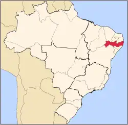
  Flores Location in Brazil | |
| Coordinates: 7°51′57″S 37°58′30″W / 7.86583°S 37.97500°W | |
| Country | Brazil |
| Region | Northeast |
| State | Pernambuco |
| Mesoregion | Sertão Pernambucano |
| Area | |
• Total | 996 km2 (385 sq mi) |
| Population | |
• Total | 20,347 |
| 20,776 | |
| • Density | 20.4/km2 (52.9/sq mi) |
| Time zone | UTC−3 (BRT) |
Flores (Central northeastern portuguese pronunciation: [ˈfloɾis]) (Portuguese for "Flowers") is a municipality (município) in the state of Pernambuco in Brazil. The population is 20,776 (2025 est.) in an area of 995.56 km2.[1]
Geography
Economy
The main economic activities in Flores are based in agribusiness, especially creation of cattle and their milk, goats, sheep and plantations with beans, corn and guava (goiaba).
Economic Indicators
| Population | GDP x(1000 R$).[2] | GDP pc (R$) | PE |
|---|---|---|---|
| 23.034 | 59.354 | 2.703 | 0.097% |
Economy by Sector
| Primary sector | Secondary sector | Service sector |
|---|---|---|
| 20.39% | 9.10% | 70.51% |
Health Indicators
Source:[3]
| HDI (2000) | Hospitals (2007) | Hospitals beds (2007) | Children's mortality every 1000 (2005) |
|---|---|---|---|
| 0.613 | 1 | 22 | 27.5 |
See also
References
- 1 2 3 Brazilian Institute of Geography and Statistics (IBGE). "IBGE 2025".
- ↑ Flores 2007 GDP IBGE page 31 Archived March 4, 2016, at the Wayback Machine
- ↑ "PE State site - City by city profile". Archived from the original on 2009-08-04. Retrieved 2009-07-31.
Capital: Recife | ||||||||||||||
| Mesoregion Agreste Pernambucano |
|  | ||||||||||||
| Mesoregion Mata Pernambucana |
| |||||||||||||
| Mesoregion Metropolitana de Recife |
| |||||||||||||
| Mesoregion Sao Francisco Pernambucano |
| |||||||||||||
| Mesoregion Sertão Pernambucano |
| |||||||||||||
