Cumaru
Cumaru | |
|---|---|
 View of Cumaru | |
 Flag  Coat of arms | |
| Motto: | |
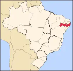
 Location of Cumaru in Pernambuco | |
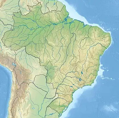  Cumaru Location within Brazil  Cumaru Location within South America | |
| Coordinates: 8°0′21″S 35°41′49″W / 8.00583°S 35.69694°W | |
| Country |  Brazil |
| Region | Northeast |
| State |  Pernambuco |
| Founded | 20 December 1963[2] |
| Government | |
| • Mayor | Maria Zeneide Medeiros da Costa (PSB) (2025-2028)[3][4] |
| • Vice Mayor | José Gomes da Silva Filho (PSB) (2025-2028)[3][4]' |
| Area | |
• Total | 291.429 km2 (112.521 sq mi) |
| Elevation | 443 m (1,453 ft) |
| Population | |
• Total | 15,920 |
| 16,215 | |
| • Density | 54.48/km2 (141.1/sq mi) |
| Demonym | Cumaruense (Brazilian Portuguese)[5] |
| Time zone | UTC-03:00 (Brasília Time) |
| Postal code | 55655-000, 55658-000[7] |
| HDI (2010) | 0.572 – medium[5] |
| Website | cumaru.pe.gov.br |
Cumaru (Central northeastern portuguese pronunciation: [kumɐˈɾu]) is a city in the state of Pernambuco, Brazil. It is 132 km away from the state capital Recife, and has an estimated (IBGE 2020) population of 10,192 inhabitants.[8]
Geography
- State - Pernambuco
- Region - Agreste Pernambucano
- Boundaries - Surubim (N); Bezerros (S); Passira (E); Riacho das Almas (W).
- Area - 292.24 km2
- Elevation - 443 m
- Hydrography - Capibaribe River
- Vegetation - Caatinga hipoxerófila
- Climate - Semi arid hot
- Annual average temperature - 25.0 c
- Distance to Recife - 132 km
Economy
The main economic activities in Cumaru are based in agribusiness, especially beans, corn; and livestock such as cattle, sheep, goats, pigs and poultry.
Economic indicators
| Population[9] | GDP x(1000 R$).[10] | GDP pc (R$) | PE |
|---|---|---|---|
| 13.812 | 52.455 | 3.201 | 0.09% |
Economy by Sector 2006
| Primary sector | Secondary sector | Service sector |
|---|---|---|
| 7.41% | 8.39% | 84.20% |
Health indicators
| HDI (2000) | Hospitals (2007) | Hospitals beds (2007) | Children's Mortality every 1000 (2005) |
|---|---|---|---|
| 0.575 | 1 | 31 | 49.7 |
Gallery
 Rural area view of Cumaru
 Parish of Saint Therese Church
 Virginia Heraclio Plaza
 Cumaru Courthouse
 Cumaru Correios post office
 Cumaru City Hall
 Cumaru Municipal Council
 Municipal hotel
 Public Market
See also
References
- ↑ "Hino de Cumaru". Poder Executivo de Cumaru - PE (in Brazilian Portuguese). Poder Executivo de Cumaru - PE. Retrieved 30 January 2025.
- ↑ "História & Fotos". Instituto Brasileiro de Geografia e Estatística (in Brazilian Portuguese). Instituto Brasileiro de Geografia e Estatística. Retrieved 30 January 2025.
- 1 2 "Eleições 2024: Zeneide Medeiros (PSB) | Candidato(a) a prefeito(a) de Cumaru-PE". Folha de S.Paulo (in Brazilian Portuguese). Folha de S.Paulo. 30 November 2024. Retrieved 30 January 2025.
- 1 2 "Prefeita de Cumaru (PE) toma posse nesta quarta (1º); veja lista de vereadores eleitos". G1 (in Brazilian Portuguese). Globo. 31 December 2024. Retrieved 30 January 2025.
- 1 2 3 "Cumaru". Instituto Brasileiro de Geografia e Estatística (in Brazilian Portuguese). Instituto Brasileiro de Geografia e Estatística. Retrieved 30 January 2025.
- ↑ Brazilian Institute of Geography and Statistics (IBGE). "IBGE 2025".
- ↑ "CEP Cumaru/PE - Brasil". codigo-postal.org (in Brazilian Portuguese). codigo-postal.org. Retrieved 30 January 2025.
- ↑ IBGE 2020
- ↑ http://www.ibge.gov.br/home/estatistica/populacao/estimativa2009/POP2009_DOU.pdfIBGE Population 2009 Cumaru, page 32]
- ↑ Cumaru 2007 GDP IBGE page 29 Archived 4 March 2016 at the Wayback Machine
- ↑ PE State site - City by city profile

Wikimedia Commons has media related to Cumaru.
Capital: Recife | ||||||||||||||
| Mesoregion Agreste Pernambucano |
|  | ||||||||||||
| Mesoregion Mata Pernambucana |
| |||||||||||||
| Mesoregion Metropolitana de Recife |
| |||||||||||||
| Mesoregion Sao Francisco Pernambucano |
| |||||||||||||
| Mesoregion Sertão Pernambucano |
| |||||||||||||