Underhill Flats, Vermont
Underhill Flats, Vermont | |
|---|---|
  Underhill Flats Location within Vermont  Underhill Flats Location within the United States | |
| Coordinates: 44°31′24″N 72°56′46″W / 44.52333°N 72.94611°W | |
| Country | United States |
| State | Vermont |
| County | Chittenden |
| Towns | Underhill Jericho |
| Area | |
• Total | 0.75 sq mi (1.94 km2) |
| • Land | 0.75 sq mi (1.94 km2) |
| • Water | 0 sq mi (0.0 km2) |
| Elevation | 705 ft (215 m) |
| Time zone | UTC-5 (Eastern (EST)) |
| • Summer (DST) | UTC-4 (EDT) |
| ZIP Codes | |
| Area code | 802 |
| FIPS code | 50-74125 |
| GNIS feature ID | 2807140[2] |
Underhill Flats is an unincorporated village and census-designated place (CDP) in the towns of Underhill and Jericho, Chittenden County, Vermont, United States. It was first listed as a CDP before the 2020 census. As of the 2020 census, Underhill Flats had a population of 643.[3]
Geography
The CDP is in northeastern Chittenden County, in the western part of the town of Underhill and the northern part of the town of Jericho. It sits in the valley of The Creek where it flows into the Browns River, which forms the southern border of the CDP. The Browns River is a west- and north-flowing tributary of the Lamoille River, in turn a tributary of Lake Champlain.
Vermont Route 15 passes through Underhill Flats, leading north 11 miles (18 km) to Cambridge and southwest 3 miles (5 km) to Jericho. Underhill Center is 2.5 miles (4.0 km) to the southeast via River Road, and Burlington, the state's largest city, is 17 miles (27 km) to the west-southwest.
References
- ↑ "2020 U.S. Gazetteer Files – Vermont". United States Census Bureau. Retrieved October 12, 2021.
- 1 2 U.S. Geological Survey Geographic Names Information System: Underhill Flats, Vermont
- ↑ "2020 Decennial Census Redistricting Data (Public Law 94-171)". United States Census Bureau. 2021. Retrieved March 13, 2026.
Municipalities and communities of Chittenden County, Vermont, United States | ||
|---|---|---|
| Cities | 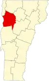 | |
| Towns | ||
| Villages | ||
| CDPs | ||
| Unincorporated communities | ||