Bolton (CDP), Vermont
Bolton, Vermont | |
|---|---|
  Bolton Location within Vermont  Bolton Location within the United States | |
| Coordinates: 44°22′29″N 72°53′16″W / 44.37472°N 72.88778°W | |
| Country | United States |
| State | Vermont |
| County | Chittenden |
| Town | Bolton |
| Area | |
• Total | 0.069 sq mi (0.18 km2) |
| • Land | 0.069 sq mi (0.18 km2) |
| • Water | 0 sq mi (0.0 km2) |
| Elevation | 341 ft (104 m) |
| Time zone | UTC-5 (Eastern (EST)) |
| • Summer (DST) | UTC-4 (EDT) |
| ZIP Code | 05676 (Waterbury) |
| Area code | 802 |
| FIPS code | 50-06475 |
| GNIS feature ID | 2807128[2] |
Bolton is the primary village and a census-designated place (CDP) in the town of Bolton, Chittenden County, Vermont, United States. It was first listed as a CDP prior to the 2020 census.
Geography
The village is in eastern Chittenden County, on the north side of the valley of the Winooski River as it cuts through the center of the Green Mountains. The village is located along U.S. Route 2, which leads east 7 miles (11 km) to Waterbury and west 6 miles (10 km) to Richmond. Interstate 89 forms the northern edge of the community; the nearest access is from Exit 10 at Waterbury or Exit 11 at Richmond.
References
- ↑ "2020 U.S. Gazetteer Files – Vermont". United States Census Bureau. Retrieved October 6, 2021.
- 1 2 U.S. Geological Survey Geographic Names Information System: Bolton (CDP), Vermont
Municipalities and communities of Chittenden County, Vermont, United States | ||
|---|---|---|
| Cities | 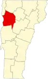 | |
| Towns | ||
| Villages | ||
| CDPs | ||
| Unincorporated communities | ||