Tonzang Township
Tonzang Township
တွန်းဇံမြို့နယ် | |
|---|---|
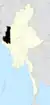
 Location (red) in Tedim District | |
| Coordinates: 23°45′N 93°44′E / 23.750°N 93.733°E | |
| Country |  Myanmar |
| State | Chin State |
| District | Tedim District |
| Township | Tonzang Township |
| Administrative centre | Tonzang |
| Area | |
• Total | 1,340.25 sq mi (3,471.24 km2) |
| Population (2014) | |
• Total | 20,722 |
| • Density | 15.461/sq mi (5.9696/km2) |
| • Religions | Christianity |
| Time zone | UTC+6:30 (MST) |
Tonzang Township (Burmese: တွန်းဇံမြို့နယ်) is a township in Tedim District, Chin State of Myanmar.[1] The 3,471.24-square-kilometre Tonzang Township is bordered by Tedim Township in the south, Kale Township of the Sagaing Division in the south-east, Tamu Township of the Sagaing Division in the north-east, the Indian states of Manipur in the north and Mizoram in the west. The township is primarily inhabited by Zomi and Zo people. The capital of the township is Tonzang.
History
On 11-12 May 2024, amid the Myanmar civil war, the Tatmadaw launched airstrikes in Tonzang Township destroying homes, a Baptist church, and a Catholic church.[2][3]
On 3 April 2025, the Zomi Revolutionary Army (ZRA) burned down around 80 homes in Nakzang village, Tonzang Township.[4]
Administrative divisions
The capital city of Tonzang Township is Tonzang. Tonzang Township is divided into 32 regions called villages:
- Anlun
- Balbil
- Bapi
- Buangmual
- Cikha (Urban)
- Darkhai (A)
- Gelmual
- Haicin
- Haipi
- Hangken
- Kampum
- Kansau
- Khuabem
- Lamthang
- Linhnuat
- Lungtak
- Mualpi
- Nakzang
- Pangmual
- Phaitu
- Saipimual
- Salzang
- Sebawk
- Senam
- Singpial
- Sipek
- Suangpek
- Suangzang
- Thuitum
- Tongcin
- Tonzang (Urban)
- Tuimang
- Tuimui
- Tungtuang
- Zampi
Demographics
According to the 2014 Myanmar census, Tonzang Township had a population of 20,722.[5] The median age was reported to be 17.5 years old. There were 95 males per 100 females, and males had a higher literacy rate than females at 93.1% and 81.8%, respectively.[5] The 3,411 households had a mean household size of 5.9 persons. The majority of the households used firewood rather than electricity for cooking.[5]
Education
In June 2026, 44 schools reopened in the township, with 3,446 students enrolled.[6]
Notes
- ↑ Township 63 "Myanmar States/Divisions & Townships Overview Map" map ID: MIMU001, created: December 2007, Myanmar Information Management Unit (MIMU)
- ↑ Brumley, Jeff (12 November 2024). "Religious freedom faces even more peril in Burma". Baptist News Global. Archived from the original on 13 November 2024. Retrieved 21 March 2026.
On May 11 and 12, military airstrikes destroyed homes and both a Catholic and a Baptist church in Tonzang Township in Chin State
- ↑ Camp, Ken (6 November 2024). "Religious minorities continue to be targeted in Burma". Baptist Standard. Archived from the original on 6 November 2024. Retrieved 21 March 2026.
The military has targeted churches and other religious sites, including both a Baptist church and a Catholic church in mid-May in Tonzang Township in Chin State
- ↑ "CNF: ZRA must be held accountable for the burning of entire Nakzang village in Tonzang". Burma News International. 8 April 2025. Archived from the original on 10 April 2025.
- 1 2 3 "The 2014 Myanmar Population and Housing Census" (PDF). themimu.info. Archived from the original (PDF) on 29 January 2022. Retrieved 21 March 2026.
- ↑ "44 Schools Reopen in Chin State's Tonzang Township, Enrolling More Than 3,400 Students". Eleven Media Group. 29 June 2026.
External links
- "Tonzang Google Satellite Map" Maplandia World Gazetteer
Capital: Hakha | ||
| Tedim District |
|   |
| Falam District |
| |
| Hakha District | ||
| Matupi District |
| |
| Paletwa District |
| |
| Mindat District | ||
| Cities and towns | ||