Cikha
Cikha | |
|---|---|
Interactive map of Cikha | |
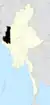
  Cikha Location within Myanmar | |
| Coordinates: 23°53′20″N 93°31′53″E / 23.8890°N 93.5315°E | |
| Country |  Myanmar (de jure)  Chinland (de facto) |
| State |  Chin |
| District | Tedim District |
| Township | Tonzang Township |
| Population (2014) | |
• Total | 1,450[1] |
| Time zone | UTC+6:30 (MST) |
Cikha is a town located in Tonzang Township, Tedim District, Chin State of Myanmar (Burma).[2] It is close to the border with the Manipur state of India, with Behiang being the opposite town in India. Cikha is the administrative seat of Cikha Sub-township.
Cikha is in the valley of the Tuivai River, which is also called "Cikha stream" in Myanmar. The officials of British Raj referred to it as "Chikoo stream".[3] The Tuivai enters the Indian territory near Behiang and follows a winding course till its confluence with the Barak River at Tipaimukh.
The town was captured by the Chin National Army on 19 May 2024, during the country's ongoing civil war.[4][5]
References
- ↑ Census Report. The 2014 Myanmar Population and Housing Census. Vol. 2. Naypyidaw: Ministry of Immigration and Population. May 2015. p. 52.
- ↑ "Chin State's District Map" (PDF). Myanmar Information Management Unit. 23 October 2017. Archived from the original (PDF) on 8 April 2018.
- ↑ Pemberton, Capt. R. Boileau (1835), Report on the Eastern Frontier of British India, Calcutta: Government of India, p. 20 – via archive.org
- ↑ "Chin Resistance Forces Capture Tonzang and Cikha Towns". Burma News International. Retrieved 22 May 2024.
- ↑ "Two Towns Near India Border in Myanmar Captured by Chin Resistance Groups". The Irrawaddy. 20 May 2024.
Capital: Hakha | ||
| Tedim District |
|  |
| Falam District |
| |
| Hakha District | ||
| Matupi District |
| |
| Paletwa District |
| |
| Mindat District | ||
| Cities and towns | ||