Sainte-Ursule
Sainte-Ursule | |
|---|---|
Municipality | |
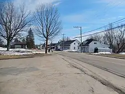 | |
 Location within Maskinongé RCM | |
  Ste-Ursule Location in central Quebec | |
| Coordinates: 46°17′N 73°02′W / 46.283°N 73.033°W[1] | |
| Country |  Canada |
| Province |  Quebec |
| Region | Mauricie |
| RCM | Maskinongé |
| Settled | 1836 |
| Constituted | July 1, 1855 |
| Government | |
| • Mayor | Réjean Carle |
| • Fed. riding | Berthier—Maskinongé |
| • Prov. riding | Maskinongé |
| Area | |
• Total | 68.35 km2 (26.39 sq mi) |
| • Land | 67.83 km2 (26.19 sq mi) |
| Population (2021)[3] | |
• Total | 1,355 |
| • Density | 20/km2 (52/sq mi) |
| • Change 2016-21 |  1.9% |
| • Dwellings | 722 |
| Time zone | UTC−5 (EST) |
| • Summer (DST) | UTC−4 (EDT) |
| Postal code(s) | |
| Area code(s) | 819 |
| Highways |  R-348  R-350 |
| Website | www |
Sainte-Ursule (French pronunciation: [sɛ̃t yʁsyl]) is a municipality in the Mauricie region of the province of Quebec, Canada.
History
In 1836, the Parish of Sainte-Ursule was formed, named after the Ursuline nuns of Trois-Rivières. Circa 1840, settlers arrived along on the east bank of the Petite Rivière du Loup (Little Wolf River) and along the Ruisseau des Bélanger (Bélanger Creek). In 1845, the Parish Municipality of Sainte-Ursule was created, abolished two years later, and reestablished in 1855. In 1851, its post office opened.[1]
In 1917, Sainte-Ursule lost a portion of its territory to the then newly-created Parish Municipality of Sainte-Angèle,[4] and again in 1950, to the then newly-created Municipality of Saint-Édouard.[5]
In 2018, the status of parish municipality was changed to that of (regular) municipality.[1]
Demographics
Historical census populations – Sainte-Ursule | ||||||||||||||||||||||||||||||||||||||||||||||||||||||||||||||||||||||||||||||||
|
|
| ||||||||||||||||||||||||||||||||||||||||||||||||||||||||||||||||||||||||||||||
| Population counts are not adjusted for boundary changes. Source: Statistics Canada[3][6][7] | ||||||||||||||||||||||||||||||||||||||||||||||||||||||||||||||||||||||||||||||||
References
- 1 2 3 "Reference number 433865". Banque de noms de lieux du Québec [Bank of place names of Quebec] (in French). Commission de toponymie du Québec.
- 1 2 "Répertoire des municipalités: Geographic code 51040". www.quebec.ca (in French). Gouvernement du Québec.
- 1 2 3 "Sainte-Ursule (Code 2451040) Census Profile". 2021 census. Government of Canada - Statistics Canada. Retrieved 2026-08-17.
- ↑ "Sainte-Angèle-de-Prémont (municipalité) 28.8.1917 - ..." www.mairesduquebec.com. Institut généalogique Drouin. Retrieved 2026-08-17.
- ↑ "Saint-Édouard-de-Maskinongé (municipalité) 1.1.1950 - ..." www.mairesduquebec.com. Institut généalogique Drouin. Retrieved 2026-08-17.
- ↑ Eighth Census of Canada 1941 - Volume II - Population by Local Subdivisions (Report). Dominion Bureau of Statistics. 1944. CS98-1941-2.
- ↑ "1971 Census of Canada - Population Census Subdivisions (Historical)". Catalogue 92-702 Vol I, part 1 (Bulletin 1.1-2). Statistics Canada. July 1973.
External links
 Media related to Sainte-Ursule at Wikimedia Commons
- Official website
Places adjacent to Sainte-Ursule | |
|---|---|


| Cities & towns | |
|---|---|
| Municipalities | |
| Parishes | |