Saint-Mathieu-du-Parc
Saint-Mathieu-du-Parc | |
|---|---|
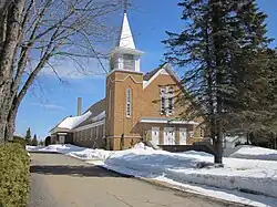 Saint-Mathieu Church | |
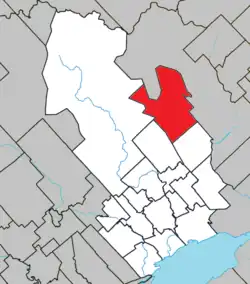 Location within Maskinongé RCM | |
  St-Mathieu-du-Parc Location in central Quebec | |
| Coordinates: 46°34′N 72°55′W / 46.567°N 72.917°W[1] | |
| Country |  Canada |
| Province |  Quebec |
| Region | Mauricie |
| RCM | Maskinongé |
| Settled | 1870s |
| Constituted | June 30, 1886 |
| Government | |
| • Mayor | Claude Mayrand |
| • Fed. riding | Berthier—Maskinongé |
| • Prov. riding | Saint-Maurice |
| Area | |
• Total | 228.96 km2 (88.40 sq mi) |
| • Land | 218.85 km2 (84.50 sq mi) |
| Population (2021)[3] | |
• Total | 1,482 |
| • Density | 6.8/km2 (18/sq mi) |
| • Change 2016-21 |  10.8% |
| • Dwellings | 1,164 |
| Time zone | UTC−5 (EST) |
| • Summer (DST) | UTC−4 (EDT) |
| Postal code(s) | |
| Area code(s) | 819 |
| Highways |  R-351 |
| Website | www |
Saint-Mathieu-du-Parc (French pronunciation: [sɛ̃ matjø dy paʁk]) is a municipality in the Mauricie region of the province of Quebec, Canada. Prior to March 28, 1998, it was known simply as Saint-Mathieu.
It is home to the Mokotakan Museum, showcasing the First Nations of Quebec, as well as Bicolline (a large LARP venue). It is also one of the main access points to La Mauricie National Park.
The municipality is bisected by the Shawinigan River and dotted with many lakes, such as Vert, Goulet, Bellemare, Trudel, and des Érables.[1]
History
Settlement of the area began in the second half of the 19th century, when 1 group settled along the Rivière des Souris and another near Lake Bellemare. In 1872, the Parish of Saint-Mathieu was formed, named in honour of Matthew the Apostle. In 1886, the Parish Municipality of Saint-Mathieu was established out of territory ceded by the Township de Shawenegan [sic]. It was sometimes also called Saint-Mathieu-de-Caxton (in reference to its location in the geographic township of Caxton) and Saint-Mathieu-du-Lac-Bellemare (referring to its location on Lake Bellemare). In 1891, its post office opened under the name Lac-Bellemare.[1][4]
In 1980, the post office was renamed to Saint-Mathieu-du-Parc; the addition "du Parc" referring to La Mauricie National Park, whose eastern entrance is located within the municipality. On March 28, 1998, the Parish Municipality of Saint-Mathieu changed its status and name to become the Municipality of Saint-Mathieu-du-Parc.[1][4]
On December 31, 2001, Saint-Mathieu-du-Parc was transferred from the Centre-de-la-Mauricie RCM to the Maskinongé RCM, following the formation of the new City of Shawinigan and the dissolution of the Centre-de-la-Mauricie RCM.[1]
Demographics
Historical census populations – Saint-Mathieu-du-Parc | ||||||||||||||||||||||||||||||||||||||||||||||||||||||||||||||||||||||||||||||||
|
|
| ||||||||||||||||||||||||||||||||||||||||||||||||||||||||||||||||||||||||||||||
| Population counts are not adjusted for boundary changes. Source: Statistics Canada[3][5][6] | ||||||||||||||||||||||||||||||||||||||||||||||||||||||||||||||||||||||||||||||||
Local government
List of former mayors:
- Daniel Petit (...–2005)
- André Berthiaume (2005–2009)
- Claude Mayrand (2009–2013, 2021–present)
- Claude McManus (2013–2017)
- Josée Magny (2017–2021)
References
- 1 2 3 4 5 "Reference number 342502". Banque de noms de lieux du Québec [Bank of place names of Quebec] (in French). Commission de toponymie du Québec.
- 1 2 "Répertoire des municipalités: Geographic code 51070". www.quebec.ca (in French). Gouvernement du Québec.
- 1 2 3 "Saint-Mathieu-du-Parc (Code 2451070) Census Profile". 2021 census. Government of Canada - Statistics Canada. Retrieved 2026-08-11.
- 1 2 "Répertoire des entités géopolitiques: Saint-Mathieu-du-Parc (municipalité) 30.6.1886 - ..." www.mairesduquebec.com. Institut généalogique Drouin. Retrieved 2026-08-12.
- ↑ Eighth Census of Canada 1941 - Volume II - Population by Local Subdivisions (Report). Dominion Bureau of Statistics. 1944. CS98-1941-2.
- ↑ "1971 Census of Canada - Population Census Subdivisions (Historical)". Catalogue 92-702 Vol I, part 1 (Bulletin 1.1-2). Statistics Canada. July 1973.
External links
 Media related to Saint-Mathieu-du-Parc at Wikimedia Commons
- Official website
Places adjacent to Saint-Mathieu-du-Parc | ||||||||||||||||
|---|---|---|---|---|---|---|---|---|---|---|---|---|---|---|---|---|
| ||||||||||||||||


| Cities & towns | |
|---|---|
| Municipalities | |
| Parishes | |