Pasuruan Regency
Pasuruan Regency
Kabupaten Pasuruan | |
|---|---|
| Other transcription(s) | |
| • Javanese | Pasuruhan (Gêdrig) ڤاسوروهن (Pégon) ꦥꦱꦸꦫꦸꦃꦲꦤ꧀ (Hånåcåråkå) |
| • Madurese | Pasuruwân (Latèn) ڤاسورووۤان (Pèghu) ꦦꦱꦸꦫꦸꦮꦤ꧀ (Carakan) |
 Candi Jawi in Prigen | |
 Coat of arms | |
| Motto: Guna Karya Sarana Bhakti (Worthwhile works for the means of service) | |
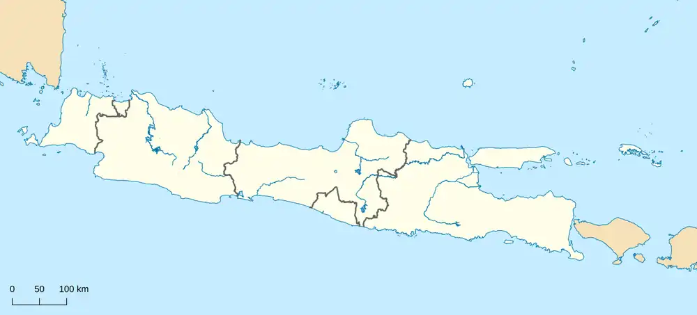
 Location within East Java | |
| Coordinates: 7°44′00″S 112°50′00″E / 7.73333°S 112.83333°E | |
| Country | Indonesia |
| Province | East Java |
| Capital city | Bangil |
| Government | |
| • Regent | Mochamad Rusdi Sutejo |
| • Vice Regent | Shobih Asrori |
| Area | |
• Total | 1,474.02 km2 (569.12 sq mi) |
| Population (mid 2025 estimate [1]) | |
• Total | 1,690,516 |
| • Density | 1,146.87/km2 (2,970.39/sq mi) |
| Time zone | UTC+7 (IWST) |
| Postal code | 67100 |
| Area code | (+62) 343 |
| Vehicle registration | N |
| Website | pasuruankab.go.id |


Pasuruan Regency (Javanese: ꦏꦧꦸꦥꦠꦺꦤ꧀ꦥꦱꦸꦫꦸꦃꦲꦤ꧀) is a regency in East Java, a province of Indonesia. The capital of this regency is Bangil. The regency covers an area of 1,474.02 km2, and it had a population of 1,512,468 at the 2010 Census[2] and 1,605,969 at the 2020 Census;[3] the official estimate as of mid 2025 was 1,690,516 (comprising 843,429 males and 847,077 females).[1]
These figures exclude the population of Pasuruan city, which lies geographically within this regency (except on the north side, where it faces onto the Madura Strait) but is administratively separate from it. There are moves underway to make Bangil the new administrative center of Pasuruan Regency, with some offices being transferred from Pasuruan city to Bangil.[4]
The Dutch spelling of the name of the regency and of the city was 'Pasoeroean'.
Demographics

The regional languages used in Pasuruan Regency are mainly Javanese (Arekan or Eastern Javanese dialect), there is also Madurese (Pasuruan dialect), especially in the east, and Tenggerese around the Bromo Tengger Semeru National Park area. Indonesian serves as the official language and lingua franca.
Administrative districts
Pasuruan Regency is divided into 24 districts (kecamatan), tabulated below with their areas and population totals from the 2010 Census[2] and the 2020 Census,[3] together with the official estimates as of mid 2025.[1] For convenience of reference the districts are grouped into three geographical sectors which have no administrative significance, but serve to indicate the differing population densities in the south and the north of the regency, with the south having over 50% of the area but only 29% of the population of the regency. The table also includes the locations of the district administrative centres, the number of administrative villages in each district (totaling 341 rural desa and 24 urban kelurahan), and their postal codes.
| Kode Wilayah | Name of District (kecamatan) | Area in km2 | Pop'n Census 2010 | Pop'n Census 2020 | Pop'n Estimate mid 2025 | Admin centre | No. of villages | Post codes |
|---|---|---|---|---|---|---|---|---|
| 35.14.01 | Purwodadi (a) | 102.46 | 65,363 | 70,015 | 73,660 | Purwodadi | 13 | 67163 |
| 35.14.02 | Tutur | 86.30 | 51,941 | 53,743 | 56,594 | Wonosari | 12 | 67165 |
| 35.14.03 | Puspo | 58.35 | 27,040 | 27,722 | 29,392 | Puspo | 7 | 67176 |
| 35.14.24 | Tosari | 98.00 | 18,478 | 18,799 | 19,167 | Tosari | 8 | 67177 |
| 35.14.04 | Lumbang | 125.55 | 32,856 | 35,174 | 37,106 | Cukurguling | 12 | 67183 |
| 35.14.05 | Pasrepan | 89.95 | 50,070 | 52,396 | 55,288 | Pasrepan | 17 | 67175 |
| 35.14.06 | Kejayan | 79.15 | 62,641 | 65,374 | 70,299 | Kejayan | 25 (b) | 67172 |
| 35.14.07 | Wonorejo | 47.30 | 56,264 | 59,864 | 63,535 | Wonorejo | 15 | 67173 |
| 35.14.08 | Purwosari | 59.67 | 77,871 | 84,137 | 89,167 | Purwosari | 15 (c) | 67162 |
| Sub-totals for | Southern Sector | 746.73 | 442,524 | 467,224 | 494,208 | 124 | ||
| 35.14.10 | Prigen | 121.90 | 82,429 | 87,227 | 91,394 | Prigen | 14 (d) | 67157 |
| 35.14.09 | Sukorejo | 58.18 | 81,060 | 87,477 | 91,910 | Glagahsari | 19 | 67161 |
| 35.14.11 | Pandaan | 43.27 | 105,326 | 111,062 | 115,837 | Petungsari | 18 (e) | 67156 |
| 35.14.12 | Gempol | 64.92 | 123,084 | 129,990 | 134,480 | Karangrejo | 15 | 67155 |
| 35.14.13 | Beji | 39.90 | 78,269 | 87,022 | 92,982 | Beji | 14 (f) | 67153 |
| 35.14.14 | Bangil | 44.60 | 84,438 | 83,307 | 86,381 | Kolursari | 15 (g) | 67153 |
| 35.14.15 | Rembang | 42.52 | 60,576 | 66,711 | 72,436 | Rembang | 17 | 67152 |
| Sub-totals for | Northwest Sector | 414.99 | 615,182 | 652,796 | 685,420 | 112 | ||
| 35.14.16 | Kraton | 50.75 | 89,128 | 88,525 | 92,029 | Kraton | 25 | 67151 |
| 35.14.17 | Pohjentrek | 11.88 | 28,308 | 31,296 | 32,225 | Susukanrejo | 9 | 67171 |
| 35.14.18 | Gondang Wetan | 26.25 | 50,612 | 56,264 | 59,342 | Gondang Wetan | 20 (h) | 67174 |
| 35.14.23 | Rejoso | 37.00 | 43,779 | 46,766 | 49,728 | Rejoso Lor | 16 | 67181 |
| 35.14.19 | Winongan | 45.97 | 41,206 | 44,287 | 46,868 | Winongan Lor | 18 | 67182 |
| 35.14.20 | Grati | 50.78 | 70,963 | 78,930 | 83,271 | Gratitunon | 15 (i) | 67184 |
| 25.14.22 | Lekok | 46.57 | 70,531 | 77,514 | 81,966 | Tambaklekok | 11 | 67186 |
| 35.14.21 | Nguling | 42.60 | 54,957 | 62,367 | 65,459 | Nguling | 15 | 67185 |
| Sub-totals for | Northeast Sector | 311.80 | 469,484 | 485,949 | 510,888 | 129 | ||
| Totals for | Regency | 1,474.02 | 1,512,468 | 1,605,969 | 1,690,516 | Bangil | 365 |
Notes: (a) within Malang Metropolitan area. (b) including one kelurahan (Kejayan). (c) including one kelurahan (Purwosari). (d) including 3 kelurahan (Ledug, Pecalukan and Prigen).
(e) including 5 kelurahan (Banjarsari, Jogosari, Kutorejo, Pandaan and Petungasri). (f) including 2 kelurahan (Glanggang and Pagak).
(g) comprising 11 kelurahan (Bendo Mungal, Dermo, Gempeng, Kalianyar, Kalirejo, Kauman, Kersikan, Kidul Dalem, Kolursari, Latek and Pogar) and 4 desa.
(h) including one kelurahan (Gondang Wetan). (i) including one kelurahan (Gratitunon).