Oti River
| Oti River Rivière Oti | |
|---|---|
 | |
 Togo with the Oti River (north) and the Mono River (south) | |
| Location | |
| Countries | |
| Physical characteristics | |
| Source | |
| • elevation | 150 m (490 ft) |
| Mouth | Lake Volta of Ghana |
• location | Gulf of Guinea |
• coordinates | 8°46′48″N 2°34′29″W / 8.78000°N 2.57472°W |
| Length | 520 km (320 mi) |
Basin size | 72,000 km2 (28,000 sq mi) |
| Discharge | |
| • location | Mouth |
| Basin features | |
Designation | |
Official name | Zone Humide de la Rivière Pendjari |
| Designated | 2 February 2007 |
| Reference no. | 1669[1] |
The Oti River or Pendjari River (French: Rivière Pendjari) is an international river in West Africa. It rises in Benin, forms the border between Benin and Burkina Faso, flows through Togo, and joins the Volta River in Ghana.
Geography
The Oti River is about 520 km (323 mi) long. Its headwaters are in Benin and Burkina Faso, it flows through Benin and Togo and joins the Volta River in Ghana. Tributaries on the left bank in Togo originate from the Togo Mountains to the south. One of its eastern tributaries is the Kara River, the confluence being on the Ghana–Togo border, where another tributary, the Koumongou River, joins from the south. The mouth of the Oti was formerly on the Volta River, but it now flows into Lake Volta reservoir in Ghana.[2]
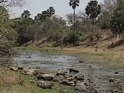
The river crosses the northern part of Togo in a savannah-clad valley some 40 or 50 km (25 or 31 mi) wide. Along the margins of the river is gallery forest which floods periodically. The dry season here lasts from about November until April, with the hot dry Harmattan wind blowing from the north. At this time of the year, the river's flow is minimal. Both the Oti and the Koumongou have floodplains, some 10 and 4 km (6.2 and 2.5 mi) wide, respectively. These flood extensively during the wet season, but during the dry season they become dry, dusty plains, with the occasional pond or lake in a depression. Cattle graze on the floodplains during the dry season. There is also some small-scale growing of crops, and the hunting of game takes place there.[3]
International borders
The river forms part of the international borders between Ghana, Burkina Faso, Togo, and Benin.[4]
Parks
The Oti River flows through Pendjari National Park in Benin[5] and the Oti-Kéran National Park in Togo.[3]
Length and Basin Characteristics
The Oti River has an approximate length of about 520 km[6].
The basin experiences strong seasonal variability, with most tributaries showing reduced flow or dry channels during the dry season.[7]
Hydrology and Seasonal Flow
The river is highly seasonal, with peak discharge occurring during the rainy season and very low flow during the dry Harmattan period. [8]
This seasonal variability causes periodic flooding of surrounding floodplains, especially in Togo and northern Ghana.[8]
Ecology and Environment
The Oti River basin includes savannah ecosystems, floodplains, and gallery forests that support seasonal agriculture and pastoralism. [8]
Floodplains along the river are used for grazing and cultivation during dry periods when water levels recede.[8]
Economic and Human Importance
The river is a key water resource for agriculture, livestock, and local fishing communities across Burkina Faso, Togo, and Ghana.[7]
It also contributes to irrigation potential and rural livelihoods in the Volta Basin, which is one of the most important hydrological systems in West Africa. [9]
References
- ↑ "Zone Humide de la Rivière Pendjari". Ramsar Sites Information Service. Retrieved 25 April 2018.
- ↑ Philip's (1994). Atlas of the World. Reed International. p. 101. ISBN 0-540-05831-9.
- 1 2 Hughes, R.H. (1992). A Directory of African Wetlands. IUCN. pp. 443–447. ISBN 978-2-88032-949-5.
- ↑ "Ghana - Rivers and Lakes". www.countrystudies.us. Retrieved 2017-08-17.
- ↑ "Parc National de la Pendjari". Archived from the original on 14 July 2017. Retrieved 21 November 2016.
- ↑ Environment, Gregory Sousa in (2017-04-25). "The Major Rivers Of Ghana". WorldAtlas. Retrieved 2026-06-17.
- 1 2 Koch, Hagen; Yangouliba, Gnibga Issoufou; Liersch, Stefan (2025-03-13). "From Data Scarcity to Solutions: Hydrological and Water Management Modeling in a Highly Managed River Basin". Water. 17 (6): 823. Bibcode:2025Water..17..823K. doi:10.3390/w17060823. ISSN 2073-4441.
- 1 2 3 4 "Burkina Faso | Coup, Map, Capital, Flag, Government, & History | Britannica". Encyclopedia Britannica. Retrieved 2026-06-17.
- ↑ "The Volta Basin". www.fao.org. Retrieved 2026-06-17.
