List of Florida state parks
| Florida State Parks | |
|---|---|
 Sunset at Honeymoon Island State Park, historically the most visited state park in the State of Florida[1] | |
| Area | 819,000 acres (331,000 ha) |
| Established | 1935 |
| Visitors | 28 million (in 2023) |
| Governing body | Florida Department of Environmental Protection, Division of Recreation and Parks |
| Website | www |
The Florida state park system is made up of 176 units managed by the Florida Park Service (FPS), a division of the Florida Department of Environmental Protection. It covers more than 819,000 acres (331,000 ha) across 63 of Florida's 67 counties.[2][n 1] The FPS classifies the units as 57 parks, 34 recreation areas, 28 preserves, 21 special feature historic sites, 10 trails, five museums, five special feature archaeological sites, four ornamental gardens, two reserves, two special feature botanical sites, two special feature geological sites, two fishing piers, one special feature cultural site, one greenway, one folk culture center, one wildlife park, and one unit of undetermined classification.[2][n 2]
Established in 1935, the system ranges from pre-Columbian archaeological sites to first-magnitude springs, coral reefs, and roadless barrier islands only accessible by boat or ferry. Of the 176 parks and trails, 13 of them contain National Natural Landmarks.[3] Many of the state's best-known parks include Silver Springs, Homosassa Springs, Rainbow Springs, and Weeki Wachee Springs, all of which started out as private tourist attractions before the State of Florida acquired them. The newest unit in the Florida park system is Shoal River Headwaters State Park in Walton County which was acquired on October 7, 2025 and opened to the public on January 23, 2026.[2]
The Florida Park Service is a four-time recipient of the National Recreation and Park Association's Gold Medal Award for the best state park system in the United States.[4] It won in 1999, 2005, 2013, and 2019, and was a finalist in 1997, 2011, and 2025.[5][6]
In 2023, the Florida Park Service's 1,040 staff members and 19,854 volunteers served 28 million visitors across 198 cabins, 3,311 campsites, 101 miles (163 km) of beaches, and 2,275 miles (3,661 km) of trails.[7] Operations are funded by dedicated documentary stamp tax revenue, visitor fees, and local non-profit "friends of the park" groups. While most parks charge an entrance fee, Florida residents can purchase an annual pass valid statewide. Campsite reservations within the parks are handled through ReserveAmerica.
Maps
Interactive Map
Florida State Park District Map
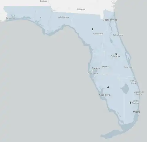
Florida state parks and reserves


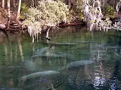




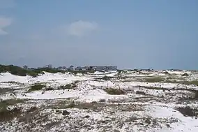







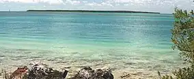












State trails
Under the Florida Park Service's 176 units, 11 units are trails and greenways. They are listed separately here because they are measured by length instead of area.[2]


Former parks
Royal Palm State Park, the first state park in Florida, is no longer part of the system. The park was founded in 1916 on Paradise Key and operated for more than thirty years by the Florida Federation of Women's Clubs. Instead of ever being managed by the State of Floirda, the park went to the federal government when Everglades National Park was dedicated on December 6, 1947.[183]
| Park name | Image | County | Area | Established | Removed | Fate |
|---|---|---|---|---|---|---|
| Royal Palm State Park |  | Miami-Dade | 4,000 acres (1,620 ha)[183] | 1916 | 1947 | Transferred to the federal government and absorbed into Everglades National Park at its dedication on December 6, 1947[184] |
References
Notes
- ↑ The DRP's July 2026 jurisdiction report gives two different totals: its covering memorandum states that the 176 units total 819,476.74 acres, while the per-district chart in the same report totals 819,416.74 acres.
- ↑ The classification counts printed in the report sum to 177 rather than 176 due to Ichetucknee Trace.
- 1 2 The division defines inception as "the date on which the parcel that constitutes the initial area of the unit was acquired by the State of Florida"; later additions to a unit are not reflected.
- 1 2 Florida Park Service administrative districts as assigned in the 2025-2026 jurisdiction report. District 1 covers the Panhandle and the western Big Bend; District 2 north and north-central Florida and the Nature Coast; District 3 east-central Florida; District 4 west-central and southwest Florida; District 5 southeast Florida and the Florida Keys.
- ↑ Areas are the acreages under Division of Recreation and Parks management jurisdiction, which for coastal and riverine units include leased submerged lands and may exceed the upland area of the park.
- ↑ Fort Foster is operated as a historic site within Hillsborough River State Park and is not counted as a separate unit in the division's jurisdiction report.
- 1 2 3 Point coordinate is the centre of the unit's boundary polygon in the Florida Department of Environmental Protection state park boundary layer; these units are linear or dispersed and have no single central point.
- ↑ Under the 2025 Florida Statutes, section 258.152, St. Marks River Preserve State Park has been officially renamed Ney Landrum State Park.
- ↑ The acreage cell for this unit is illegible in the jurisdiction report; the figure given is the residual required to reconcile the report's District 2 total of 138,201.64 acres.
Bibliography
- Florida Department of Environmental Protection (2012). Approved Unit Management Plan: Addison Blockhouse Historic State Park (2012) (PDF) (Report). Florida Department of Environmental Protection, Division of Recreation and Parks. Retrieved August 28, 2026.
- Florida Department of Environmental Protection. "Alafia River State Park". Florida Department of Environmental Protection, Division of Recreation and Parks. Retrieved August 28, 2026.
- Florida Department of Environmental Protection (2014). Approved Unit Management Plan: Alfred B. Maclay Gardens State Park (2014) (PDF) (Report). Florida Department of Environmental Protection, Division of Recreation and Parks. Retrieved August 28, 2026.
- Florida Department of Environmental Protection (2014). Approved Unit Management Plan: Allen David Broussard Catfish Creek Preserve State Park (2014) (PDF) (Report). Florida Department of Environmental Protection, Division of Recreation and Parks. Retrieved August 28, 2026.
- Florida Department of Environmental Protection. Approved Unit Management Plan: Amelia Island State Park (PDF) (Report). Florida Department of Environmental Protection, Division of Recreation and Parks. Retrieved August 28, 2026.
- Florida Department of Environmental Protection (2016). Approved Unit Management Plan: Anastasia State Park (2016) (PDF) (Report). Florida Department of Environmental Protection, Division of Recreation and Parks. Retrieved August 28, 2026.
- Florida Department of Environmental Protection (2014). Approved Unit Management Plan: Anclote Key Preserve State Park (2014) (PDF) (Report). Florida Department of Environmental Protection, Division of Recreation and Parks. Retrieved August 28, 2026.
- Florida Department of Environmental Protection. "Anderson's Landing (Managed by Manatee Springs State Park)". Florida Department of Environmental Protection, Division of Recreation and Parks. Retrieved August 28, 2026.
- Florida Department of Environmental Protection (2021). Approved Unit Management Plan: Atlantic Ridge Preserve State Park (2021) (PDF) (Report). Florida Department of Environmental Protection, Division of Recreation and Parks. Retrieved August 28, 2026.
- Florida Department of Environmental Protection (2014). Approved Unit Management Plan: Avalon State Park (2014) (PDF) (Report). Florida Department of Environmental Protection, Division of Recreation and Parks. Retrieved August 28, 2026.
- Florida Department of Environmental Protection (2020). Approved Unit Management Plan: Bahia Honda State Park (2020) (PDF) (Report). Florida Department of Environmental Protection, Division of Recreation and Parks. Retrieved August 28, 2026.
- Florida Department of Environmental Protection (2023). Approved Unit Management Plan: Bald Point State Park (2023) (PDF) (Report). Florida Department of Environmental Protection, Division of Recreation and Parks. Retrieved August 28, 2026.
- Florida Department of Environmental Protection. "Big Lagoon State Park". Florida Department of Environmental Protection, Division of Recreation and Parks. Retrieved August 28, 2026.
- Florida Department of Environmental Protection. Approved Unit Management Plan: Big Shoals State Park (PDF) (Report). Florida Department of Environmental Protection, Division of Recreation and Parks. Retrieved August 28, 2026.
- Florida Department of Environmental Protection. Approved Unit Management Plan: Big Talbot Island State Park (PDF) (Report). Florida Department of Environmental Protection, Division of Recreation and Parks. Retrieved August 28, 2026.
- Florida Department of Environmental Protection (2012). Approved Unit Management Plan: Bill Baggs Cape Florida State Park (2012) (PDF) (Report). Florida Department of Environmental Protection, Division of Recreation and Parks. Retrieved August 28, 2026.
- Florida Department of Environmental Protection (2013). Approved Unit Management Plan: Blackwater Heritage State Trail (2013) (PDF) (Report). Florida Department of Environmental Protection, Division of Recreation and Parks. Retrieved August 28, 2026.
- Florida Department of Environmental Protection (2016). Approved Unit Management Plan: Blackwater River State Park (2016) (PDF) (Report). Florida Department of Environmental Protection, Division of Recreation and Parks. Retrieved August 28, 2026.
- Florida Department of Environmental Protection (2005). Approved Unit Management Plan: Blue Spring State Park (2005) (PDF) (Report). Florida Department of Environmental Protection, Division of Recreation and Parks. Retrieved August 28, 2026.
- Florida Department of Environmental Protection (2012). Approved Unit Management Plan: Bulow Creek State Park (2012) (PDF) (Report). Florida Department of Environmental Protection, Division of Recreation and Parks. Retrieved August 28, 2026.
- Florida Department of Environmental Protection (2012). Approved Unit Management Plan: Bulow Plantation Ruins Historic State Park (2012) (PDF) (Report). Florida Department of Environmental Protection, Division of Recreation and Parks. Retrieved August 28, 2026.
- Florida Department of Environmental Protection (2022). Approved Unit Management Plan: Caladesi Island State Park (2022) (PDF) (Report). Florida Department of Environmental Protection, Division of Recreation and Parks. Retrieved August 28, 2026.
- Florida Department of Environmental Protection (2014). Approved Unit Management Plan: Camp Helen State Park (2014) (PDF) (Report). Florida Department of Environmental Protection, Division of Recreation and Parks. Retrieved August 28, 2026.
- Florida Department of Environmental Protection (2005). Approved Unit Management Plan: Cayo Costa State Park (2005) (PDF) (Report). Florida Department of Environmental Protection, Division of Recreation and Parks. Retrieved August 28, 2026.
- Florida Department of Environmental Protection. Approved Unit Management Plan: Cedar Key Museum State Park (PDF) (Report). Florida Department of Environmental Protection, Division of Recreation and Parks. Retrieved August 28, 2026.
- Florida Department of Environmental Protection. Approved Unit Management Plan: Cedar Key Scrub State Reserve (PDF) (Report). Florida Department of Environmental Protection, Division of Recreation and Parks. Retrieved August 28, 2026.
- Florida Department of Environmental Protection (2007). Approved Unit Management Plan: Charlotte Harbor Preserve State Park (2007) (PDF) (Report). Florida Department of Environmental Protection, Division of Recreation and Parks. Retrieved August 28, 2026.
- Florida Department of Environmental Protection (2015). Approved Unit Management Plan: Cockroach Bay Preserve State Park (2015) (PDF) (Report). Florida Department of Environmental Protection, Division of Recreation and Parks. Retrieved August 28, 2026.
- Florida Department of Environmental Protection (2004). Approved Unit Management Plan: Collier-Seminole State Park (2004) (PDF) (Report). Florida Department of Environmental Protection, Division of Recreation and Parks. Retrieved August 28, 2026.
- Florida Department of Environmental Protection (2007). Approved Unit Management Plan: Colt Creek State Park (2007) (PDF) (Report). Florida Department of Environmental Protection, Division of Recreation and Parks. Retrieved August 28, 2026.
- Florida Department of Environmental Protection (2014). Approved Unit Management Plan: Constitution Convention Museum State Park (2014) (PDF) (Report). Florida Department of Environmental Protection, Division of Recreation and Parks. Retrieved August 28, 2026.
- Florida Department of Environmental Protection. Approved Unit Management Plan: Crystal River Archaeological State Park (PDF) (Report). Florida Department of Environmental Protection, Division of Recreation and Parks. Retrieved August 28, 2026.
- Florida Department of Environmental Protection. Approved Unit Management Plan: Crystal River Preserve State Park (PDF) (Report). Florida Department of Environmental Protection, Division of Recreation and Parks. Retrieved August 28, 2026.
- Florida Department of Environmental Protection (2016). Approved Unit Management Plan: Curry Hammock State Park (2016) (PDF) (Report). Florida Department of Environmental Protection, Division of Recreation and Parks. Retrieved August 28, 2026.
- Florida Department of Environmental Protection (2017). Approved Unit Management Plan: Dade Battlefield Historic State Park (2017) (PDF) (Report). Florida Department of Environmental Protection, Division of Recreation and Parks. Retrieved August 28, 2026.
- Florida Department of Environmental Protection (2019). Approved Unit Management Plan: Dagny Johnson Key Largo Hammock Botanical State Park (2019) (PDF) (Report). Florida Department of Environmental Protection, Division of Recreation and Parks. Retrieved August 28, 2026.
- Florida Department of Environmental Protection (2016). Approved Unit Management Plan: De Leon Springs State Park (2016) (PDF) (Report). Florida Department of Environmental Protection, Division of Recreation and Parks. Retrieved August 28, 2026.
- Florida Department of Environmental Protection (2016). Approved Unit Management Plan: Deer Lake State Park (2016) (PDF) (Report). Florida Department of Environmental Protection, Division of Recreation and Parks. Retrieved August 28, 2026.
- Florida Department of Environmental Protection (2009). Approved Unit Management Plan: Delnor-Wiggins Pass State Park (2009) (PDF) (Report). Florida Department of Environmental Protection, Division of Recreation and Parks. Retrieved August 28, 2026.
- Florida Department of Environmental Protection. Approved Unit Management Plan: Devil's Millhopper Geological State Park (PDF) (Report). Florida Department of Environmental Protection, Division of Recreation and Parks. Retrieved August 28, 2026.
- Florida Department of Environmental Protection (2013). Approved Unit Management Plan: Don Pedro Island State Park (2013) (PDF) (Report). Florida Department of Environmental Protection, Division of Recreation and Parks. Retrieved August 28, 2026.
- Florida Department of Environmental Protection (2012). Approved Unit Management Plan: Dr. Von D. Mizell-Eula Johnson State Park (2012) (PDF) (Report). Florida Department of Environmental Protection, Division of Recreation and Parks. Retrieved August 28, 2026.
- Florida Department of Environmental Protection. Approved Unit Management Plan: Dudley Farm Historic State Park (PDF) (Report). Florida Department of Environmental Protection, Division of Recreation and Parks. Retrieved August 28, 2026.
- Florida Department of Environmental Protection (2019). Approved Unit Management Plan: Dunns Creek State Park (2019) (PDF) (Report). Florida Department of Environmental Protection, Division of Recreation and Parks. Retrieved August 28, 2026.
- Florida Department of Environmental Protection (2018). Approved Unit Management Plan: Econfina River State Park (2018) (PDF) (Report). Florida Department of Environmental Protection, Division of Recreation and Parks. Retrieved August 28, 2026.
- Florida Department of Environmental Protection (2012). Approved Unit Management Plan: Eden Gardens State Park (2012) (PDF) (Report). Florida Department of Environmental Protection, Division of Recreation and Parks. Retrieved August 28, 2026.
- Florida Department of Environmental Protection (2022). Approved Unit Management Plan: Edward Ball Wakulla Springs State Park (2022) (PDF) (Report). Florida Department of Environmental Protection, Division of Recreation and Parks. Retrieved August 28, 2026.
- Florida Department of Environmental Protection. "Egmont Key State Park". Florida Department of Environmental Protection, Division of Recreation and Parks. Retrieved August 28, 2026.
- Florida Department of Environmental Protection (2004). Approved Unit Management Plan: Estero Bay Preserve State Park (2004) (PDF) (Report). Florida Department of Environmental Protection, Division of Recreation and Parks. Retrieved August 28, 2026.
- Florida Department of Environmental Protection (2014). Approved Unit Management Plan: Fakahatchee Strand Preserve State Park (2014) (PDF) (Report). Florida Department of Environmental Protection, Division of Recreation and Parks. Retrieved August 28, 2026.
- Florida Department of Environmental Protection (2017). Approved Unit Management Plan: Falling Waters State Park (2017) (PDF) (Report). Florida Department of Environmental Protection, Division of Recreation and Parks. Retrieved August 28, 2026.
- Florida Department of Environmental Protection. Approved Unit Management Plan: Fanning Springs State Park (PDF) (Report). Florida Department of Environmental Protection, Division of Recreation and Parks. Retrieved August 28, 2026.
- Florida Department of Environmental Protection (2017). Approved Unit Management Plan: Faver-Dykes State Park (2017) (PDF) (Report). Florida Department of Environmental Protection, Division of Recreation and Parks. Retrieved August 28, 2026.
- Florida Department of Environmental Protection. Approved Unit Management Plan: Fernandina Plaza Historic State Park (PDF) (Report). Florida Department of Environmental Protection, Division of Recreation and Parks. Retrieved August 28, 2026.
- Florida Department of Environmental Protection (2018). Approved Unit Management Plan: Florida Caverns State Park (2018) (PDF) (Report). Florida Department of Environmental Protection, Division of Recreation and Parks. Retrieved August 28, 2026.
- Florida Department of Environmental Protection (2000). Approved Unit Management Plan: Florida Keys Overseas Heritage Trail (2000) (PDF) (Report). Florida Department of Environmental Protection, Division of Recreation and Parks. Retrieved August 28, 2026.
- Florida Department of Environmental Protection. Approved Unit Management Plan: Forest Capital Museum State Park (PDF) (Report). Florida Department of Environmental Protection, Division of Recreation and Parks. Retrieved August 28, 2026.
- Florida Department of Environmental Protection. Approved Unit Management Plan: Fort Clinch State Park (PDF) (Report). Florida Department of Environmental Protection, Division of Recreation and Parks. Retrieved August 28, 2026.
- Florida Department of Environmental Protection. Approved Unit Management Plan: Fort Cooper State Park (PDF) (Report). Florida Department of Environmental Protection, Division of Recreation and Parks. Retrieved August 28, 2026.
- Florida Department of Environmental Protection. Approved Unit Management Plan: Fort George Island Cultural State Park (PDF) (Report). Florida Department of Environmental Protection, Division of Recreation and Parks. Retrieved August 28, 2026.
- Florida Department of Environmental Protection (2016). Approved Unit Management Plan: Fort Mose Historic State Park (2016) (PDF) (Report). Florida Department of Environmental Protection, Division of Recreation and Parks. Retrieved August 28, 2026.
- Florida Department of Environmental Protection (2021). Approved Unit Management Plan: Fort Pierce Inlet State Park (2021) (PDF) (Report). Florida Department of Environmental Protection, Division of Recreation and Parks. Retrieved August 28, 2026.
- Florida Department of Environmental Protection (2008). Approved Unit Management Plan: Fort Zachary Taylor Historic State Park (2008) (PDF) (Report). Florida Department of Environmental Protection, Division of Recreation and Parks. Retrieved August 28, 2026.
- Florida Department of Environmental Protection (2018). Approved Unit Management Plan: Fred Gannon Rocky Bayou State Park (2018) (PDF) (Report). Florida Department of Environmental Protection, Division of Recreation and Parks. Retrieved August 28, 2026.
- Florida Department of Environmental Protection. "Gainesville-Hawthorne State Trail". Florida Department of Environmental Protection, Division of Recreation and Parks. Retrieved August 28, 2026.
- Florida Department of Environmental Protection (2015). Approved Unit Management Plan: Gamble Plantation Historic State Park (2015) (PDF) (Report). Florida Department of Environmental Protection, Division of Recreation and Parks. Retrieved August 28, 2026.
- Florida Department of Environmental Protection (2018). Approved Unit Management Plan: Gamble Rogers Memorial State Recreation Area at Flagler Beach (2018) (PDF) (Report). Florida Department of Environmental Protection, Division of Recreation and Parks. Retrieved August 28, 2026.
- Florida Department of Environmental Protection (2014). Approved Unit Management Plan: Gasparilla Island State Park (2014) (PDF) (Report). Florida Department of Environmental Protection, Division of Recreation and Parks. Retrieved August 28, 2026.
- Florida Department of Environmental Protection (2012). Approved Unit Management Plan: General James A. Van Fleet State Trail (2012) (PDF) (Report). Florida Department of Environmental Protection, Division of Recreation and Parks. Retrieved August 28, 2026.
- Florida Department of Environmental Protection. Approved Unit Management Plan: George Crady Bridge Fishing Pier (PDF) (Report). Florida Department of Environmental Protection, Division of Recreation and Parks. Retrieved August 28, 2026.
- Florida Department of Environmental Protection. Approved Unit Management Plan: Gilchrist Blue Springs State Park (PDF) (Report). Florida Department of Environmental Protection, Division of Recreation and Parks. Retrieved August 28, 2026.
- Florida Department of Environmental Protection (2013). Approved Unit Management Plan: Grayton Beach State Park (2013) (PDF) (Report). Florida Department of Environmental Protection, Division of Recreation and Parks. Retrieved August 28, 2026.
- Florida Department of Environmental Protection (2016). Approved Unit Management Plan: Haw Creek Preserve State Park (2016) (PDF) (Report). Florida Department of Environmental Protection, Division of Recreation and Parks. Retrieved August 28, 2026.
- Florida Department of Environmental Protection (2013). Approved Unit Management Plan: Henderson Beach State Park (2013) (PDF) (Report). Florida Department of Environmental Protection, Division of Recreation and Parks. Retrieved August 28, 2026.
- Florida Department of Environmental Protection (2018). Approved Unit Management Plan: Highlands Hammock State Park (2018) (PDF) (Report). Florida Department of Environmental Protection, Division of Recreation and Parks. Retrieved August 28, 2026.
- Florida Department of Environmental Protection (2020). Approved Unit Management Plan: Hillsborough River State Park (2020) (PDF) (Report). Florida Department of Environmental Protection, Division of Recreation and Parks. Retrieved August 28, 2026.
- Florida Department of Environmental Protection. Approved Unit Management Plan: Homosassa Springs Wildlife State Park (PDF) (Report). Florida Department of Environmental Protection, Division of Recreation and Parks. Retrieved August 28, 2026.
- Florida Department of Environmental Protection (2022). Approved Unit Management Plan: Honeymoon Island State Park (2022) (PDF) (Report). Florida Department of Environmental Protection, Division of Recreation and Parks. Retrieved August 28, 2026.
- Florida Department of Environmental Protection (2005). Approved Unit Management Plan: Hontoon Island State Park (2005) (PDF) (Report). Florida Department of Environmental Protection, Division of Recreation and Parks. Retrieved August 28, 2026.
- Florida Department of Environmental Protection (2020). Approved Unit Management Plan: Hugh Taylor Birch State Park (2020) (PDF) (Report). Florida Department of Environmental Protection, Division of Recreation and Parks. Retrieved August 28, 2026.
- Florida Department of Environmental Protection. Approved Unit Management Plan: Ichetucknee Springs State Park (PDF) (Report). Florida Department of Environmental Protection, Division of Recreation and Parks. Retrieved August 28, 2026.
- Florida Department of Environmental Protection. "Ichetucknee Trace". Florida Department of Environmental Protection, Division of Recreation and Parks. Retrieved August 28, 2026.
- Florida Department of Environmental Protection (2012). Approved Unit Management Plan: Indian Key Historic State Park (2012) (PDF) (Report). Florida Department of Environmental Protection, Division of Recreation and Parks. Retrieved August 28, 2026.
- Florida Department of Environmental Protection (2015). Approved Unit Management Plan: Indian River Lagoon Preserve State Park (2015) (PDF) (Report). Florida Department of Environmental Protection, Division of Recreation and Parks. Retrieved August 28, 2026.
- Florida Department of Environmental Protection (2020). Approved Unit Management Plan: John D. MacArthur Beach State Park (2020) (PDF) (Report). Florida Department of Environmental Protection, Division of Recreation and Parks. Retrieved August 28, 2026.
- Florida Department of Environmental Protection (2014). Approved Unit Management Plan: John Gorrie Museum State Park (2014) (PDF) (Report). Florida Department of Environmental Protection, Division of Recreation and Parks. Retrieved August 28, 2026.
- Florida Department of Environmental Protection (2019). Approved Unit Management Plan: John Pennekamp Coral Reef State Park (2019) (PDF) (Report). Florida Department of Environmental Protection, Division of Recreation and Parks. Retrieved August 28, 2026.
- Florida Department of Environmental Protection (2012). Approved Unit Management Plan: Jonathan Dickinson State Park (2012) (PDF) (Report). Florida Department of Environmental Protection, Division of Recreation and Parks. Retrieved August 28, 2026.
- Florida Department of Environmental Protection (2018). Approved Unit Management Plan: Kissimmee Prairie Preserve State Park (2018) (PDF) (Report). Florida Department of Environmental Protection, Division of Recreation and Parks. Retrieved August 28, 2026.
- Florida Department of Environmental Protection (2003). Approved Unit Management Plan: Koreshan State Historic Site (2003) (PDF) (Report). Florida Department of Environmental Protection, Division of Recreation and Parks. Retrieved August 28, 2026.
- Florida Department of Environmental Protection. Approved Unit Management Plan: Lafayette Blue Springs State Park (PDF) (Report). Florida Department of Environmental Protection, Division of Recreation and Parks. Retrieved August 28, 2026.
- Florida Department of Environmental Protection (2016). Approved Unit Management Plan: Lake Griffin State Park (2016) (PDF) (Report). Florida Department of Environmental Protection, Division of Recreation and Parks. Retrieved August 28, 2026.
- Florida Department of Environmental Protection (2016). Approved Unit Management Plan: Lake Jackson Mounds Archaeological State Park (2016) (PDF) (Report). Florida Department of Environmental Protection, Division of Recreation and Parks. Retrieved August 28, 2026.
- Florida Department of Environmental Protection (2016). Approved Unit Management Plan: Lake June in Winter Scrub State Park (2016) (PDF) (Report). Florida Department of Environmental Protection, Division of Recreation and Parks. Retrieved August 28, 2026.
- Florida Department of Environmental Protection (2014). Approved Unit Management Plan: Lake Kissimmee State Park (2014) (PDF) (Report). Florida Department of Environmental Protection, Division of Recreation and Parks. Retrieved August 28, 2026.
- Florida Department of Environmental Protection (2005). Approved Unit Management Plan: Lake Louisa State Park (2005) (PDF) (Report). Florida Department of Environmental Protection, Division of Recreation and Parks. Retrieved August 28, 2026.
- Florida Department of Environmental Protection (2018). Approved Unit Management Plan: Lake Manatee State Park (2018) (PDF) (Report). Florida Department of Environmental Protection, Division of Recreation and Parks. Retrieved August 28, 2026.
- Florida Department of Environmental Protection (2020). Approved Unit Management Plan: Lake Talquin State Park (2020) (PDF) (Report). Florida Department of Environmental Protection, Division of Recreation and Parks. Retrieved August 28, 2026.
- Florida Department of Environmental Protection (2018). Approved Unit Management Plan: Letchworth-Love Mounds Archaeological State Park (2018) (PDF) (Report). Florida Department of Environmental Protection, Division of Recreation and Parks. Retrieved August 28, 2026.
- Florida Department of Environmental Protection (2012). Approved Unit Management Plan: Lignumvitae Key Botanical State Park (2012) (PDF) (Report). Florida Department of Environmental Protection, Division of Recreation and Parks. Retrieved August 28, 2026.
- Florida Department of Environmental Protection (2016). Approved Unit Management Plan: Little Manatee River State Park (2016) (PDF) (Report). Florida Department of Environmental Protection, Division of Recreation and Parks. Retrieved August 28, 2026.
- Florida Department of Environmental Protection. Approved Unit Management Plan: Little Talbot Island State Park (PDF) (Report). Florida Department of Environmental Protection, Division of Recreation and Parks. Retrieved August 28, 2026.
- Florida Department of Environmental Protection (2016). Approved Unit Management Plan: Long Key State Park (2016) (PDF) (Report). Florida Department of Environmental Protection, Division of Recreation and Parks. Retrieved August 28, 2026.
- Florida Department of Environmental Protection (2005). Approved Unit Management Plan: Lovers Key State Park (2005) (PDF) (Report). Florida Department of Environmental Protection, Division of Recreation and Parks. Retrieved August 28, 2026.
- Florida Department of Environmental Protection (2017). Approved Unit Management Plan: Lower Wekiva River Preserve State Park (2017) (PDF) (Report). Florida Department of Environmental Protection, Division of Recreation and Parks. Retrieved August 28, 2026.
- Florida Department of Environmental Protection (2015). Approved Unit Management Plan: Madira Bickel Mound State Archaeological Site (2015) (PDF) (Report). Florida Department of Environmental Protection, Division of Recreation and Parks. Retrieved August 28, 2026.
- Florida Department of Environmental Protection. Approved Unit Management Plan: Madison Blue Spring State Park (PDF) (Report). Florida Department of Environmental Protection, Division of Recreation and Parks. Retrieved August 28, 2026.
- Florida Department of Environmental Protection (2018). Approved Unit Management Plan: Manatee Springs State Park (2018) (PDF) (Report). Florida Department of Environmental Protection, Division of Recreation and Parks. Retrieved August 28, 2026.
- Florida Department of Environmental Protection (2018). Approved Unit Management Plan: Marjorie Harris Carr Cross Florida Greenways State Recreation and Conservation Area (2018) (PDF) (Report). Florida Department of Environmental Protection, Division of Recreation and Parks. Retrieved August 28, 2026.
- Florida Department of Environmental Protection. Approved Unit Management Plan: Marjorie Kinnan Rawlings Historic State Park (PDF) (Report). Florida Department of Environmental Protection, Division of Recreation and Parks. Retrieved August 28, 2026.
- Florida Department of Environmental Protection. Approved Unit Management Plan: Mike Roess Gold Head Branch State Park (PDF) (Report). Florida Department of Environmental Protection, Division of Recreation and Parks. Retrieved August 28, 2026.
- Florida Department of Environmental Protection (2003). Approved Unit Management Plan: Mound Key Archaeological State Park (2003) (PDF) (Report). Florida Department of Environmental Protection, Division of Recreation and Parks. Retrieved August 28, 2026.
- Florida Department of Environmental Protection. "Myakka River State Park". Florida Department of Environmental Protection, Division of Recreation and Parks. Retrieved August 28, 2026.
- Florida Department of Environmental Protection (2016). Approved Unit Management Plan: Natural Bridge Battlefield Historic State Park (2016) (PDF) (Report). Florida Department of Environmental Protection, Division of Recreation and Parks. Retrieved August 28, 2026.
- Florida Department of Environmental Protection. Approved Unit Management Plan: Nature Coast State Trail (PDF) (Report). Florida Department of Environmental Protection, Division of Recreation and Parks. Retrieved August 28, 2026.
- Florida Department of Environmental Protection. "Ney Landrum State Park". Florida Department of Environmental Protection, Division of Recreation and Parks. Retrieved August 28, 2026.
- Florida Department of Environmental Protection (2018). Approved Unit Management Plan: North Peninsula State Park (2018) (PDF) (Report). Florida Department of Environmental Protection, Division of Recreation and Parks. Retrieved August 28, 2026.
- Florida Department of Environmental Protection. Approved Unit Management Plan: O'Leno State Park (PDF) (Report). Florida Department of Environmental Protection, Division of Recreation and Parks. Retrieved August 28, 2026.
- Florida Department of Environmental Protection (2023). Approved Unit Management Plan: Ochlockonee River State Park (2023) (PDF) (Report). Florida Department of Environmental Protection, Division of Recreation and Parks. Retrieved August 28, 2026.
- Florida Department of Environmental Protection (2010). Approved Unit Management Plan: Okeechobee Battlefield State Park (2010) (PDF) (Report). Florida Department of Environmental Protection, Division of Recreation and Parks. Retrieved August 28, 2026.
- Florida Department of Environmental Protection (2022). Approved Unit Management Plan: Oleta River State Park (2022) (PDF) (Report). Florida Department of Environmental Protection, Division of Recreation and Parks. Retrieved August 28, 2026.
- Florida Department of Environmental Protection. Approved Unit Management Plan: Olustee Battlefield Historic State Park (PDF) (Report). Florida Department of Environmental Protection, Division of Recreation and Parks. Retrieved August 28, 2026.
- Florida Department of Environmental Protection (2014). Approved Unit Management Plan: Orman House Historic State Park (2014) (PDF) (Report). Florida Department of Environmental Protection, Division of Recreation and Parks. Retrieved August 28, 2026.
- Florida Department of Environmental Protection (2011). Approved Unit Management Plan: Oscar Scherer State Park (2011) (PDF) (Report). Florida Department of Environmental Protection, Division of Recreation and Parks. Retrieved August 28, 2026.
- Florida Department of Environmental Protection. Approved Unit Management Plan: Palatka-to-Lake Butler State Trail (PDF) (Report). Florida Department of Environmental Protection, Division of Recreation and Parks. Retrieved August 28, 2026.
- Florida Department of Environmental Protection. Approved Unit Management Plan: Palatka-to-St. Augustine State Trail (PDF) (Report). Florida Department of Environmental Protection, Division of Recreation and Parks. Retrieved August 28, 2026.
- Florida Department of Environmental Protection (2016). Approved Unit Management Plan: Paynes Creek Historic State Park (2016) (PDF) (Report). Florida Department of Environmental Protection, Division of Recreation and Parks. Retrieved August 28, 2026.
- Florida Department of Environmental Protection. Approved Unit Management Plan: Paynes Prairie Preserve State Park (PDF) (Report). Florida Department of Environmental Protection, Division of Recreation and Parks. Retrieved August 28, 2026.
- Florida Department of Environmental Protection. "Perdido Key State Park". Florida Department of Environmental Protection, Division of Recreation and Parks. Retrieved August 28, 2026.
- Florida Department of Environmental Protection (2016). Approved Unit Management Plan: Ponce de Leon Springs State Park (2016) (PDF) (Report). Florida Department of Environmental Protection, Division of Recreation and Parks. Retrieved August 28, 2026.
- Florida Department of Environmental Protection. Approved Unit Management Plan: Price's Scrub State Park (PDF) (Report). Florida Department of Environmental Protection, Division of Recreation and Parks. Retrieved August 28, 2026.
- Florida Department of Environmental Protection. Approved Unit Management Plan: Pumpkin Hill Creek Preserve State Park (PDF) (Report). Florida Department of Environmental Protection, Division of Recreation and Parks. Retrieved August 28, 2026.
- Florida Department of Environmental Protection. Approved Unit Management Plan: Rainbow Springs State Park (PDF) (Report). Florida Department of Environmental Protection, Division of Recreation and Parks. Retrieved August 28, 2026.
- Florida Department of Environmental Protection (2023). Approved Unit Management Plan: Ravine Gardens State Park (2023) (PDF) (Report). Florida Department of Environmental Protection, Division of Recreation and Parks. Retrieved August 28, 2026.
- Florida Department of Environmental Protection. Approved Unit Management Plan: River Rise Preserve State Park (PDF) (Report). Florida Department of Environmental Protection, Division of Recreation and Parks. Retrieved August 28, 2026.
- Florida Department of Environmental Protection (2017). Approved Unit Management Plan: Rock Springs Run State Reserve (2017) (PDF) (Report). Florida Department of Environmental Protection, Division of Recreation and Parks. Retrieved August 28, 2026.
- Florida Department of Environmental Protection. Approved Unit Management Plan: San Felasco Hammock Preserve State Park (PDF) (Report). Florida Department of Environmental Protection, Division of Recreation and Parks. Retrieved August 28, 2026.
- Florida Department of Environmental Protection. "San Marcos de Apalache Historic State Park". Florida Department of Environmental Protection, Division of Recreation and Parks. Retrieved August 28, 2026.
- Florida Department of Environmental Protection (2012). Approved Unit Management Plan: San Pedro Underwater Archaeological Preserve State Park (2012) (PDF) (Report). Florida Department of Environmental Protection, Division of Recreation and Parks. Retrieved August 28, 2026.
- Florida Department of Environmental Protection (2017). Approved Unit Management Plan: Savannas Preserve State Park (2017) (PDF) (Report). Florida Department of Environmental Protection, Division of Recreation and Parks. Retrieved August 28, 2026.
- Florida Department of Environmental Protection (2014). Approved Unit Management Plan: Seabranch Preserve State Park (2014) (PDF) (Report). Florida Department of Environmental Protection, Division of Recreation and Parks. Retrieved August 28, 2026.
- Florida Department of Environmental Protection (2008). Approved Unit Management Plan: Sebastian Inlet State Park (2008) (PDF) (Report). Florida Department of Environmental Protection, Division of Recreation and Parks. Retrieved August 28, 2026.
- Florida Department of Environmental Protection. "Shoal River Headwaters State Park". Florida Department of Environmental Protection, Division of Recreation and Parks. Retrieved August 28, 2026.
- Florida Department of Environmental Protection (2010). Approved Unit Management Plan: Silver Springs State Park (2010) (PDF) (Report). Florida Department of Environmental Protection, Division of Recreation and Parks. Retrieved August 28, 2026.
- Florida Department of Environmental Protection (2002). Approved Unit Management Plan: Skyway Fishing Pier State Park (2002) (PDF) (Report). Florida Department of Environmental Protection, Division of Recreation and Parks. Retrieved August 28, 2026.
- Florida Department of Environmental Protection (2008). Approved Unit Management Plan: South Fork State Park (2008) (PDF) (Report). Florida Department of Environmental Protection, Division of Recreation and Parks. Retrieved August 28, 2026.
- Florida Department of Environmental Protection (2016). Approved Unit Management Plan: St. Andrews State Park (2016) (PDF) (Report). Florida Department of Environmental Protection, Division of Recreation and Parks. Retrieved August 28, 2026.
- Florida Department of Environmental Protection (2016). Approved Unit Management Plan: St. George Island State Park (2016) (PDF) (Report). Florida Department of Environmental Protection, Division of Recreation and Parks. Retrieved August 28, 2026.
- Florida Department of Environmental Protection. "St. Lucie Inlet Preserve State Park". Florida Department of Environmental Protection, Division of Recreation and Parks. Retrieved August 28, 2026.
- Florida Department of Environmental Protection (2019). Approved Unit Management Plan: St. Sebastian River Preserve State Park (2019) (PDF) (Report). Florida Department of Environmental Protection, Division of Recreation and Parks. Retrieved August 28, 2026.
- Florida Department of Environmental Protection. Approved Unit Management Plan: Stephen Foster Folk Culture Center State Park (PDF) (Report). Florida Department of Environmental Protection, Division of Recreation and Parks. Retrieved August 28, 2026.
- Florida Department of Environmental Protection (2013). Approved Unit Management Plan: Stump Pass Beach State Park (2013) (PDF) (Report). Florida Department of Environmental Protection, Division of Recreation and Parks. Retrieved August 28, 2026.
- Florida Department of Environmental Protection. Approved Unit Management Plan: Suwannee River State Park (PDF) (Report). Florida Department of Environmental Protection, Division of Recreation and Parks. Retrieved August 28, 2026.
- Florida Department of Environmental Protection. Approved Unit Management Plan: Suwannee River Wilderness Trail (PDF) (Report). Florida Department of Environmental Protection, Division of Recreation and Parks. Retrieved August 28, 2026.
- Florida Department of Environmental Protection (2014). Approved Unit Management Plan: T.H. Stone Memorial St. Joseph Peninsula State Park (2014) (PDF) (Report). Florida Department of Environmental Protection, Division of Recreation and Parks. Retrieved August 28, 2026.
- Florida Department of Environmental Protection (2003). Approved Unit Management Plan: Tallahassee-St. Marks Historic Railroad State Trail (2003) (PDF) (Report). Florida Department of Environmental Protection, Division of Recreation and Parks. Retrieved August 28, 2026.
- Florida Department of Environmental Protection. "Tarkiln Bayou Preserve State Park". Florida Department of Environmental Protection, Division of Recreation and Parks. Retrieved August 28, 2026.
- Florida Department of Environmental Protection (2012). Approved Unit Management Plan: Terra Ceia Preserve State Park (2012) (PDF) (Report). Florida Department of Environmental Protection, Division of Recreation and Parks. Retrieved August 28, 2026.
- Florida Department of Environmental Protection (2016). Approved Unit Management Plan: The Barnacle Historic State Park (2016) (PDF) (Report). Florida Department of Environmental Protection, Division of Recreation and Parks. Retrieved August 28, 2026.
- Florida Department of Environmental Protection (2005). Approved Unit Management Plan: Three Rivers State Park (2005) (PDF) (Report). Florida Department of Environmental Protection, Division of Recreation and Parks. Retrieved August 28, 2026.
- Florida Department of Environmental Protection. "Three Servicemen Memorial (Managed by Orman House)". Florida Department of Environmental Protection, Division of Recreation and Parks. Retrieved August 28, 2026.
- Florida Department of Environmental Protection (2012). Approved Unit Management Plan: Tomoka State Park (2012) (PDF) (Report). Florida Department of Environmental Protection, Division of Recreation and Parks. Retrieved August 28, 2026.
- Florida Department of Environmental Protection (2019). Approved Unit Management Plan: Topsail Hill Preserve State Park (2019) (PDF) (Report). Florida Department of Environmental Protection, Division of Recreation and Parks. Retrieved August 28, 2026.
- Florida Department of Environmental Protection (2012). Approved Unit Management Plan: Torreya State Park (2012) (PDF) (Report). Florida Department of Environmental Protection, Division of Recreation and Parks. Retrieved August 28, 2026.
- Florida Department of Environmental Protection. Approved Unit Management Plan: Troy Spring State Park (PDF) (Report). Florida Department of Environmental Protection, Division of Recreation and Parks. Retrieved August 28, 2026.
- Florida Department of Environmental Protection. Approved Unit Management Plan: Waccasassa Bay Preserve State Park (PDF) (Report). Florida Department of Environmental Protection, Division of Recreation and Parks. Retrieved August 28, 2026.
- Florida Department of Environmental Protection (2017). Approved Unit Management Plan: Washington Oaks Gardens State Park (2017) (PDF) (Report). Florida Department of Environmental Protection, Division of Recreation and Parks. Retrieved August 28, 2026.
- Florida Department of Environmental Protection (2022). Approved Unit Management Plan: Weeki Wachee Springs (2022) (PDF) (Report). Florida Department of Environmental Protection, Division of Recreation and Parks. Retrieved August 28, 2026.
- Florida Department of Environmental Protection (2017). Approved Unit Management Plan: Wekiwa Springs State Park (2017) (PDF) (Report). Florida Department of Environmental Protection, Division of Recreation and Parks. Retrieved August 28, 2026.
- Florida Department of Environmental Protection (2013). Approved Unit Management Plan: Werner-Boyce Salt Springs State Park (2013) (PDF) (Report). Florida Department of Environmental Protection, Division of Recreation and Parks. Retrieved August 28, 2026.
- Florida Department of Environmental Protection. Approved Unit Management Plan: Wes Skiles Peacock Springs State Park (PDF) (Report). Florida Department of Environmental Protection, Division of Recreation and Parks. Retrieved August 28, 2026.
- Florida Department of Environmental Protection (2022). Approved Unit Management Plan: William J "Billy Joe" Rish Recreation Area (2022) (PDF) (Report). Florida Department of Environmental Protection, Division of Recreation and Parks. Retrieved August 28, 2026.
- Florida Department of Environmental Protection (2012). Approved Unit Management Plan: Windley Key Fossil Reef Geological State Park (2012) (PDF) (Report). Florida Department of Environmental Protection, Division of Recreation and Parks. Retrieved August 28, 2026.
- Florida Department of Environmental Protection (2008). Approved Unit Management Plan: Wingate Creek State Park (2008) (PDF) (Report). Florida Department of Environmental Protection, Division of Recreation and Parks. Retrieved August 28, 2026.
- Florida Department of Environmental Protection. Approved Unit Management Plan: Withlacoochee State Trail (PDF) (Report). Florida Department of Environmental Protection, Division of Recreation and Parks. Retrieved August 28, 2026.
- Florida Department of Environmental Protection (2016). Approved Unit Management Plan: Ybor City Museum State Park (2016) (PDF) (Report). Florida Department of Environmental Protection, Division of Recreation and Parks. Retrieved August 28, 2026.
- Florida Department of Environmental Protection. Approved Unit Management Plan: Yellow Bluff Fort Historic State Park (PDF) (Report). Florida Department of Environmental Protection, Division of Recreation and Parks. Retrieved August 28, 2026.
- Florida Department of Environmental Protection (2022). Approved Unit Management Plan: Yellow River Marsh Preserve State Park (2022) (PDF) (Report). Florida Department of Environmental Protection, Division of Recreation and Parks. Retrieved August 28, 2026.
- Florida Department of Environmental Protection. Approved Unit Management Plan: Yulee Sugar Mill Ruins Historic State Park (PDF) (Report). Florida Department of Environmental Protection, Division of Recreation and Parks. Retrieved August 28, 2026.
Citations
- 1 2 FDEP & Honeymoon Island 2022.
- 1 2 3 4 5 6 7 Office of Park Planning (July 1, 2026). Florida State Park and Trail Units: 2025-2026 Jurisdiction Report (PDF) (Report). Florida Department of Environmental Protection, Division of Recreation and Parks. Retrieved August 27, 2026.
- ↑ "National Natural Landmarks: Florida". National Park Service. Retrieved August 30, 2026.
- ↑ Bray, Taryn (November 18, 2013). "Florida Parks Receive Record Number Of Gold Medals For Excellence". WUFT News. Retrieved August 30, 2026.
- ↑ "National Gold Medal Awards – State Park Award Winners & Finalists" (PDF). National Recreation and Park Association. Retrieved August 30, 2026.
- ↑ "2019 Gold Medal Awards for Excellence in Parks and Recreation Announced". nrpa.org. September 24, 2019. Retrieved December 22, 2019.
- ↑ "Florida State Parks Volunteer Overview" (PDF). Florida Department of Environmental Protection, Division of Recreation and Parks. January 2024. Retrieved January 21, 2026.
- ↑ FDEP & Addison Blockhouse 2012.
- ↑ FDEP & Alafia River.
- ↑ FDEP & Alfred B. Maclay Gardens 2014.
- ↑ FDEP & Allen David Broussard Catfish Creek 2014.
- ↑ FDEP & Amelia Island.
- ↑ FDEP & Anastasia 2016.
- ↑ FDEP & Anclote Key 2014.
- ↑ FDEP & Atlantic Ridge 2021.
- ↑ FDEP & Avalon 2014.
- ↑ FDEP & Bahia Honda 2020.
- ↑ FDEP & Bald Point 2023.
- ↑ FDEP & The Barnacle Historic 2016.
- ↑ FDEP & Big Lagoon.
- ↑ FDEP & Big Shoals.
- ↑ FDEP & Big Talbot Island.
- ↑ FDEP & Bill Baggs Cape Florida 2012.
- ↑ FDEP & Blackwater River 2016.
- ↑ FDEP & Blue Spring 2005.
- ↑ FDEP & Bulow Creek 2012.
- ↑ FDEP & Bulow Plantation Ruins 2012.
- ↑ FDEP & Caladesi Island 2022.
- ↑ FDEP & Camp Helen 2014.
- ↑ FDEP & Cayo Costa 2005.
- ↑ FDEP & Cedar Key Museum.
- ↑ FDEP & Cedar Key Scrub.
- ↑ FDEP & Charlotte Harbor 2007.
- ↑ FDEP & Cockroach Bay 2015.
- ↑ FDEP & Collier-Seminole 2004.
- ↑ FDEP & Colt Creek 2007.
- ↑ FDEP & Constitution Convention Museum 2014.
- ↑ FDEP & Crystal River Archaeological.
- ↑ FDEP & Crystal River.
- ↑ FDEP & Curry Hammock 2016.
- ↑ FDEP & Dade Battlefield 2017.
- ↑ FDEP & Dagny Johnson Key Largo Hammock Botanical 2019.
- ↑ FDEP & De Leon Springs 2016.
- ↑ FDEP & Deer Lake 2016.
- ↑ FDEP & Delnor-Wiggins Pass 2009.
- ↑ FDEP & Devil's Millhopper Geological.
- ↑ FDEP & Don Pedro Island 2013.
- ↑ FDEP & St. George Island 2016.
- ↑ FDEP & Dr. Von D. Mizell-Eula Johnson 2012.
- ↑ FDEP & Dudley Farm.
- ↑ FDEP & Dunns Creek 2019.
- ↑ FDEP & Econfina River 2018.
- ↑ FDEP & Eden Gardens 2012.
- ↑ FDEP & Edward Ball Wakulla Springs 2022.
- ↑ FDEP & Egmont Key.
- ↑ FDEP & Homosassa Springs Wildlife.
- ↑ FDEP & Estero Bay 2004.
- ↑ FDEP & Fakahatchee Strand 2014.
- ↑ FDEP & Falling Waters 2017.
- ↑ FDEP & Fanning Springs.
- ↑ FDEP & Faver-Dykes 2017.
- ↑ FDEP & Fernandina Plaza.
- ↑ FDEP & Florida Caverns 2018.
- ↑ FDEP & Forest Capital Museum.
- ↑ FDEP & Fort Clinch.
- ↑ FDEP & Fort Cooper.
- ↑ FDEP & Fort George Island Cultural.
- ↑ FDEP & Fort Mose 2016.
- ↑ FDEP & Fort Pierce Inlet 2021.
- ↑ FDEP & Fort Zachary Taylor 2008.
- ↑ FDEP & Fred Gannon Rocky Bayou 2018.
- ↑ FDEP & Gamble Rogers Memorial at Flagler Beach 2018.
- ↑ FDEP & Gasparilla Island 2014.
- ↑ FDEP & George Crady Bridge Fishing Pier.
- ↑ FDEP & Grayton Beach 2013.
- ↑ FDEP & Haw Creek 2016.
- ↑ FDEP & Henderson Beach 2013.
- ↑ FDEP & Highlands Hammock 2018.
- ↑ FDEP & Hillsborough River 2020.
- ↑ FDEP & Hontoon Island 2005.
- ↑ FDEP & Hugh Taylor Birch 2020.
- ↑ FDEP & Ichetucknee Springs.
- ↑ FDEP & Ichetucknee Trace.
- ↑ FDEP & Indian Key 2012.
- ↑ FDEP & Indian River Lagoon 2015.
- ↑ FDEP & John D. MacArthur Beach 2020.
- ↑ FDEP & John Gorrie Museum 2014.
- ↑ FDEP & John Pennekamp Coral Reef 2019.
- ↑ FDEP & Jonathan Dickinson 2012.
- ↑ FDEP & Gamble Plantation 2015.
- ↑ FDEP & Kissimmee Prairie 2018.
- ↑ FDEP & Koreshan 2003.
- ↑ FDEP & Lafayette Blue Springs.
- ↑ FDEP & Lake Griffin 2016.
- ↑ FDEP & Lake Jackson Mounds 2016.
- ↑ FDEP & Lake June in Winter Scrub 2016.
- ↑ FDEP & Lake Kissimmee 2014.
- ↑ FDEP & Lake Louisa 2005.
- ↑ FDEP & Lake Manatee 2018.
- ↑ FDEP & Lake Talquin 2020.
- ↑ FDEP & Letchworth-Love Mounds 2018.
- ↑ FDEP & Lignumvitae Key Botanical 2012.
- ↑ FDEP & Little Manatee River 2016.
- ↑ FDEP & Little Talbot Island.
- ↑ FDEP & Long Key 2016.
- ↑ FDEP & Lovers Key 2005.
- ↑ FDEP & Lower Wekiva River 2017.
- ↑ FDEP & Madira Bickel Mound State Archaeological Site 2015.
- ↑ FDEP & Madison Blue Spring.
- ↑ FDEP & Manatee Springs 2018.
- ↑ FDEP & Marjorie Kinnan Rawlings.
- ↑ FDEP & Mike Roess Gold Head Branch.
- ↑ FDEP & Mound Key 2003.
- ↑ FDEP & Myakka River.
- ↑ FDEP & Natural Bridge Battlefield 2016.
- ↑ FDEP & Ney Landrum.
- ↑ FDEP & North Peninsula 2018.
- ↑ FDEP & Ochlockonee River 2023.
- ↑ FDEP & Okeechobee Battlefield 2010.
- ↑ FDEP & O'Leno.
- ↑ FDEP & Oleta River 2022.
- ↑ FDEP & Olustee Battlefield.
- ↑ FDEP & Orman House 2014.
- ↑ FDEP & Oscar Scherer 2011.
- ↑ FDEP & Paynes Creek 2016.
- ↑ FDEP & Paynes Prairie.
- ↑ FDEP & Perdido Key.
- ↑ FDEP & Ponce de Leon Springs 2016.
- ↑ FDEP & Price's Scrub.
- ↑ FDEP & Pumpkin Hill Creek.
- ↑ FDEP & Rainbow Springs.
- ↑ FDEP & Ravine Gardens 2023.
- ↑ FDEP & River Rise.
- ↑ FDEP & Rock Springs Run 2017.
- ↑ FDEP & Gilchrist Blue Springs.
- ↑ FDEP & San Felasco Hammock.
- ↑ FDEP & San Marcos de Apalache.
- ↑ FDEP & San Pedro Underwater Archaeological 2012.
- ↑ FDEP & Savannas 2017.
- ↑ FDEP & Seabranch 2014.
- ↑ FDEP & Sebastian Inlet 2008.
- ↑ FDEP & Shoal River Headwaters.
- ↑ FDEP & Silver Springs 2010.
- ↑ FDEP & Skyway Fishing Pier 2002.
- ↑ FDEP & South Fork 2008.
- ↑ FDEP & St. Andrews 2016.
- ↑ FDEP & St. Lucie Inlet.
- ↑ FDEP & St. Sebastian River 2019.
- ↑ FDEP & Stephen Foster Folk Culture Center.
- ↑ FDEP & Stump Pass Beach 2013.
- ↑ FDEP & Suwannee River.
- ↑ FDEP & T.H. Stone Memorial St. Joseph Peninsula 2014.
- ↑ FDEP & Tarkiln Bayou.
- ↑ FDEP & Terra Ceia 2012.
- ↑ FDEP & Three Rivers 2005.
- ↑ FDEP & Tomoka 2012.
- ↑ FDEP & Topsail Hill 2019.
- ↑ FDEP & Torreya 2012.
- ↑ FDEP & Troy Spring.
- ↑ FDEP & Waccasassa Bay.
- ↑ FDEP & Washington Oaks Gardens 2017.
- ↑ FDEP & Weeki Wachee Springs 2022.
- ↑ FDEP & Wekiwa Springs 2017.
- ↑ FDEP & Werner-Boyce Salt Springs 2013.
- ↑ FDEP & Wes Skiles Peacock Springs.
- ↑ FDEP & Windley Key Fossil Reef Geological 2012.
- ↑ FDEP & Wingate Creek 2008.
- ↑ FDEP & Ybor City Museum 2016.
- ↑ FDEP & Yellow Bluff Fort.
- ↑ FDEP & Yellow River Marsh 2022.
- ↑ FDEP & Yulee Sugar Mill Ruins.
- ↑ FDEP & Blackwater Heritage 2013.
- ↑ FDEP & Florida Keys Overseas Heritage Trail 2000.
- ↑ FDEP & Gainesville-Hawthorne.
- ↑ FDEP & General James A. Van Fleet 2012.
- ↑ FDEP & Marjorie Harris Carr Cross Florida Greenways State Recreation and Conservation Area 2018.
- ↑ FDEP & Nature Coast.
- ↑ FDEP & Palatka-to-Lake Butler.
- ↑ FDEP & Palatka-to-St. Augustine.
- ↑ FDEP & Suwannee River Wilderness Trail.
- ↑ FDEP & Tallahassee-St. Marks Historic Railroad 2003.
- ↑ FDEP & Withlacoochee.
- 1 2 "Royal Palm State Park". NPS.gov. National Park Service. Retrieved February 8, 2023.
- ↑ Vance, Linda D. (1976). "May Mann Jennings and Royal Palm State Park". The Florida Historical Quarterly. 55 (1): 1–17. JSTOR 30071307.
External links


Tallahassee (capital) | |
| History |
|
| Geography | |
| Major hurricanes |
|
| Society |
|
| Culture | |
| Environment | |
| Other | |
