2026 Pacific hurricane season
| 2026 Pacific hurricane season | |
|---|---|
 Season summary map | |
| Seasonal boundaries | |
| First system formed | June 2, 2026 |
| Last system dissipated | Season ongoing |
| Strongest storm | |
| Name | Genevieve |
| • Maximum winds | 160 mph (260 km/h) (1-minute sustained) |
| • Lowest pressure | 925 mbar (hPa; 27.32 inHg) |
| Seasonal statistics | |
| Total depressions | 14 |
| Total storms | 14 |
| Hurricanes | 4 |
| Major hurricanes (Cat. 3+) | 3 |
| ACE | 91.9 |
| Total fatalities | 15 total |
| Total damage | > $200 million (2026 USD) |
| Related articles | |
The 2026 Pacific hurricane season is the current Pacific hurricane season for the Northern Hemisphere. The season officially began on May 15, 2026, and will end on November 30, 2026. For the Central Pacific (140°W to 180°), the season began on June 1, 2026, and will end on November 30, 2026, with the most active period typically occurring between July and October. Those dates, adopted by convention, describe the period in which most tropical cyclogenesis occurs in the Pacific Ocean. The first system of the season, Tropical Storm Amanda, formed in the open eastern Pacific on June 2. Then on June 7, Tropical Storm Boris formed off the southwestern coast of Mexico before being followed by Tropical Storm Cristina off the coast of Central America a day later. Boris made some impacts on southern Mexico while Cristina generated heavy rain in Central America, causing flooding. In July, Hurricane Fausto became the first hurricane, while Hurricane Genevieve became the first major hurricane, and first Category 5 hurricane, of the season. In August, Hurricane Lala became the first hurricane to directly hit the Big Island of Hawaii since 1871 while also becoming Hawaii's third-wettest tropical cyclone on record, behind Hurricane Hiki in 1950 and Hurricane Lane in 2018.
Seasonal forecasts
| Record | Named storms |
Hurricanes | Major hurricanes |
ACE | Ref | |
|---|---|---|---|---|---|---|
| Average (1991–2020) | 15.4 | 8.3 | 4.2 | 100.5 | [1] | |
| Record high activity | 27 | 16† | 11 | 318.1 | [2] | |
| Record low activity | 8† | 3 | 0† | 22.3 | [2] | |
| Date | Source | Named storms |
Hurricanes | Major hurricanes |
ACE | Ref |
| April 22, 2026 | SMN | 18–21 | 9–11 | 4–5 | N/A | [3] |
| May 21, 2026 | NOAA | 15–22 | 9–14 | 5–9 | N/A | [4][5] |
| Area | Named storms |
Hurricanes | Major hurricanes |
ACE | Ref | |
| Actual activity: | EPAC | 12 | 3 | 2 | 61.1 | |
| Actual activity: | CPAC | 2 | 1 | 1 | 30.8 | |
| Actual combined activity: | 14 | 4 | 3 | 91.9 | ||
| * May 15–November 30 only
† Most recent of several such occurrences. (See all) | ||||||
In advance of each Pacific hurricane season, forecasts of hurricane activity are issued by forecasters from the United States National Oceanic and Atmospheric Administration (NOAA)'s Climate Prediction Center, and Mexico's Servicio Meteorológico Nacional (SMN). The forecasts include weekly and monthly changes in significant factors that help determine the amount of tropical storms, hurricanes, and major hurricanes within a particular season.
According to NOAA, the average Pacific hurricane season between 1991 and 2020 contained about 15 named storms, 8 hurricanes, and 4 major hurricanes (Category 3 and higher), as well as a median accumulated cyclone energy (ACE) index of 75.38–110.55 units.[1] Broadly speaking, ACE is the measure of the power of a tropical or subtropical cyclone multiplied by the length of time it existed. ACE is only calculated for full advisories on specific tropical or subtropical cyclones reaching wind speeds of 39 mph (63 km/h) or higher. NOAA typically describes a season as above-average, average, or below-average depending on the cumulative ACE index, but the number of tropical storms, hurricanes or major hurricanes can also be considered.
On April 22, 2026, Mexico's National Meteorological Service (SMN) issued its first forecast for the Pacific hurricane season, predicting 18–21 named storms, 9–11 hurricanes and 4–5 major hurricanes.[3] On May 21, 2026, NOAA issued its forecast, indicating an above-normal season with 15–22 named storms, 9–14 hurricanes, and 5–9 major hurricanes.[4] Their reasoning for these elevated numbers centered around an El Niño event that is likely to develop by the peak of the season (July to September).[5]
Seasonal summary


Officially, the 2026 Pacific hurricane season began on May 15 in the Eastern Pacific, on June 1 in the Central Pacific, and both will end on November 30.[6] The Pacific hurricane season was defined by an exceptionally strong start, with three named systems developing by early June—the most active opening to a season in the basin since 1985.[7] On June 2, Tropical Storm Amanda formed in the open Pacific, becoming the first tropical cyclone of the season.[8] Five days later, Tropical Storm Boris formed off the southwestern coast of Mexico, followed by Tropical Storm Cristina the next day off the Pacific coast of Nicaragua.[9] Boris caused damage in southern Mexico while Cristina brought torrential rain throughout Central America. In early July, Tropical Storm Douglas formed in the open Pacific, without affecting any land.[10] Tropical Storm Fausto formed on July 19 and subsequently became the first hurricane of the season; Fausto crossed into the central Pacific a week later. On July 24, Hurricane Genevieve formed near the coast of Mexico and, a few days later, became the first major hurricane of the season. Genevieve ultimately became the first Category 5 hurricane in the basin since Kristy in 2024.[11] August saw an unusual number of tropical cyclones, with seven forming during the month, the highest since 2009. However, most of them were weak and short-lived, except for Lala and Karina.
This season's ACE index is approximately 91.9 units, as officially calculated by the National Hurricane Center (NHC) on August 30.[12][13] This number represents sum of the squares of the maximum sustained wind speed (knots) for all named storms while they are at least tropical storm intensity, divided by 10,000.
Systems
Tropical Storm Amanda
| Tropical storm (SSHWS) | |
  | |
| Duration | June 2 – June 7 |
|---|---|
| Peak intensity | 50 mph (85 km/h) (1-min); 1003 mbar (hPa) |
On May 31, the National Hurricane Center (NHC) noted that an area of low pressure could form well to the southwest of the Baja California Peninsula.[14] The system quickly organized over time, and by June 2, the system was designated as Tropical Depression One-E after its cloud pattern had improved and scatterometer data identified a closed low-level circulation.[15][16] The next day, the depression strengthened into a tropical storm and was named Amanda, following deepening convection near its center.[17] Through June 3 to June 4, Amanda strengthened and organized slightly, though suffering from some wind shear.[18][19] On June 5, Amanda began weakening and its center became completely exposed.[20] On June 6, Amanda weakened into a tropical depression in the face of shear and dry air, though warm waters allowed Amanda to continue producing some convection.[21] Amanda continued to wane through June 7 as environmental shear and dry air increased.[22] By June 8, Amanda lacked enough convection to be considered a tropical cyclone, transitioning into a remnant low.[15][23]
Tropical Storm Boris
| Tropical storm (SSHWS) | |
  | |
| Duration | June 7 – June 9 |
|---|---|
| Peak intensity | 50 mph (85 km/h) (1-min); 1000 mbar (hPa) |
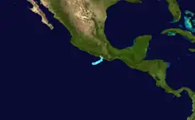
On June 3, the NHC noted the possibility of an area of low pressure forming off the southwestern coast of Mexico.[24] On June 7, an Oceansat-3 pass had indicated that the disturbance had consolidated a closed low-level circulation, the low was classified as Tropical Depression Two-E at 15:00 UTC.[25] Early the next day, the system acquired tropical storm-force wind and received the name Boris.[26] Most of the convection at this point was organized linearly with some banding around the center of the storm.[26] On June 9, Boris made landfall on the far southwestern coast of Oaxaca.[27] The rugged terrain proved unfavorable for this system, therefore transitioning it into a post-tropical cyclone, and then quickly dissipating afterward.[28]
One person died in Manzanillo, Colima, in rough seas.[29] In Tecomán, two additional were swept away by rough surf in Tecomán and later found dead.[29][30] Commercial losses in Acapulco were estimated at Mex$1.5 billion (US$87.1 million).[31] In Oaxaca, a man drowned after his truck was swept away by an overflowing river. An outdoor theater worth Mex$54 million (US$3.16 million) was destroyed by swells.[32] As of July 2026, Arthur J. Gallagher & Co. estimated that losses totaled to US$100 million.[33]
Tropical Storm Cristina
| Tropical storm (SSHWS) | |
  | |
| Duration | June 8 – June 10 |
|---|---|
| Peak intensity | 50 mph (85 km/h) (1-min); 1002 mbar (hPa) |
On June 3, the NHC noted the possibility of an area of low pressure forming off the western coast of Central America.[24] On June 8, after developing persistent deep convection, the low was classed as a tropical depression and was it designated Tropical Depression Three-E.[34] Soon, the depression intensified into a tropical storm, becoming named Cristina, with winds of 50 mph (85 km/h) and a pressure of 1002 mbar (hPa) based on scatterometer data.[35] At the time while moving at an erratic movement, Cristina exhibited an exposed low-level circulation, a characteristic typical of tropical cyclones under the effects of high wind shear because of the interaction of a nearby and slightly stronger Tropical Storm Boris.[36] Cristina weakened into a tropical depression as a result. The trend continued, and on June 11, Cristina opened up into a trough as the circulation was no longer well defined.[37] The trough merged with a low pressure system which later produced heavy rainfall along the western Gulf of Mexico coast.[38]
Prior to becoming a tropical depression, Cristina produced heavy rains that caused flooding in San Pedro Sula, Honduras, killing a 60-year-old man and disrupting traffic.[39] In Santa Cruz, Costa Rica, five people were left missing after heavy winds attributed to Cristina capsized two boats.[40] Across El Salvador, 58 damaged or flooded homes, 11 affected vehicles, 38 fallen trees, 34 blocked roads and 5 landslides were reported.[41] In Acajutla, residents and business owners estimated that losses totaled to US$150,000.[42] Heavy rainfall related to Cristina, combined with the effects of the local rainy season, resulted in five deaths and three injuries in Guatemala; two deaths occurred each in Momostenango and Casillas and a child died in Senahú.[43] In Chiapas, heavy rainfall from Cristina caused flooding. A man was found dead after being swept away by an overflowing river.[44]
Tropical Storm Douglas
| Tropical storm (SSHWS) | |
  | |
| Duration | July 1 – July 3 |
|---|---|
| Peak intensity | 40 mph (65 km/h) (1-min); 1003 mbar (hPa) |
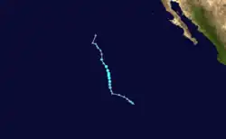
On June 21, the NHC began monitoring a disturbance off the southwestern coast of Mexico and noted the possibility of tropical development.[45] The disturbance increased in chances for development as it showed signs of further organization as it moved into open waters.[46] The disturbance eventually had a 90% chance of development according to the NHC.[47] By July 1, the low pressure system obtained enough organization to be classified as Tropical Depression Four-E and had winds of 35 mph (55 km/h) and a pressure of 1005 mbar (29.67 inHg).[10] Later, it strengthened into a tropical storm and received the name Douglas.[48][49] The system meandered slowly over the open waters, eventually reaching peak winds of 40 mph (65 km/h) and a minimum central pressure of 1003 mbar (29.61 inHg) over the open waters,[50] which it maintained until July 3. The system weakened into a remnant low with only a little amount of convection and cloud tops near the circulation mainly due to cooler sea surface temperatures.[51][52] The remnants of the system continued moving generally to the northwest towards cooler waters in the open Eastern Pacific Ocean,[52] before dissipating on July 5.
Tropical Storm Elida
| Tropical storm (SSHWS) | |
  | |
| Duration | July 14 – July 20 |
|---|---|
| Peak intensity | 70 mph (110 km/h) (1-min); 990 mbar (hPa) |
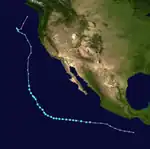
On July 7, at 06:00 UTC, the NHC began monitoring a disturbance off the coast of southern Mexico with a low chance for development.[53] Over the next few days, the disturbance became better organized under favorable conditions for tropical cyclogenesis. On July 14 at 18:00 UTC, the system consolidated into Tropical Depression Five-E,[54] and twelve hours later, the depression was upgraded to Tropical Storm Elida.[55] Though some dry air and mid-level wind wind shear hindered the storm, it continued to strengthen.[56] It attained its peak intensity on July 18 with winds of 70 mph (110 km/h) and a pressure of 990 mbar (29 inHg).[57] The storm then weakened as it moved over colder waters as well as experiencing more dry air and wind shear. The system stopped producing significant convection on July 20 and became post-tropical.[58]
Elida impacted Clarion Island with strong winds and rough seas throughout July 16.[59] Swells related to the remnants of Elida as well as the further distant Hurricanes Fausto and Genevieve on July 25 impacted produced significant swells on the California coast. A total of 464 water rescues took place in San Diego while another 160 rescues took place in Oceanside.[60] The Los Angeles County Fire Department performed a record 1,950 rescues on July 25.[61] Further north, more than 25 rescues occurred at beaches in the Santa Cruz area that same day.[62] A lifeguard who was caught on video performing one of these rescues in Santa Cruz was invited to the White House to receive a high civilian honor.[63]
Hurricane Fausto
| Category 2 hurricane (SSHWS) | |
  | |
| Duration | July 19 – July 29 |
|---|---|
| Peak intensity | 105 mph (165 km/h) (1-min); 967 mbar (hPa) |
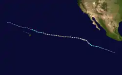
The NHC began monitoring an area for development on July 12,[64] with a tropical wave being located offshore of southern Mexico by July 16.[65] The tropical wave developed into a broad low on July 18.[66] The low gained sufficient organization and developed into Tropical Depression Six-E at 03:00 UTC on July 19.[67] The depression continued to organize and strengthened to Tropical Storm Fausto at 21:00 UTC later that day.[68] Fausto strengthened slowly over the next two days, with persistent northerly shear counteracting an otherwise conducive environment.[69] Despite this, Fausto continued to organize, and strengthened into a hurricane at 03:00 UTC on July 22, becoming the first hurricane of the season.[70] Thereafter, Fausto struggled to strengthen for a couple days due to resurgent wind shear and dry air intrusions.[71][72] Despite a marginal environment, the storm reorganized and strengthened again on July 24, becoming a Category 2 hurricane.[73] Fausto continued moving west, and weakened back to a Category 1 hurricane due to drier air and cooler sea surface temperatures on July 26.[74] On July 28, Fausto weakened to a tropical storm under further unfavorable conditions,[75] ultimately degenerating into a remnant low the following day, devoid of sufficient convection.[76]
Fausto impacted the Revillagigedo Islands with strong winds and rough seas throughout July 20.[77] Significant swells from Fausto also affected the California coast in conjunction with the remnants of Elida and the developing Genevieve.[60]
Hurricane Genevieve
| Category 5 hurricane (SSHWS) | |
  | |
| Duration | July 24 – August 2 |
|---|---|
| Peak intensity | 160 mph (260 km/h) (1-min); 925 mbar (hPa) |
On July 17, the NHC began noting the potential for a low-pressure area to develop over the Gulf of Tehuantepec over the next few days and for the potential of tropical cyclogenesis to occur amidst favorable environmental conditions.[78] A tropical wave entered the Eastern Pacific from Central America and by July 21 it began producing a large area of convection.[79] A low-pressure system formed the following day several hundred miles to the south of Mexico.[80] The system became better organized and by 15:00 UTC on July 24, it was designated as a tropical depression, the seventh of the season,[81] intensifying into Tropical Storm Genevieve six hours later. Within an area of modest west-northwesterly wind shear,[82] the nascent storm only intensified gradually, being upgraded to a hurricane early on July 25 as it was steered to the west-northwest by powerful mid-level tropospheric ridging over the Southern United States and western Caribbean Sea, allowing the storm to enter a region of high ocean heat content and light wind shear.[83] Within this environment, Genevieve rapidly intensified and at 15:00 UTC on July 26, Genevieve was upgraded to a major hurricane,[84] the first major hurricane of the 2026 Pacific hurricane season.[85] Genevieve continued to rapidly intensify within extremely warm sea surface temperatures of around 86 °F (30 °C).[86] Genevieve was quickly upgraded to a Category 4 hurricane after only a few hours of intensification, clearing out a warm and symmetric eye.[87] Imagery from the GMI Microwave Imager depicted intense lightning activity within the northern and eastern eyewall of Genevieve and a deep band of convection developing around the storm's inner core.[88] Based on several satellite intensity estimates ranging from 158 mph; 254 km/h to 163 mph; 263 km/h, Genevieve was upgraded to a Category 5 hurricane at 09:00 UTC on July 27.[89] Genevieve's maximum sustained winds peaked at 160 mph (260 km/h) and its minimum central pressure fell to 925 mbar (hPa; 27.32 inHg).[90]
Genevieve's rapid intensification ended by the afternoon of July 27 as it entered the early stages of an eyewall replacement cycle.[91] Over the next several hours Genevieve's eye became colder and more cloud—filled[92] and an outer eyewall began to form.[93] By late the following day, Genevieve had fallen to a Category 3 hurricane and its structure had degraded due to dry air intrusions and a minor amount of northerly wind shear, and weakened was expected to continue as it moved into cooler sea surface temperatures.[94] However, the hurricane unexpectedly reintensified while its satellite presentation improved, being reupgraded to a Category 4 hurricane at 00:00 UTC on July 29.[95] After this brief resurgence, Genevieve resumed weakening and the eye became more clouded.[96] Increased northwesterly wind shear and dry air caused Genevieve to weaken to a Category 3 hurricane by 15:00 UTC that day despite microwave satellite imagery indicating the completion of the eyewall replacement cycle.[97] Genevieve's eye completely collapsed by early the next day and its low-level center became entirely obscured underneath a central dense overcast.[98] Genevieve fell to a minimal hurricane that day as the storm's deepest convection became displaced to the south and east of its center.[99] At 03:00 UTC on July 31, Genevieve was downgraded to a tropical storm.[100] Genevieve continued to weaken and degenerated to a post-tropical cyclone at 15:00 UTC on August 2.[101]
Genevieve generated swells that caused rough surf and rip current conditions along the western coast of Baja California peninsula and parts of Southwestern Mexico.[102][103] Genevieve produced blustery conditions on Clarion Island, with a peak sustained wind of 63 mph (101 km/h) and a peak wind gust of 86 mph (138 km/h) being observed.[104] Genevieve also generated swells that caused coastal flooding in Southern California, leading to the cancellation of two Pacific Surfliner trains, as well as delays on Metrolink.[105] City officials in Long Beach constructed sand berms on local beaches to prevent flooding from increased tides.[106] A High Surf advisory was issued for Southern California beaches from between July 29 and August 1 due to the threat of dangerous surf conditions.[107] Several water rescues occurred from rough ocean conditions.[105]
Tropical Storm Hernan
| Tropical storm (SSHWS) | |
  | |
| Duration | August 13 – August 15 |
|---|---|
| Peak intensity | 45 mph (75 km/h) (1-min); 1003 mbar (hPa) |
The NHC began monitoring a tropical wave south of Baja California on August 8.[108] The system slowly organized over the next few days, developing a well-defined low on August 11.[109] The system was designated Invest 99E and had a high 70% chance of development. The chance of the system decreased to a medium 60% chance according to the NHC. The system then gained a lot of organization despite being sheared by wind shear. On August 13, it then was designated Tropical Depression Eight-E at 03:00 UTC after developing persistent deep convection and enough organization.[110] Tropical Depression Eight-E later strengthened to a tropical storm soon after at 09:00 UTC, gaining the name Hernan,[111] and soon attaining a peak pressure of 1,003 mbar (29.6 inHg) and peak winds of 45 mph (75 km/h) at 21:00 UTC.[112] Strong shear then exposed the storm's center,[113] weakening it to a tropical depression a day later.[114] On August 15, Hernan weakened and became a remnant low.[115]
Hurricane Lala
| Category 4 hurricane (SSHWS) | |
  | |
| Duration | August 13 – August 28 |
|---|---|
| Peak intensity | 130 mph (215 km/h) (1-min); 947 mbar (hPa) |
On August 12, the NHC designated Potential Tropical Cyclone One due to a tropical disturbance east-southeast of Hawaii.[116] A day later, the NHC redesignated the system as Tropical Storm Lala, after increased convection and consolidation of the circulation.[117] The storm strengthened while moving towards Hawaii, but was deterred slightly by dry air intrusions..[118] At 19:00 UTC on August 15, Lala attained hurricane status.[119] At 03:00 UTC on August 16, Lala passed just south of the Big Island with winds of 80 mph (130 km/h).[120] Land interaction quickly weakened Lala back to a tropical storm, but it regained hurricane status on August 18 after passing the island chain.[121][122] Lala rapidly intensified, attaining peak winds of 130 mph (215 km/h) on August 19, with a minimum pressure of 947 mbar (28.0 inHg).[123] A trough to its north turned Lala to the north, bringing it through the Papahanaumokuakea Marine National Monument on August 21. By that time, it had weakened due to dry air and cooler waters.[124] Lala fell to tropical storm status on August 23. It turned back to the northwest due to a building ridge.[125] Stronger wind shear caused the storm to weaken on August 27.[126] On August 28, Lala transitioned into a post-tropical cyclone.[127] The system crossed the international date line later that day, with the Joint Typhoon Warning Center (JTWC) marking it as a subtropical system, while the Japan Meteorological Agency (JMA) classified it as an extratropical low.[128][129]
A 93-year-old woman was found deceased in her home in Nāʻālehu following the storm.[130] In addition, one man was killed and two others were injured, including one critically, as a result of a head-on car accident in Hawaiian Ocean View due to inclement weather caused by Lala's passage.[131][132] A few days after Lala's passage, an unidentified man, believed to be in his 60s, was found deceased near Hawaiʻi Belt Road in Nāʻālehu in a pasture, with his death being attributed to Lala.[133] Elsewhere, another woman was hospitalized with "moderate injuries" after she was swept 100 yards away by floodwaters after her home was knocked off its foundation in Waiʻōhinu.[134]
Tropical Storm Moke
| Tropical storm (SSHWS) | |
  | |
| Duration | August 20 – August 25 |
|---|---|
| Peak intensity | 50 mph (85 km/h) (1-min); 994 mbar (hPa) |
A tropical depression formed about 960 miles (1,540 km) east-southeast of Hilo over the Central Pacific on August 20,[135] with the initial intensity being set at 35 mph (55 km/h) based on an earlier ASCAT pass.[136] The next day, based on data obtained by recon, the storm was upgraded to a tropical storm, and received the name Moke.[137] The Central Pacific Hurricane Center (CPHC) noted that although the storm was expected to cause some wind, rain and surf impacts in the Hawaiian Islands, no tropical storm watches or warnings were expected due to the storm's compact nature.[137] Moke threatened Hawaii just a few days after the passage of Lala, threatening to bring additional rainfall and flooding to the Big Island. Members of the Hawaii Army National Guard and Hawaii Air National Guard were deployed to the southern region of the Big Island to begin storm preparations for Moke in conjunction with ongoing recovery efforts from Lala.[138] Moke began to encounter unfavorable conditions and then, on August 25, Moke became a remnant low.
Tropical Storm Iselle
| Tropical storm (SSHWS) | |
  | |
| Duration | August 23 – August 27 |
|---|---|
| Peak intensity | 70 mph (110 km/h) (1-min); 988 mbar (hPa) |
An area of disturbed weather formed south of Mexico on August 21. The system became more organized overnight on August 22 and strengthened into Tropical Storm Iselle the following morning.[139] Iselle strengthened further in favorable conditions, topping out at 70 mph with a pressure of 988 mbar. However, Iselle began to weaken by August 25, as a result of cooler sea surface temperatures.
Iselle generated swells that affected the Revillagigedo Islands and the western coast of Baja California peninsula.[140][141]
Tropical Storm Julio
| Tropical storm (SSHWS) | |
  | |
| Duration | August 24 – August 25 |
|---|---|
| Peak intensity | 50 mph (85 km/h) (1-min); 1001 mbar (hPa) |
On August 24, an area of low pressure south of Mexico, few hundred miles south-southwest of Iselle, developed tropical characteristics. As a result, the disturbance was designated Tropical Depression Ten-E.[142] On the next day the depression was upgraded to a tropical storm, receiving the name Julio on August 25 at 09:00 UTC.[143] Julio strengthened a little, and soon reached peak winds of 50 mph (85 km/h) and a peak central pressure of 1001 mbar (hPa).[144] Julio had a brief Fujiwhara interaction with nearby Iselle, before being absorbed by it later that evening and dissipating.[145]
Hurricane Karina
| Category 3 hurricane (SSHWS) | |
  | |
| Duration | August 27 – present |
|---|---|
| Peak intensity | 125 mph (205 km/h) (1-min); 954 mbar (hPa) |
Late on August 21, the NHC began noting the potential for an area of disturbed weather to form well southwest of Mexico over the next several days and undergo tropical cyclogenesis.[146] Five days later, an area of low pressure formed in association with a tropical wave well offshore Southwestern Mexico and began to consolidate.[147] At 21:00 UTC on August 27, the system having already attained gale-force winds was upgraded into Tropical Storm Karina.[148] At 09:00 UTC on August 30, Karina was upgraded to a hurricane with winds of 80 mph (130 km/h) and a pressure of 980 mbar (29 inHg).[149] Moving over warm waters near 84 °F (29 °C), Karina rapidly intensified, becoming a major hurricane at 00:00 UTC with winds of 110 kt (125 MPH) on August 31.[150]
Karina impacted the Revillagigedo Islands with rough seas and strong winds.[151][152]
Tropical Storm Lowell
| Tropical storm (SSHWS) | |
  | |
| Duration | August 27 – present |
|---|---|
| Peak intensity | 50 mph (85 km/h) (1-min); 999 mbar (hPa) |
At 00:00 UTC on August 27, after gaining some organization and a medium chance for development, an area of low pressure was designated Invest 94E by the NHC.[153] On August 28, Lowell reached winds of 45 mph (75 km/h) and a pressure of 1003 mbar (hPa) after slowly becoming better organized.[154] Lowell slowly strengthened over the next few days and gained a little more organization despite battling easterly wind shear.[155]
Storm names
The following list of names is being used for named storms that form in the North Pacific Ocean east of 140°W during 2026.[156] This is the same list used in the 2020 season.
|
|
For storms that form in the North Pacific from 140°W to the International Date Line, the names come from a series of four rotating lists. Names are used one after the other without regard to year, and when the bottom of one list is reached, the next named storm receives the name at the top of the next list.[156] Two named storms, listed below, have formed within the area in 2026. Named storms in the table above that cross into the area during the season are noted (*).
|
Season effects
The following is a table which will include all of the storms that form in the 2026 Pacific hurricane season. It will include their duration, names, intensities, areas affected, damages, and death totals. Deaths in parentheses are additional and indirect (an example of an indirect death would be a traffic accident), but were still related to that storm. Damage and deaths include totals while the storm was extratropical, a wave, or a low, and all of the damage figures are in 2026 USD.
| Saffir–Simpson scale | ||||||
| TD | TS | C1 | C2 | C3 | C4 | C5 |
| Storm name |
Dates active | Storm category at peak intensity |
Max 1-min wind mph (km/h) |
Min. press. (mbar) |
Areas affected | Damage (US$) |
Deaths | Ref(s). | ||
|---|---|---|---|---|---|---|---|---|---|---|
| Amanda | June 2–7 | Tropical storm | 50 (85) | 1003 | None | None | None | |||
| Boris | June 7–9 | Tropical storm | 50 (85) | 1000 | Southern Mexico | $100 million | 4 | |||
| Cristina | June 8–10 | Tropical storm | 50 (85) | 1002 | Central America, Southern Mexico | >$150,000 | 7 | |||
| Douglas | July 1–3 | Tropical storm | 40 (65) | 1003 | None | None | None | |||
| Elida | July 14–20 | Tropical storm | 70 (110) | 990 | Clarion Island, Coastal California | None | None | |||
| Fausto | July 19–29 | Category 2 hurricane | 105 (165) | 967 | Revillagigedo Islands, Hawaiian Islands, Coastal California | None | None | |||
| Genevieve | July 24 – August 2 | Category 5 hurricane | 160 (260) | 925 | Revillagigedo Islands, Baja California peninsula, Southwestern Mexico, Coastal California | None | None | |||
| Hernan | August 13–15 | Tropical storm | 45 (75) | 1003 | None | None | None | |||
| Lala | August 13–28 | Category 4 hurricane | 130 (215) | 947 | Hawaiian Islands | $100 million | 3 (1) | |||
| Moke | August 20–25 | Tropical storm | 50 (85) | 994 | Hawaiian Islands | None | None | |||
| Iselle | August 23–27 | Tropical storm | 70 (110) | 988 | Revillagigedo Islands, Baja California peninsula | None | None | |||
| Julio | August 24–25 | Tropical storm | 50 (85) | 1001 | None | None | None | |||
| Karina | August 27–present | Category 3 hurricane | 125 (205) | 954 | Revillagigedo Islands | None | None | |||
| Lowell | August 27–present | Tropical storm | 50 (85) | 999 | None | None | None | |||
| Season aggregates | ||||||||||
| 14 systems | June 2 – Season ongoing | 160 (260) | 925 | >$200 million | 14 (1) | |||||
See also
- Weather of 2026
- Tropical cyclones in 2026
- 2026 Atlantic hurricane season
- 2026 Pacific typhoon season
- 2026 North Indian Ocean cyclone season
- South-West Indian Ocean cyclone seasons: 2025–26, 2026–27
- Australian region cyclone seasons: 2025–26, 2026–27
- South Pacific cyclone seasons: 2025–26, 2026–27
References
- 1 2 "Background Information: Eastern Pacific Hurricane Season". College Park, Maryland: NOAA Climate Prediction Center. May 14, 2022. Retrieved June 1, 2023.
- 1 2 "Northeast Pacific Ocean Historical Tropical Cyclone Statistics". Fort Collins, Colorado: Colorado State University. Retrieved May 6, 2024.
- 1 2 "Temporada de Ciclones Tropicales 2026". Ciudad de México: Gobierno de Mexico. April 22, 2026. Retrieved April 24, 2026.
- 1 2 Rice, Doyle; Pulver, Dinah Voyles (May 21, 2026). "NOAA's hurricane forecast includes El Niño and a surprising twist". USA Today. Retrieved May 21, 2026.
- 1 2 Rosencrans, Matthew; Wang, Hui; Harnos, Daniel; Long, Lindsey; Novella, Nicholas; Blake, Eric; Brenchley, Christopher; Goldenberg, Stanley (May 21, 2026). "NOAA 2026 Eastern Pacific Hurricane Season Outlook". Climate Prediction Center. Retrieved May 28, 2026.
- ↑ "Frequently Asked Questions". Miami, Florida: Atlantic Oceanographic and Meteorological Laboratory. June 1, 2023. Retrieved June 8, 2026.
- ↑ Gunther, Emil B.; R.L. Cross (October 1986). "Eastern North Pacific Tropical Cyclones of 1985". Monthly Weather Review. 114 (10): 1931–1949. Bibcode:1986MWRv..114.1931G. doi:10.1175/1520-0493(1986)114<1931:ENPTCO>2.0.CO;2.
- ↑ Sosnowski, Alex (June 3, 2026). "Tropical Storm Amanda forms in eastern Pacific; Hurricane threat looms". accuweather.com. Retrieved June 8, 2026.
- ↑ Fortuna, Angela; Atienza, Julian (June 8, 2026). "Tropical Storm Boris and Tropical Depression Three-E form in the Eastern Pacific, threatening flooding rain". foxweather.com. Retrieved June 8, 2026.
- 1 2 Kelly, Larry (2026-07-01). "Tropical Depression Four-E Advisory Number 1". www.nhc.noaa.gov. Retrieved 2026-07-04.
- ↑ Hurricane Genevieve Discussion Number 12 (Report). Miami, Florida: National Hurricane Center. July 27, 2027. Retrieved July 27, 2026.
- ↑ "2026 Eastern Pacific Hurricane Season". Miami, Florida: National Hurricane Center. July 15, 2026. Retrieved July 15, 2026.
- ↑ "2026 Central Pacific Hurricane Season". nhc.noaa.gov. 2026-07-28. Retrieved 2026-07-28.
- ↑ Kelly, Larry (May 31, 2026). Two-Day Tropical Outlook (Report). Miami, Florida: National Hurricane Center.
- 1 2 Papin, Philippe (July 28, 2026). Tropical Cyclone Report: Tropical Storm Amanda (PDF) (Report). Miami, Florida: National Hurricane Center. Retrieved July 29, 2026.
- ↑ Reinhart, Brad (June 2, 2026). Tropical Depression One-E Discussion Number 1 (Report). Miami, Florida: National Hurricane Center. Retrieved June 2, 2026.
- ↑ Kelly, Larry; Adams, Elizabeth (June 3, 2026). Tropical Storm Amanda Discussion Number 4 (Report). Miami, Florida: National Hurricane Center. Retrieved June 3, 2026.
- ↑ Kelly, Larry; Adams, Elizabeth (June 3, 2026). Tropical Storm Amanda Discussion Number 5 (Report). Miami, Florida: National Hurricane Center. Retrieved June 5, 2026.
- ↑ Beven, Jack (June 4, 2026). Tropical Storm Amanda Discussion Number 7 (Report). Miami, Florida: National Hurricane Center. Retrieved June 5, 2026.
- ↑ Adams, Elizabeth; Brown, Michael (June 5, 2026). Tropical Storm Amanda Discussion Number 13 (Report). Miami, Florida: National Hurricane Center. Retrieved June 5, 2026.
- ↑ Brown, Michael (June 6, 2026). Tropical Depression Amanda Discussion Number 17 (Report). Miami, Florida: National Hurricane Center. Retrieved June 6, 2026.
- ↑ Roberts, Dave (2026-06-07). "Tropical Depression Amanda Discussion Number 20". National Hurricane Center. Miami, Florida. Retrieved 2026-06-08.
- ↑ Adams, Elizabeth; Papin, Philippe (2026-08-06). "Post-Tropical Cyclone Amanda Discussion Number 22". National Hurricane Center. Miami, Florida. Retrieved 2026-06-08.
- 1 2 Kelly, Larry (2026-06-03). "NHC Graphical Outlook Archive". National Hurricane Center. Miami, Florida. Retrieved 2026-06-08.
{{cite web}}: CS1 maint: url-status (link) - ↑ Pasch, Richard (June 7, 2026). Tropical Depression Two-E Discussion Number 1 (Report). Miami, Florida: National Hurricane Center. Retrieved June 7, 2025.
- 1 2 Berg, Robbie (2026-06-08). "Tropical Storm Boris Discussion Number 4". National Hurricane Center. Miami, Florida. Retrieved 2026-06-08.
- ↑ Hagen, Andrew (2026-06-09). "Tropical Storm Boris Advisory Number 9". National Hurricane Center. Miami, Florida. Retrieved 2026-06-09.
- ↑ Beven, Jack (2026-06-09). "Post-Tropical Cyclone Boris Discussion Number 10". National Hurricane Center. Miami, Florida. Retrieved 2026-06-09.
- 1 2 "Tormenta tropical Boris deja una mujer muerta y dos desaparecidos en Colima; conoce su trayectoria" (in Mexican Spanish). Eje Central. June 9, 2026. Retrieved June 10, 2026.
- ↑ Juan Carlos Flores (2026-06-14). "Localizan sin vida a dos comerciantes que se encontraban desaparecidos tras paso de la tormenta 'Boris' en Colima". La Jornada (in Spanish). Retrieved 2026-06-14.
- ↑ "Tormenta Boris dejó pérdidas millonarias y cierre de negocios en Acapulco". OEM (in Spanish). Retrieved 2026-06-12.
- ↑ "Tormenta tropical "Boris" deja una persona fallecida en Oaxaca". El Universal (in Spanish). Retrieved 2026-06-13.
- ↑ Bowen, Steve; Kerschner, Brian; Zheng Ng, Jin (July 15, 2026). "H1 2026 Natural Catastrophe and Climate Report" (PDF). ajg.com. Retrieved July 15, 2026.
- ↑ Bucci, Lisa (2026-06-08). "Tropical Depression Three-E Discussion Number 1". National Hurricane Center. Miami, Florida. Retrieved 2026-06-08.
- ↑ Cangialosi, John (2026-08-14). "TROPICAL CYCLONE REPORT TROPICAL STORM CRISTINA (EP032026)" (PDF). National Hurricane Center.
- ↑ Bucci, Lisa (June 8, 2026). Tropical Storm Cristina Discussion Number 3 (Report). Miami, Florida: National Hurricane Center. Retrieved June 8, 2026.
- ↑ Reinhart, Brad (2026-06-11). "Remnants of Cristina Tropical Cyclone Update". National Hurricane Center. Miami, Florida. Retrieved 2026-06-11.
- ↑ Rice, Doyle (June 15, 2026). "Tropical trouble in the Gulf? Forecasters eye developing system". USA Today. Retrieved June 17, 2026.
- ↑ "Lluvias en San Pedro Sula causan primera muerte y fuertes inundaciones". Consulta Monterrey (in Spanish). 3 June 2026. Retrieved 10 June 2026.
- ↑ "Tormenta tropical Cristina deja cinco desaparecidos en Costa Rica" (in Spanish). 9 June 2026. Retrieved 10 June 2026.
- ↑ "Protección Civil mantiene listos 180 albergues y reporta más de 150 incidentes por lluvias 08/JUNIO/2026". Government of El Salvador (in Spanish). 8 June 2026. Retrieved 10 June 2026.
- ↑ "El Salvador: damnificados exigen atención del Estado tras destrozos por tormenta Cristina en Acajutla". Noticias de Venezuela (in Spanish). 2026-06-18. Retrieved 2026-06-18.
- ↑ "Cinco personas han fallecido durante la temporada de lluvias en Guatemala". Emisoras Unidas (in Spanish). 8 June 2026. Retrieved 10 June 2026.
- ↑ Edgar H. Clemente (2026-06-12). "Localizan cuerpo de un hombre que fue arrastrado por corriente de río en Chiapas". La Jornada (in Spanish). Retrieved 2026-06-14.
- ↑ Cangialosi, John (2026-06-21). "NHC Graphical Outlook Archive". National Hurricane Center. Miami, Florida. Retrieved 2026-07-01.
{{cite web}}: CS1 maint: url-status (link) - ↑ Adams, Elizabeth (2026-06-29). "NHC Graphical Outlook Archive". www.nhc.noaa.gov. Retrieved 2026-07-04.
- ↑ Adams, Elizabeth (2026-07-01). "NHC Graphical Outlook Archive". www.nhc.noaa.gov. Retrieved 2026-07-04.
- ↑ Kelly, Larry (2026-07-01). "Tropical Depression Four-E Discussion Number 1". National Hurricane Center. Miami, Florida. Retrieved 2026-07-02.
- ↑ Adams, Elizabeth; Beven, Jack (2026-07-01). "Tropical Storm Douglas Discussion Number 3". National Hurricane Center. Miami, Florida.
- ↑ Adams, Elizabeth; Beven, Jack (2026-07-01). "Tropical Storm Douglas Advisory Number 3". National Hurricane Center. Miami, Florida. Retrieved 2026-07-04.
- ↑ Blake (July 2, 2026). "Tropical Storm Douglas Discussion Number 8". National Hurricane Center. Retrieved August 9, 2026.
- 1 2 Reinhart, Brad (2026-07-03). "Post Tropical Cyclone Douglas Discussion Number 9". National Hurricane Center. Miami, Florida. Retrieved 2026-07-04.
- ↑ Cangialosi (July 6, 2026). "Tropical Weather Outlook". National Hurricane Center. Retrieved July 20, 2026.
- ↑ "NHC ARCHIVED ADVISORY". www.nhc.noaa.gov. Retrieved 2026-07-15.
- ↑ "NHC ARCHIVED ADVISORY". www.nhc.noaa.gov. Retrieved 2026-07-15.
- ↑ Katz; Papin (July 15, 2026). "Tropical Storm Elida Discussion Number 5". National Hurricane Center. Retrieved July 20, 2026.
- ↑ Berg (July 18, 2026). "Tropical Storm Elida Advisory Number 15". National Hurricane Center. Retrieved July 20, 2026.
- ↑ Katz (July 20, 2026). "Post-Tropical Cyclone Elida Discussion Number 24". National Hurricane Center. Retrieved July 20, 2026.
- ↑ "Eastern North Pacific Tropical Weather Discussion". www.nhc.noaa.gov. Archived from the original on 2026-07-17. Retrieved 2026-07-17.
- 1 2 Anna Ashcraft (July 30, 2026). "Hurricane brings life-threatening surf to San Diego coast". KUSI. Retrieved July 30, 2026.
- ↑ Laylan Connelly (July 28, 2026). "Hurricane Genevieve to bring 'extreme' conditions to Southern California beaches". The Orange County Register. Retrieved July 30, 2026.
- ↑ Sooji Nam (July 27, 2026). "Dramatic California beach rescue caught on video as powerful surf, rip currents hit coast". CBS News. Retrieved July 27, 2026.
- ↑ Cody Taylor (July 29, 2026), Hurricane Genevieve brings in large waves and results in thousands of ocean rescues, Spectrum News, retrieved July 30, 2026
- ↑ Gibbs; Cangialosi (July 11, 2026). "Tropical Weather Outlook". National Hurricane Center. Retrieved July 19, 2026.
- ↑ Kelly (July 16, 2026). "Tropical Weather Outlook". National Hurricane Center. Retrieved July 19, 2026.
- ↑ Berg (July 18, 2026). "Tropical Weather Outlook". National Hurricane Center Miami. Retrieved July 19, 2026.
- ↑ Beven (July 18, 2026). "Tropical Depression Six-E Discussion Number 1". National Hurricane Center. Retrieved July 19, 2026.
- ↑ Pasch (July 19, 2026). "Tropical Storm Fausto Discussion Number 4". National Hurricane Center. Retrieved July 19, 2026.
- ↑ "Tropical Storm Fausto Discussion Number 6". nhc.noaa.gov. 2026-07-20. Retrieved 2026-07-21.
- ↑ "Hurricane Fausto Discussion Number 9". nhc.noaa.gov. 2026-07-20. Retrieved 2026-07-21.
- ↑ "Hurricane Fausto Discussion Number 11". nhc.noaa.gov. 2026-07-21. Retrieved 2026-07-24.
- ↑ "Hurricane Fausto Discussion Number 15". nhc.noaa.gov. 2026-07-22. Retrieved 2026-07-24.
- ↑ "Hurricane Fausto Discussion Number 22". nhc.noaa.gov. 2026-07-23. Retrieved 2026-07-24.
- ↑ "Hurricane Fausto Discussion Number 30". nhc.noaa.gov. 2026-07-25. Retrieved 2026-07-26.
- ↑ Richard Pasch (July 27, 2026), Tropical Storm Fausto Advisory Number 37, National Hurricane Center, retrieved August 2, 2026
- ↑ Jack Beven (July 29, 2026), Post-Tropical Cyclone Fausto Advisory Number 43, National Hurricane Center, retrieved August 2, 2026
- ↑ "Eastern North Pacific Tropical Weather Discussion". www.nhc.noaa.gov. Archived from the original on 2026-07-21. Retrieved 2026-07-21.
- ↑ Brad Reinhart (July 17, 2026). "Seven-Day Graphic Tropical Weather Outlook". Miami, Florida: National Hurricane Center. Retrieved July 17, 2026.
- ↑ Larry Kelly (July 21, 2026). "Seven-Day Graphical Tropical Weather Outlook". Miami, Florida: National Hurricane Center. Retrieved July 21, 2026.
- ↑ Larry Kelly (July 22, 2026), Seven-Day Graphical Tropical Weather Outlook, National Hurricane Center, retrieved July 22, 2026
- ↑ Eric Reinhart (July 24, 2026), Tropical Depression Seven-E Discussion Number 1, Miami, Florida: National Hurricane Center, retrieved July 26, 2026
- ↑ Dave Roberts (July 24, 2026), Tropical Storm Genevieve Discussion Number 2, Miami, Florida: National Hurricane Center, retrieved July 26, 2026
- ↑ Robbie Berg (July 25, 2026), Hurricane Genevieve Discussion Number 7, National Hurricane Center, retrieved July 26, 2026
- ↑ Brian Adams; Philipp Papin (July 26, 2026), Hurricane Genevieve Discussion Number 9, Miami, Florida: National Hurricane Center, retrieved July 26, 2026
- ↑ Anthony Edwards (July 26, 2026). "Eastern Pacific About to Get First Major Hurricane of the Season". San Francisco Chronicle. Retrieved July 26, 2026.
- ↑ Bob Henson; Irene Sans (July 27, 2026). "Genevieve becomes the first Category 5 hurricane of 2026". Yale Climate Connections. Retrieved July 27, 2026.
- ↑ Brian Adams; Philip Papin (July 26, 2026), Hurricane Genevieve Discussion Number 10, retrieved July 30, 2026
- ↑ Larry Kelly (July 26, 2026), Hurricane Genevieve Discussion Number 11, National Hurricane Center, retrieved July 30, 2026
- ↑ Andrew Hagen (July 27, 2026), Hurricane Genevieve Discussion Number 12, National Hurricane Center, retrieved July 27, 2026
- ↑ Andrew Hagen (July 27, 2026), Hurricane Genevieve Advisory Number 12, National Hurricane Center, retrieved July 27, 2026
- ↑ Brian Adams; Philip Papin (July 27, 2026), Hurricane Genevieve Discussion Number 13, National Hurricane Center, retrieved July 30, 2026
- ↑ Larry Kelly (July 27, 2026), Hurricane Genevieve Discussion Number 15, National Hurricane Center, retrieved July 30, 2026
- ↑ John Cangialosi (July 28, 2026), Hurricane Genevieve Discussion Numbed 16, National Hurricane Center, retrieved July 30, 2026
- ↑ Brian Adams; Philip Papin (July 28, 2026), Hurricane Genevieve Discussion Number 18, National Hurricane Center, retrieved July 30, 2026
- ↑ Larry Kelly (July 28, 2026), Hurricane Genevieve Special Discussion Number 19, National Hurricane Center, retrieved July 30, 2026
- ↑ Larry Kelly (July 29, 2026), Hurricane Genevieve Discussion Number 20, National Hurricane Center, retrieved July 30, 2026
- ↑ Brian Adams; Jack Beven (July 29, 2026), Hurricane Genevieve Discussion Number 22, National Hurricane Center, retrieved July 30, 2026
- ↑ Alex Gibbs; Cole Evans (July 29, 2026), Hurricane Genevieve Discussion Number 25, National Hurricane Center, retrieved July 30, 2026
- ↑ Brian Adams; Jack Beven (July 30, 2026), Hurricane Genevieve Discussion Number 26, National Hurricane Center, retrieved July 30, 2026
- ↑ Jeremy Katz; Richard Pasch (July 30, 2026), Tropical Storm Genevieve Discussion Number 28, National Hurricane Center, retrieved July 31, 2026
- ↑ Brian Adams; John Cangialosi (August 2, 2026), Post-Tropical Cyclone Genevieve Discussion Number 39, National Hurricane Center, retrieved August 2, 2026
- ↑ "Eastern North Pacific Tropical Weather Discussion". www.nhc.noaa.gov. Archived from the original on 2026-07-28. Retrieved 2026-07-28.
- ↑ "Offshore Waters Forecast". www.nhc.noaa.gov. Archived from the original on 2026-07-28. Retrieved 2026-07-28.
- ↑ Brian Adams; Jack Beven (July 28, 2026), Hurricane Genevieve Advisory Number 17, National Hurricane Center, retrieved July 29, 2026
- 1 2 Dallow, Lily (July 29, 2026). "High surf delays trains, creates dangerous beach conditions across Southern California". KTLA. Retrieved August 1, 2026.
- ↑ John Donegan (July 29, 2026). "Long Beach prepares for high tides, larger waves stirred by Hurricane Genevieve". Long Beach Post. Retrieved July 30, 2026.
- ↑ Sergio Robles (July 27, 2026). "Hurricane Genevieve to bring swells to California beaches". KUSI. Retrieved July 27, 2026.
- ↑ Beven (August 7, 2026). "Tropical Weather Outlook". National Hurricane Center. Retrieved August 14, 2026.
- ↑ Hagen (August 11, 2026). "Tropical Weather Outlook". National Hurricane Center. Retrieved August 14, 2026.
- ↑ Hagen (August 13, 2026). "Tropical Depression Eight-E Discussion Number 1". National Hurricane Center. Retrieved August 14, 2026.
- ↑ Katz; Beven (August 13, 2026). "Tropical Storm Hernan Discussion Number 2". National Hurricane Center. Retrieved August 14, 2026.
- ↑ Adams; Cangialosi (August 13, 2026). "Tropical Storm Hernan Advisory Number 4". National Hurricane Center. Retrieved August 14, 2026.
- ↑ Adams (August 13, 2026). "Tropical Storm Hernan Discussion Number 4". National Hurricane Center. Retrieved August 14, 2026.
- ↑ www.nhc.noaa.gov https://www.nhc.noaa.gov/text/refresh/MIATCPEP3+shtml/142034.shtml?. Retrieved 2026-08-14.
{{cite web}}: Missing or empty|title=(help) - ↑ "Post-Tropical Cyclone Hernan Discussion Number 12". nhc.noaa.gov. 2026-08-15. Retrieved 2026-08-19.
- ↑ Pasch, Richard (2026-08-12). "Potential Tropical Cyclone One-C Discussion Number 1". National Hurricane Center. Retrieved 2026-08-30.
- ↑ Cangialosi, John; Pierce, Patrick (2026-08-13). "Tropical Storm Lala Discussion Number 5". National Hurricane Center. Retrieved 2026-08-30.
- ↑ "Tropical Storm Lala Discussion Number 7". National Hurricane Center. 2026-08-13. Retrieved 2026-08-19.
- ↑ "Hurricane Lala Tropical Cyclone Update: 1900 UTC". www.nhc.noaa.gov. Retrieved 2026-08-16.
- ↑ "Hurricane Lala Advisory Number 15". www.nhc.noaa.gov. Retrieved 2026-08-16.
- ↑ "Tropical Storm Lala Intermediate Advisory Number 16A". www.nhc.noaa.gov. Retrieved 2026-08-16.
- ↑ Hagen, Andrew (August 18, 2026). "Hurricane Lala Discussion Number 24". National Hurricane Center. Miami, Florida. Retrieved August 18, 2026.
- ↑ "Hurricane Lala Discussion Number 28". nhc.noaa.gov. 2026-08-18. Retrieved 2026-08-19.
- ↑ "Hurricane Lala Discussion Number 36". National Hurricane Center. 2026-08-21. Retrieved 2026-08-30.
- ↑ "Tropical Storm Lala Discussion Number 43". National Hurricane Center. 2026-08-21. Retrieved 2026-08-30.
- ↑ "Tropical Storm Lala Discussion Number 60". National Hurricane Center. 2026-08-27. Retrieved 2026-08-30.
- ↑ Cangialosi, John (2026-08-28). "Post-Tropical Cyclone Lala Discussion Number 64". www.nhc.noaa.gov. Retrieved 2026-08-28.
- ↑ Significant Tropical Weather Advisory for the Western and South Pacific Oceans, 28 August 2026 (Report). United States Joint Typhoon Warning Center. 28 August 2026. Archived from the original on August 28, 2026. Retrieved 28 August 2026.
- ↑ WARNING AND SUMMARY 281800 (Report). Japan Meteorological Agency. August 28, 2026. Archived from the original on August 28, 2026.
- ↑ "Hawaii Island woman, 93, found dead after Hurricane Lala identified". Hawaii News Now. 2026-08-18. Retrieved 2026-08-20.
- ↑ Fujimori, Leila (2026-08-16). "Hawaii island avoids a direct hit, but Lala still wreaks havoc". Honolulu Star-Advertiser. Retrieved 2026-08-18.
- ↑ "Ocean View Man Killed in Two Car Crash – Hawaiʻi Police Department". Hawaiʻi Police Department – Making Hawaiʻi Island a safe place to live. 2026-08-15. Retrieved 2026-08-18.
- ↑ "Man found dead in Naalehu following Hurricane Lala". Hawaii News Now. 2026-08-19. Retrieved 2026-08-20.
- ↑ DeMasters, Tiffany (2026-08-16). "Hurricane Lala devastates Ka'ū District; damaged bridges block access to communities". Big Island Now. Retrieved 2026-08-20.
- ↑ "Tropical Depression Two-C Advisory Number 1". nhc.noaa.gov. 2026-08-20. Retrieved 2026-08-20.
- ↑ "Tropical Depression Two-C Discussion Number 1". nhc.noaa.gov. 2026-08-20. Retrieved 2026-08-20.
- 1 2 "Tropical Storm Moke Discussion Number 6". nhc.noaa.gov. 2026-08-21. Retrieved 2026-08-22.
- ↑ Kevin Dayton (August 20, 2026). "Storm Trifecta? Hawaiʻi Governor Urges Vigilance Days After Lala". Honolulu Civil Beat. Retrieved August 22, 2026.
- ↑ Hagen, Andrew. "Tropical Storm Iselle Discussion Number 1". National Hurricane Center. Miami, Florida. Retrieved 2026-08-25.
- ↑ "Eastern North Pacific Tropical Weather Discussion". www.nhc.noaa.gov. Archived from the original on 2026-08-25. Retrieved 2026-08-25.
- ↑ "Offshore Waters Forecast". www.nhc.noaa.gov. Archived from the original on 2026-08-25. Retrieved 2026-08-25.
- ↑ Hagen, Andrew. "Tropical Depression Ten-E Discussion Number 1". National Hurricane Center. Miami, Florida. Retrieved 2026-08-25.
- ↑ "Tropical Storm Julio Discussion Number 3". nhc.noaa.gov. 2026-08-25. Retrieved 2026-08-30.
- ↑ "Tropical Storm Julio Advisory Number 4". nhc.noaa.gov. 2026-08-25. Retrieved 2026-08-30.
- ↑ "Remnants Of Julio Discussion Number 5". nhc.noaa.gov. 2026-08-25. Retrieved 2026-08-30.
- ↑ Seven-Day Graphical Tropical Weather Outlook, National Hurricane Center, August 21, 2026, retrieved August 27, 2026
- ↑ Seven-Day Graphical Tropical Weather Outlook, August 26, 2026, retrieved August 27, 2026
- ↑ Cole Evans; Patrick Pierce; David Zelinsky (August 27, 2026), Tropical Storm Karina Discussion Number 1, National Hurricane Center, retrieved August 27, 2026
- ↑ John Cangialiosi (August 30, 2026), Hurriacane Karina Discussion Number 11, National Hurricane Center, retrieved August 30, 2026
- ↑ Elizabeth Adams (August 31, 2026). "Hurricane Karina Special Discussion Number 14". National Hurricane Center. Retrieved August 31, 2026.
- ↑ "Eastern North Pacific Tropical Weather Discussion". www.nhc.noaa.gov. Archived from the original on 2026-08-30. Retrieved 2026-08-30.
- ↑ "Offshore Waters Forecast". www.nhc.noaa.gov. Archived from the original on 2026-08-30. Retrieved 2026-08-30.
- ↑ Evans; Zelinsky (August 27, 2026). "Tropical Weather Outlook". National Hurricane Center. Retrieved August 30, 2026.</ref At 21:00 UTC on August 27, scatterometer data revealed that the disturbance had developed gale-force winds and was upgraded into Tropical Storm Lowell.<ref>"Tropical Storm Lowell Discussion Number 1". www.nhc.noaa.gov. Archived from the original on 2026-08-27. Retrieved 2026-08-27.
- ↑ "Tropical Storm Lowell Discussion Number 3". www.nhc.noaa.gov. Archived from the original on 2026-08-30. Retrieved 2026-08-30.
- ↑ "Tropical Storm Lowell Discussion Number 1". www.nhc.noaa.gov. Archived from the original on 2026-08-30. Retrieved 2026-08-30.
- 1 2 "Tropical Cyclone Names". Miami, Florida: National Hurricane Center. Retrieved December 18, 2025.
External links

- National Hurricane Center and Central Pacific Hurricane Center (website)
- Servicio Meteorológico Nacional (website, in Spanish)
- Joint Typhoon Warning Center (website)
Tropical cyclones of the 2026 Pacific hurricane season | ||
|---|---|---|
| ||
