2026 Nevada wildfires
| 2026 Nevada wildfires | |
|---|---|
 The Grapevine Fire on June 17 | |
| Impacts | |
| Deaths | 1 |
| Injuries | 9 |
← 2025 | |
A series of wildfires have been burning throughout the U.S. state of Nevada. There has been one fatality and nine injuries.
Background

The typical fire season in Nevada lasts from May to October, the time when vegetation is the driest.[1] However, the timing varies every year based on a number of other factors, including if there is hot, dry weather, the amount of dry vegetation, and when there are more natural causes possible, such as lightning. The peak time of the season is also determined by these factors.[2] Historically, wildfire severity has increased due to large amounts of dry fuel, and acreage typically increases in drought-like and heavy precipitation years.[3]
Summary
Preseason conditions and outlook
Nevada had record low snowpack levels after the 2025–26 winter, with many measuring cites in Northern and Eastern having all snow melted between one and two months before normal. Significant snowpack was only noted in areas above 8,000 feet (2,400 m) in elevation in early June. The snowmelt in lower elevations has exposed vegetation fuel. Significant drought throughout the state has dried those fuels out, with all areas of the state reported to be at least "abnormally dry".[4] Humidity levels have been dropping into the single digits, further drying vegetation. Above-average temperatures have been reported in Western Nevada, with low temperatures 60–70 °F (16–21 °C) and high temperatures potentially reaching triple digits, with forecasts predicting extreme temperatures to last through August.[5] The National Interagency Fire Center (NIFC) has reported wildfire risk for Southern Nevada in June and wildfire potential across Northern Nevada in July and August.[6]
Events
Dry thunderstorms occurred in Lincoln County in mid–June, igniting the Grapevine and Kane Springs fires south of Caliente.[7] The Grapevine Fire prompted level one "ready" evacuations in Washington County, Utah.[8] The fires spread rapidly due to strong winds and low relative humidity.[9] Lightning sparked the Dry Canyon and Parsnip Peak fires on July 9,[10][11] driven by low humidity, strong winds, and extremely dry vegetation.[12] Five large wildfires ignited across Northern and Southern Nevada: the Mouse Meadows and Quail Springs fires in Nevada Test and Training Range, the New Pass Fire northwest of Austin, the Chimney Fire in western Elko County, and the Secret Pass Fire in Ruby Mountain State Recreation Area.[13]
On August 8, the Bug Fire ignited in Lassen County, California, rapidly spreading into Sierra and Washoe counties, prompting evacuations.[14] The Fred Mountain Fire ignited a day later; it also caused evacuations and power outages that overlapped with the Bug Fire.[15] The Stallion Fire, which started on August 10 and is burning south of Pyramid Lake, has closed the lake and is prompting evacuation warnings in and around Nixon.[16] On August 10, Governor Joe Lombardo declared a state of emergency for the Bug and Fred Mountain fires;[17] the Fred Mountain Fire merged with the Bug Fire on August 11.[14] A woman was arrested for third–degree arson and possession of a controlled substance.[18] While evacuating from the Bug Fire on August 12, an elderly couple was injured. The wife with Parkinson's disease died on August 15 from severe burns and smoke inhalation.[19] Overall, the two wildfires have forced evacuations for 5,000[20] to over 6,000 residents[21] and 300 large animals,[20] caused power outages for up to 6,400 customers,[22] and destroyed nine residential structures.[21]
On August 22, the Hawk Fire started in Humboldt–Toiyabe National Forest near Peavine Peak from human origin. U.S. Route 395 was closed and approximately 59,000 NV Energy customers lost power on August 22.[23] Reno Stead Airport is only open for firefighting aircraft. Three civilians and three firefighters have been injured and an unknown number of structures have been destroyed.[24] Damage assessments have not yet commenced due to unsafe conditions.[25]
List of wildfires
The following is a list of fires that burned more than 1,000 acres (400 ha), produced significant structural damage, or resulted in casualties.
| Name | County | Acres | Start date | Containment date[a] | Notes | Image | Ref. |
|---|---|---|---|---|---|---|---|
| Quartz | Pershing | 2,448 | May 23 | May 27 | Unknown cause. Burned in Dun Glen Canyon in Imlay. Threatened structures. | [27][28] | |
| Egberts | Elko | 654 | May 25 | June 1 | Caused by an agricultural burn that escaped containment lines. Burned near Clover Valley 10 miles (16 km) southwest of Wells. 14 firefighters were treated at a local hospital after contracting an allergic reaction of an unknown source. | [29][30] | |
| Navato | Washoe | 100 | June 16 | June 17 | Cause under investigation. Burned in Sparks. Prompted evacuations and caused power outages for nearly 70,000 customers. | [31][32][33] | |
| Grapevine | Lincoln | 26,464 | June 17 | July 17 | Lightning-caused. Burned in Clover Mountain Wilderness Area and showed extreme fire behavior. Prompting level one evacuations in Washington County, Utah and closed Beaver Dam State Park. |  |
[8][34] |
| Kane Springs | Lincoln | 17,042 | June 17 | July 13 | Lightning-caused. Burning 17 miles (27 km) southwest of Caliente and spread to the northeast. | 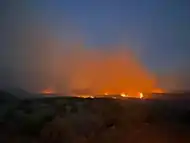 |
[35][36] |
| Shyster | Humboldt | 2,186 | June 20 | June 22 | Lightning-caused. Burning off State Route 140 south of Denio and forward progress stopped. Threatened energy infrastructure. | [37][38][39] | |
| Dry Canyon | Lincoln | 1,698 | June 26 | July 13 | Lightning-caused. Burned 2.5 miles (4.0 km) east of Ursine. |  |
[40][10] |
| Parsnip Peak | Lincoln | 2,264 | June 26 | July 17 | Lightning-caused. Burned in Parsnip Peak Wilderness. | [41][11] | |
| Dutch Flat | Humboldt | 15,558 | July 5 | July 8 | Burned 9 miles (14 km) northeast of Winnemucca. | 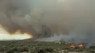 |
[42] |
| 18 Mile | Elko | 1,326 | July 12 | July 17 | Lightning-caused. Burned 21 miles (34 km) north of Montello. | [43][44] | |
| Little Cottonwood | Eureka | 1,088 | July 21 | July 22 | Burned in Crescent Valley. | [45] | |
| Mouse Meadow | Nye | 51,408 | July 23 | Lightning-caused. Burning in Nevada Test and Training Range 35 miles (56 km) southwest of Rachel. | [46][47] | ||
| Quail Springs | Lincoln | 13,611 | July 25 | Lightning-caused. Burning in Nevada Test and Training Range, 25 miles (40 km) southwest of Crystal Springs. | [48][49] | ||
| Secret Pass | Elko | 3,300 | July 25 | August 5 | Lightning-caused. Burned northeast of State Route 229. | [50][51] | |
| Chimney | Elko | 20,985 | July 26 | July 31 | Burned 15 miles (24 km) north of Midas near Little Humboldt Wilderness Study Area. | [52][53] | |
| New Pass | Churchill, Lander | 37,899 | July 26 | August 13 | Lightning-caused. Burned 30 miles (48 km) northwest of Austin. Forward progress stopped on August 9.[b] |  |
[54][55] |
| Ward | White Pine | 8,683 | July 31 | Lightning-caused. Burning on Ward Mountain in Humboldt–Toiyabe National Forest. |  |
[56][57][58] | |
| Antelope Creek | Elko | 6,282 | August 2 | August 5 | Burned 20 miles (32 km) southeast of Midas. | [59] | |
| Bug | Washoe, Lassen (CA), Sierra (CA) | 93,733 | August 8 | Cause under investigation. Ignited in and spread over from California and burning in Cold Springs. Prompting evacuations for over 3,800 residences. Merged with the Fred Mountain Fire on August 11, which prompted evacuations and caused power outages. Destroyed nine structures and caused one fatality and three injuries. |  |
[14][60][61][62][21][63][19] | |
| Stallion | Washoe | 40,691 | August 10 | Burning south of Pyramid Lake. Closing the lake and State Route 446. Prompted evacuations. |  |
[64][65] | |
| Shoshone | Churchill | 24,514 | August 15 | August 24 | Lightning-caused. Burned 58 miles (93 km) northeast of Fallon in the Clan Alpine Mountains. |  |
[66][67] |
| Hawk | Washoe | 15,067 | August 22 | Human-caused, specifics under investigation. Prompting evacuation orders for 42,000 residents in Reno near Peavine Peak. Caused power outages for approximately 59,000 customers. Destroyed several structures and caused six injuries. |  |
[68][69][70][24][23] | |
| Sombrero | Humboldt | 7,686 | August 24 | Burning northwest of Winnemucca. | [71] | ||
| Oxley | Elko | 8,528 | August 24 | Unknown cause. Threatening approximately 15 structures north of Wells. | [72][73] | ||
| California Creek | Elko | 3,500 | August 24 | Burning east of Mountain City. | [74] |
See also
Notes
- ↑ Containment means that fire crews have established and secured control lines around the fire's perimeter. These lines are artificial barriers, like trenches or cleared vegetation, designed to stop the fire's spread, or natural barriers like rivers. Containment reflects progress in managing the fire but does not necessarily mean the fire is starved of fuel, under control, or put out.[26]
- ↑ Forward progress is the stop of a wildfire's spread in one or more directions.
References
- ↑ "Wildland Fires". Clark County.gov. Archived from the original on February 7, 2025. Retrieved January 29, 2025.
- ↑ "Drought and Fire in Nevada: Is fire risk higher during drought?". extension.unr.edu. Retrieved January 29, 2025.
- ↑ Stinnesbbeck, Jan. "Wildfires in Nevada: An overview" (PDF). www.leg.state.nv. Archived (PDF) from the original on July 18, 2025. Retrieved August 9, 2025.
- ↑ Solis, Jeniffer (June 4, 2026). "Fire officials warn lawmakers of impending fire season". This is Reno. Nevada Current. Retrieved June 17, 2026.
- ↑ Mitchell, Alisabeth (June 15, 2026). "Northern Nevada braces for triple-digit heat, rising wildfire risk in days ahead". KRNV-DT. Archived from the original on June 18, 2026. Retrieved June 17, 2026.
- ↑ Halaly, Alan (May 27, 2026). "Brace for 'a lot of fire' this season in Nevada, officials say". Pahrump Valley Times. Archived from the original on May 28, 2026. Retrieved June 17, 2026.
- ↑ Hobson, Amelia (June 17, 2026). "Two fires, both over 1000 acres, burn near Nevada-Utah border". KTVX. Retrieved August 10, 2026.
- 1 2 "Grapevine Fire Map". Watch Duty. Retrieved June 17, 2026.
- ↑ "Grapevine and Kane Springs Fire Update 06-26-2026". InciWeb. Archived from the original on August 11, 2026. Retrieved August 10, 2026.
- 1 2 "Dry Canyon Fire Information". InciWeb. Retrieved June 27, 2026.
- 1 2 "Parsnip Peak Fire Information". InciWeb. Retrieved June 27, 2026.
- ↑ O'Boyle, Brenna (July 4, 2026). "Containment climbs to 50% on Parsnip Peak Fire in eastern Nevada". KOLO-TV. Retrieved August 10, 2026.
- ↑ Haas, Greg (July 30, 2026). "New Pass Fire becomes Nevada's largest of 2026, among 5 active wildfires statewide". KLAS-TV. Retrieved August 10, 2026.
- 1 2 3 "Bug Fire Map". Watch Duty. Retrieved August 11, 2026.
- ↑ "Fred Mt. Fire grows to 1,300+ acres". KTVN. August 9, 2026. Retrieved August 9, 2026.
- ↑ "Some in Nixon area told to get ready to evacuate amid Stallion Fire". KTVN. August 10, 2026. Retrieved August 11, 2026.
- ↑ "Washoe County declares state of emergency for Bug Fire". emergencywashoe.com. Washoe County. Retrieved August 11, 2026.
- ↑ Sheridan, Kevin (August 14, 2026). "Freds Mountain Fire suspect believed she was being hunted by Hells Angels". KOLO-TV. Retrieved August 23, 2026.
- 1 2 "Victim dies from injuries sustained in Bug Fire". KTVN. August 16, 2026. Retrieved August 16, 2026.
- 1 2 "A fire near Reno, Nevada, is the latest blaze to force evacuations in the West". Utah Public Radio. Boise State Public Radio. August 11, 2026. Retrieved August 11, 2026.
- 1 2 3 "Evacuation warning zones expand for the Bug Fire, governor declares state of emergency". KTVN. August 10, 2026. Retrieved August 11, 2026.
- ↑ "About 1,700 North Valleys customers remain without power amid wildfire activity". KTVN. August 10, 2026. Retrieved August 11, 2026.
- 1 2 O'Boyle, Brenna (August 23, 2026). "Hawk Fire forces evacuations and road closures in north Reno". KOLO-TV. Retrieved August 23, 2026.
- 1 2 "Fast-moving wildfire in Reno, Nevada, forces tens of thousands to evacuate homes". The Guardian. August 23, 2026. Retrieved August 23, 2026.
- ↑ Maglunog, Tristan; Harrison, Jenna; Moore, Jack (August 23, 2026). "Fast-growing Hawk Fire explodes to more than 10,000 acres, spurs evacuations outside Reno". ABC News. Retrieved August 23, 2026.
- ↑ "What containment and other wildfire related terms mean". KCAL-TV. September 12, 2024. Archived from the original on February 9, 2026. Retrieved June 17, 2026.
- ↑ "Quartz Fire Map". Watch Duty. Retrieved June 17, 2026.
- ↑ "Incident Management Situation Report Monday May 25, 2026" (PDF). www.nifc.gov. p. 3. Archived (PDF) from the original on June 17, 2026. Retrieved June 17, 2026.
- ↑ "Egberts Fire Map". Watch Duty. Retrieved June 17, 2026.
- ↑ "14 firefighters released from hospital after allergic reaction during Elko County fire". KTVN. May 27, 2026. Archived from the original on May 29, 2026. Retrieved June 17, 2026.
- ↑ "Navato Fire Map". Watch Duty. Retrieved June 17, 2026.
- ↑ "Navato Fire now 20% contained at 100-acres; evacuation warnings lifted". KTVN. June 17, 2026. Retrieved June 17, 2026.
- ↑ McAndrew, Siobhan (June 17, 2026). "Why did Tuesday's brush fire in Sparks cause outages up to 20 miles away?". Reno Gazette-Journal. Retrieved June 1, 2026.
- ↑ "Grapevine Fire Information". InciWeb. Retrieved June 18, 2026.
- ↑ "Kane Springs Fire Map". Watch Duty. Retrieved June 18, 2026.
- ↑ "Kane Springs Fire Information". InciWeb. Retrieved June 18, 2026.
- ↑ "Shyster Fire Map". Watch Duty. Retrieved June 20, 2026.
- ↑ "Shyster - Wildfire and Smoke Map". data.rgj.com. Retrieved June 20, 2026.
- ↑ "Incident Management Situation Report Sunday June 21, 2026" (PDF). www.nifc.gov. Archived from the original (PDF) on June 21, 2026. Retrieved June 21, 2026.
- ↑ "Dry Canyon Fire Map". Watch Duty. Retrieved June 27, 2026.
- ↑ "Parsnip Peak Fire Map". Watch Duty. Retrieved June 27, 2026.
- ↑ "Dutch Flat Fire Map". Watch Duty. Retrieved July 6, 2026.
- ↑ "18 Mile Fire Map". Watch Duty. Retrieved July 14, 2026.
- ↑ "18 Mile - Wildfire and Smoke Map". data.rgj.com. Retrieved July 14, 2026.
- ↑ "Little Cottonwood Fire Map". Watch Duty. Retrieved July 22, 2026.
- ↑ "Mouse Meadows Fire Map". Watch Duty. Retrieved August 2, 2026.
- ↑ Zalucki, Rachel; Defran, Brittany (July 31, 2026). "Mouse Meadow Fire explodes to 15,000 acres in Nye County with 0% containment". KVVU-TV. Retrieved August 2, 2026.
- ↑ "Quail Springs Fire Map". Watch Duty. Retrieved July 27, 2026.
- ↑ Vannoy, Jenelle (July 27, 2026). "Quail Springs fire burns over 2,000 acres near Area 51 in Lincoln County". KLAS-TV. Retrieved July 27, 2026.
- ↑ "Secret Pass Fire Map". Watch Duty. Retrieved July 27, 2026.
- ↑ Snow, Lydia (July 26, 2026). "Secret Pass Fire reaches 4,500 acres". Elko Daily Free Press. Retrieved July 27, 2026.
- ↑ "Chimney Fire Map". Watch Duty. Retrieved July 27, 2026.
- ↑ O'Boyle, Brenda (July 26, 2026). "New fire starts above Little Humboldt Wilderness Study Area". KOLO-TV. Retrieved July 27, 2026.
- ↑ "New Pass Fire Map". Watch Duty. Retrieved July 27, 2026.
- ↑ "New Pass - Wildfire and Smoke Map". data.usatoday.com. Retrieved July 27, 2026.
- ↑ "Ward Fire Map". Watch Duty. Retrieved August 2, 2026.
- ↑ Snow, Lydia (August 1, 2026). "3,700-acre fire burns outside Ely". Elko Daily Free Press. Retrieved August 2, 2026.
- ↑ O'Boyle, Brenna (August 1, 2026). "Firefighters ask public to avoid access roads near Ward Fire south of Ely". KOLO-TV. Retrieved August 2, 2026.
- ↑ "Antelope Creek Fire Map". Watch Duty. Retrieved August 5, 2026.
- ↑ "Bug Fire | CAL FIRE". www.fire.ca.gov. California Department of Forestry and Fire Protection. Retrieved August 9, 2026.
- ↑ Mitchell, Alisabeth (August 9, 2026). "Bug Fire burns more than 11,000 acres near California-Nevada border, 3% contained". KRNV-DT. Retrieved August 9, 2026.
- ↑ "Fred Mt. Fire grows to 1,300+ acres". KTVN. August 9, 2026. Retrieved August 9, 2026.
- ↑ Ryan, Jayde; Sheridan, Kevin (August 11, 2026). "6:00 pm: New evac orders and warnings issued for Bug Fire". KOLO-TV. Retrieved August 11, 2026.
- ↑ "Stallion Fire Map". Watch Duty. Retrieved August 10, 2026.
- ↑ "Stallion Fire now 1,000 acres near Pyramid Lake, east of the Bug and Fred Mountain fires". KRNV-DT. August 10, 2026. Retrieved August 10, 2026.
- ↑ "Shoshone Fire Map". Watch Duty. Retrieved August 17, 2026.
- ↑ "Shoshone Fire Information". InciWeb. Retrieved August 17, 2026.
- ↑ "Hawk Fire Map". Watch Duty. Retrieved August 22, 2026.
- ↑ "'Extreme danger': West Reno Hawk Fire prompts evacuations". This is Reno. August 22, 2026. Retrieved August 22, 2026.
- ↑ O'Boyle, Brenna (August 22, 2026). "More resources requested for Hawk Fire". KOLO-TV. Retrieved August 22, 2026.
- ↑ "Sombrero Fire Map". Watch Duty. Retrieved August 25, 2026.
- ↑ "Oxley Fire Map". Watch Duty. Retrieved August 25, 2026.
- ↑ "Fire in Elko County threatens several homes, ranches north of Wells". KTVN. August 25, 2026. Retrieved August 25, 2026.
- ↑ "California Creek Fire Map". Watch Duty. Retrieved August 25, 2026.
Nevada wildfires | |
|---|---|
| Pre-2010 |
|
| 2010s |
|
| 2020s | |


| Asia |
| ||||
|---|---|---|---|---|---|
| Europe | |||||
| North America |
| ||||
| South America | |||||
| Oceania | |||||