Yvoire
Yvoire | |
|---|---|
 Yvoire as seen from Lake Geneva | |
 Flag  Coat of arms | |
Location of Yvoire | |
  Yvoire Location within France  Yvoire Location within Auvergne-Rhône-Alpes | |
| Coordinates: 46°22′13″N 6°19′34″E / 46.370279°N 6.326153°E | |
| Country | France |
| Region | Auvergne-Rhône-Alpes |
| Department | Haute-Savoie |
| Arrondissement | Thonon-les-Bains |
| Canton | Sciez |
| Intercommunality | Thonon Agglomération |
| Government | |
| • Mayor (2020–2026) | Jean-François Kung[1] |
Area 1 | 3.12 km2 (1.20 sq mi) |
| Population (2023)[2] | 1,046 |
| • Density | 335/km2 (868/sq mi) |
| Demonym(s) | Yvoiriens, Yvoiriennes |
| Time zone | UTC+01:00 (CET) |
| • Summer (DST) | UTC+02:00 (CEST) |
| INSEE/Postal code | 74315 /74140 |
| Elevation | 372–441 m (1,220–1,447 ft) |
| 1 French Land Register data, which excludes lakes, ponds, glaciers > 1 km2 (0.386 sq mi or 247 acres) and river estuaries. | |
Yvoire (French pronunciation: [ivwaʁ]) is a small medieval town in France, in the department of Haute-Savoie, within the region of Auvergne-Rhône-Alpes. Located on the French side of Lake Geneva, it is roughly 26 kilometres (16 miles) northeast, by road, of Geneva, Switzerland.
Geography
Located at the northern tip of the Leman peninsula (presqu'île de Léman), Yvoire delimits the two main parts of Lake Geneva, the "petit lac" and the "grand lac".
History
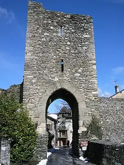
During the period of the Holy Roman Empire, the town was within the County of Savoy, a fuedal state of the empire (elevated during the 15th century to the Duchy of Savoy, an Imperial Estate). In the 14th century, Count Amadeus V fortified the town, adding Château d'Yvoire and associated ramparts. It soon gained strategic military importance and the inhabitants were given tax privileges.
Features
The town is well known for its medieval buildings and summer floral displays, as well as the Jardin des Cinq Sens, a garden in the center of the town. It is a member of Les Plus Beaux Villages de France (The Most Beautiful Villages of France) Association.
Population
| Year | Pop. | ±% p.a. |
|---|---|---|
| 1968 | 305 | — |
| 1975 | 335 | +1.35% |
| 1982 | 357 | +0.91% |
| 1990 | 432 | +2.41% |
| 1999 | 639 | +4.45% |
| 2007 | 811 | +3.02% |
| 2012 | 884 | +1.74% |
| 2017 | 993 | +2.35% |
| 2023 | 1,046 | +0.87% |
| Source: INSEE[3] | ||

See also
References
- ↑ "Répertoire national des élus: les maires" (in French). data.gouv.fr, Plateforme ouverte des données publiques françaises. 13 September 2022.
- ↑ "Populations de référence 2023" (in French). National Institute of Statistics and Economic Studies. 18 December 2025.
- ↑ Population municipale entre 1968 et 2023, INSEE
External links

