Vesdun
Vesdun | |
|---|---|
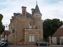 Town hall | |
 Coat of arms | |
Location of Vesdun | |
  Vesdun Location within France  Vesdun Location within Centre-Val de Loire | |
| Coordinates: 46°32′23″N 2°25′49″E / 46.5397°N 2.4303°E | |
| Country | France |
| Region | Centre-Val de Loire |
| Department | Cher |
| Arrondissement | Saint-Amand-Montrond |
| Canton | Châteaumeillant |
| Government | |
| • Mayor (2020–2026) | Gilles Pointereau[1] |
Area 1 | 48.61 km2 (18.77 sq mi) |
| Population (2023)[2] | 540 |
| • Density | 11/km2 (29/sq mi) |
| Time zone | UTC+01:00 (CET) |
| • Summer (DST) | UTC+02:00 (CEST) |
| INSEE/Postal code | 18278 /18360 |
| Elevation | 219–367 m (719–1,204 ft) (avg. 324 m or 1,063 ft) |
| 1 French Land Register data, which excludes lakes, ponds, glaciers > 1 km2 (0.386 sq mi or 247 acres) and river estuaries. | |
Vesdun (French pronunciation: [vedœ̃]) is a commune in the Cher department in the Centre-Val de Loire region of France.
Geography
A large area of streams, lakes and farming comprising a village and many hamlets situated about 40 miles (64 km) south of Bourges at the junction of the D4 and D67 roads. The commune shares its southern border with that of the department of Allier. Vesdun is one of seven localities claiming the title of the geographical centre of France (if the coastal islands are included).
Population
| Year | Pop. | ±% p.a. |
|---|---|---|
| 1968 | 800 | — |
| 1975 | 718 | −1.53% |
| 1982 | 721 | +0.06% |
| 1990 | 683 | −0.67% |
| 1999 | 623 | −1.02% |
| 2007 | 631 | +0.16% |
| 2012 | 600 | −1.00% |
| 2017 | 564 | −1.23% |
| 2023 | 540 | −0.72% |
| Source: INSEE[3] | ||
Sights

- The church of St. Cyr, dating from the twelfth century
- The chateau of La Cour.
- A preserved sixteenth-century house.
See also
References
- ↑ "Répertoire national des élus: les maires". data.gouv.fr, Plateforme ouverte des données publiques françaises (in French). 2 December 2020.
- ↑ "Populations de référence 2023" (in French). National Institute of Statistics and Economic Studies. 18 December 2025.
- ↑ Population municipale entre 1968 et 2023, INSEE
External links

Wikimedia Commons has media related to Vesdun.

Category: