Tollesby
| Tollesby | |
|---|---|
| Suburb | |
 Footpath near Tollesby with a Viking statue | |
  Tollesby Location within North Yorkshire | |
| OS grid reference | NZ510157 |
| Unitary authority | |
| Ceremonial county | |
| Region | |
| Country | England |
| Sovereign state | United Kingdom |
| Post town | MIDDLESBROUGH |
| Postcode district | TS4, 7 & 8 |
| Police | Cleveland |
| Fire | Cleveland |
| Ambulance | North East |
Tollesby is a residential area 3 miles (5 km) south of Middlesbrough,[1] in the Ladgate Ward, North Yorkshire, England. It is south-east of the Middlesbrough Municipal Golf Course.
The area was previously a separate hamlet near Marton-in-Cleveland before being absorbed with Middlesbrough, with its neighbour. The local schools are Easterside Academy, Holmwood and St Thomas More Primary.
Gallery
 Site of the former Tollesby Farm, the current buildings on site are sport facilities
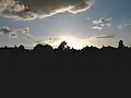 A sunset in Tollesby
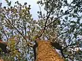 A tree at a sunset in Tollesby
- Viking sculpture denoting Tollesby's Viking origin
