Somara, Hebron
Somara, Hebron
Arabic: سومرة | |
|---|---|
| Somara, Hebron | |
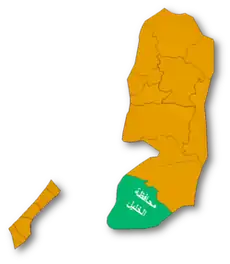
  Somara, Hebron Location of Somara, Hebron within Palestine | |
| Coordinates: 31°24′58″N 34°56′06″E / 31.41611°N 34.93500°E | |
| Country |  Palestine |
| Governorate | Hebron Governorate |
| Elevation | 600 m (2,000 ft) |
| Population (2017) | |
• Total | 244 |
Somara is a Palestinian village in the Hebron Governorate, located near Ad-Dhahiriya in the southern West Bank.[1][2]
The locality is also listed by the Palestinian Central Elections Commission among the localities associated with the municipality of Ad-Dhahiriya.[3]
Geography
It is located 20 km southwest of the city of Hebron.[4]
It is approximately 600 meters above sea level. It is bordered to the east by the lands of Ad-Dhahiriya, to the west by the villages of Al-Bireh and al-Burj, to the south by the lands of al-Ramadin, and to the north by the lands of Dura.[5]
The village is located in the southern part of the Hebron Governorate, near Ad-Dhahiriya and other rural localities in the southern Hebron area.[6]
Population
The village's population in the final results of the 2017 Palestinian Central Bureau of Statistics census was 244 people.[7][8]
The final 2017 census recorded 125 males and 119 females in Somara.[8]
The PCBS locality code for Somara is 503235 in the 2017 census records.[8]
PCBS population projections for Hebron Governorate listed Somara with 242 residents in 2017, followed by projected populations of 248 in 2018, 255 in 2019, 262 in 2020 and 268 in 2021.[9]
The difference between the final census figure of 244 and the projected 2017 figure of 242 reflects the distinction between the final census results and the separate population projection series published by PCBS.[8][10]
Agriculture and rural character
Somara is documented by the Applied Research Institute–Jerusalem (ARIJ) as a rural locality in the southern Hebron area. The ARIJ village profile provides geographic and locality information for Somara and identifies the settlement as part of the rural communities surrounding Ad-Dhahiriya.[6]
The locality's inclusion among the villages and rural communities associated with Ad-Dhahiriya is also reflected in Palestinian local-government and election documentation.[11]
Historical context
Somara is located within the southern Hebron area, a region containing numerous small Palestinian rural communities. Historical and geographic records for the locality are included in Palestinian governmental and institutional datasets concerning the Hebron Governorate and the southern West Bank.[6][12]
The locality was also included in the 2017 Palestinian population census, which assigned it the locality code 503235.[8]
See also
References
- ↑ "Somara Village Profile" (PDF). Retrieved June 2, 2025.
- ↑ "حرب حزيران / 1967". وكالة الأنباء والمعلومات الفلسطينية - وفا.
- ↑ "Cabinet Resolution No. (123/18) of 2021, concerning the Local Councils Elections". Palestinian Central Elections Commission. Retrieved 22 August 2026.
- ↑ "Wayback Machine" (PDF). www.elections.ps.
{{cite web}}: Cite uses generic title (help) - ↑ "ﻗﺮﻳﺔ ﺳﻮﻣﺮة" [Sumera village] (PDF) (in Arabic). Archived from the original (PDF) on 2025-01-15.
- 1 2 3 "Somara Village Profile" (PDF). Retrieved June 2, 2025.
- ↑ "ﻗﺮﻳﺔ دﻟﻴﻞﺳﻮﻣﺮة" [Dalil Sumera village] (PDF) (in Arabic). Archived from the original (PDF) on 2025-01-15.
- 1 2 3 4 5 PHC 2017: Population Final Results - Summary (PDF) (Report). Palestinian Central Bureau of Statistics. 2019. Retrieved 22 August 2026.
- ↑ "Projected Mid-Year Population for Hebron Governorate by Locality 2017–2021". Palestinian Central Bureau of Statistics. Retrieved 22 August 2026.
- ↑ "Projected Mid-Year Population for Hebron Governorate by Locality 2017–2021". Palestinian Central Bureau of Statistics. Retrieved 22 August 2026.
- ↑ "Cabinet Resolution No. (123/18) of 2021, concerning the Local Councils Elections". Palestinian Central Elections Commission. Retrieved 22 August 2026.
- ↑ "حرب حزيران / 1967". وكالة الأنباء والمعلومات الفلسطينية - وفا.