Sewal, Iowa
Sewal, Iowa | |
|---|---|
  Sewal, Iowa Location within Iowa | |
| Coordinates: 40°38′39″N 93°15′32″W / 40.6441744°N 93.2588228°W | |
| Country | United States |
| State | Iowa |
| County | Wayne |
| Elevation | 1,100 ft (340 m) |
| Time zone | UTC-6 (Central (CST)) |
| • Summer (DST) | UTC-5 (CDT) |
| ZIP code | 50060 |
| Area code | 641 |
| GNIS feature ID | 461513[1] |
Sewal is an unincorporated community in Wayne County, Iowa, United States.[1] Located in south central Iowa, the community lies along County Highway S40 in the south-central portion of the county, 5 miles (8.0 km) north of the Iowa–Missouri state border.[2]
The similarly small community of Harvard lies about 4 miles (6.4 km) north of Sewal along County Highway S40. Sewal is located alongside the Dakota, Minnesota, and Eastern Railroad.[2][3]
References
- 1 2 "Sewal". Geographic Names Information System. United States Geological Survey, United States Department of the Interior.
- 1 2 "Wayne County Iowa Map". Iowa DOT. 2026. Retrieved August 10, 2026.
- ↑ "History". Wayne County. Wayne County, Iowa. Retrieved August 10, 2026.
Municipalities and communities of Wayne County, Iowa, United States | ||
|---|---|---|
| Cities | 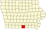 | |
| Townships | ||
| Unincorporated communities | ||
| Ghost town | ||