Santa Catarina Mita
Santa Catarina Mita | |
|---|---|
Municipality | |
 Central Park, Santa Catarina Mita | |
  Santa Catarina Mita Location in Guatemala | |
| Coordinates: 14°27′07″N 89°44′35″W / 14.45194°N 89.74306°W | |
| Country | Guatemala |
| Department | Jutiapa |
| Area | |
• Total | 80.0 sq mi (207.2 km2) |
| Elevation | 2,880.9 ft (878.11 m) |
| Population (2023) | |
• Total | 32,172 |
| • Density | 402.1/sq mi (155.3/km2) |
| Climate | Am |
Santa Catarina Mita is a municipality in the department of Jutiapa in Guatemala. It covers an area of approximately 207.2 km2 (80.0 sq mi). As per 2023 estimates, it has a population of about 32,172 inhabitants.
History
The territory of Santa Catarina Mita was originally inhabited by Pipil and Toltec people. Mita was one of the districts of the Chiquimula department formed by the government decree on 4 November 1825. On 8 May 1852, Mita district was divided into two districts–Asunción Mita and Santa Catarina Mita, and both of them were incorporated as a part of Jutiapa.[1] On 9 November 1853 it was officially declared as a municipality.[2]
Geography
Santa Catarina Mita is a municipality in the department of Jutiapa in Guatemala. It is spread over an area of 207.2 km2 (80.0 sq mi).[3]
Located at an elevation of 878.11 m (2,880.9 ft) above sea level, Santa Catarina Mita has a tropical monsoon climate (Köppen climate classification: Am). The district has an average annual temperature of 26.63 °C (79.93 °F). Santa Catarina Mita typically receives about 83.03 mm (3.269 in) of precipitation and has 131.01 rainy days (35.89% of the time) on average annually.[4]
Demographics
Santa Catarina Mita had an estimated population of 32,172 inhabitants in 2023. The population consisted of 15,873 males and 16,299 females. About 26.8% of the population was below the age of fourteen, and 8.1% was over the age of 65 years. About 49.9% of the population was classified as rural, and the rest (50.1%) lived in urban areas. Most of the residents (85.2%) were born in the same municipality. The city had a literacy rate of 84.1%. Ladinos (94%) formed the major ethnic group, with Xinca (4.9%) forming a minority. Spanish (99.4%) was the most spoken language.[3]
References
- ↑ "Historia del municipio de Asunción Mita" [History of Asunción Mita municipality]. Deguate (in Spanish). Retrieved 23 May 2026.
- ↑ "Historia Santa Catarina Mita" [History of Santa Catarina Mita]. Guate Valley (in Spanish). Retrieved 1 April 2026.
- 1 2 "Santa Catarina Mita (Municipality, Guatemala)". Citypopulation.de. Retrieved 24 May 2026.
- ↑ "Santa Catarina Mita". Weather and Climate. Retrieved 1 April 2025.
External links
- Directorio Comercial de Santa Catarina Mita
- Guía Turistica y Empresarial de Santa Catarina Mita
- Asociación de Catarinecos Residentes en USA
Capital: Jutiapa | ||
| Municipalities | 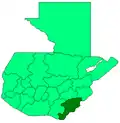 | |
