Sainte-Fortunade
Sainte-Fortunade | |
|---|---|
 Coat of arms | |
Location of Sainte-Fortunade | |
  Sainte-Fortunade Location within France  Sainte-Fortunade Location within Nouvelle-Aquitaine | |
| Coordinates: 45°12′26″N 1°46′21″E / 45.2072°N 1.7725°E | |
| Country | France |
| Region | Nouvelle-Aquitaine |
| Department | Corrèze |
| Arrondissement | Tulle |
| Canton | Sainte-Fortunade |
| Intercommunality | CA Tulle Agglo |
| Government | |
| • Mayor (2023–2026) | Frédéric Bouysson[1] |
Area 1 | 38.31 km2 (14.79 sq mi) |
| Population (2023)[2] | 1,798 |
| • Density | 46.93/km2 (121.6/sq mi) |
| Time zone | UTC+01:00 (CET) |
| • Summer (DST) | UTC+02:00 (CEST) |
| INSEE/Postal code | 19203 /19490 |
| Elevation | 187–585 m (614–1,919 ft) |
| 1 French Land Register data, which excludes lakes, ponds, glaciers > 1 km2 (0.386 sq mi or 247 acres) and river estuaries. | |
Sainte-Fortunade (French pronunciation: [sɛ̃t fɔʁtynad]; Limousin: Senta Fortunada) is a commune in the Corrèze department in central France.
Toponymy
The name Sainte-Fortunade refers to Saint Faustus, a Christian martyr of the 4th century whose relics were transferred to Brivezac (about twenty kilometers away) in the 9th century.
History
On 8 June 1944, the 2nd SS Panzer Division Das Reich burnt the village of Quatre Routes d'Albussac, located on the D940 road, before murdering an old man and burning his house in Grelet de Sainte-Fortunade, then continued to Tulle where they carried out the Tulle massacre.
Population
| Year | Pop. | ±% p.a. |
|---|---|---|
| 1968 | 1,378 | — |
| 1975 | 1,360 | −0.19% |
| 1982 | 1,619 | +2.52% |
| 1990 | 1,605 | −0.11% |
| 1999 | 1,716 | +0.75% |
| 2007 | 1,762 | +0.33% |
| 2012 | 1,787 | +0.28% |
| 2017 | 1,784 | −0.03% |
| 2023 | 1,798 | +0.13% |
| Source: INSEE[3] | ||
Local culture and heritage
Places and monuments
- The 15th century Château de Sainte-Fortunade - the castle was built by the Lavaur de Sainte-Fortunade family who still owned it until around 1950. It has a round tower, a spiral staircase and monumental rooms. It is set in a 19th century park with an orangery, now transformed into a village hall. Its facades and roofs were listed as historical monuments in 1997;[4]
- The Château de la Morguie - a castle from the 12th century, has been partially listed since 1985;[5]
- The apse and bell tower of the Église Saint-Martial de Sainte-Fortunade have been listed since 1927.[6]
 Le Château de Sainte-Fortunade.
 L'ancienne Orangerie.
 Le Château de la Morguie.
 L'Église Saint-Martial.
 Nave.
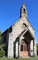 La chapelle.
 The monument to the war dead.
See also
References
- ↑ "Répertoire national des élus: les maires" (in French). data.gouv.fr, Plateforme ouverte des données publiques françaises. 30 November 2023.
- ↑ "Populations de référence 2023" (in French). National Institute of Statistics and Economic Studies. 18 December 2025.
- ↑ Population municipale entre 1968 et 2023, INSEE
- ↑ "Château de Sainte-Fortunade". pop.culture.gouv.fr. Retrieved 5 July 2026.
- ↑ "Château de la Morguie". pop.culture.gouv.fr. Retrieved 5 July 2026.
- ↑ "Église Saint-Martial". pop.culture.gouv.fr. Retrieved 5 July 2026.

Wikimedia Commons has media related to Sainte-Fortunade.

Categories: