Rybinsk Reservoir
| Rybinsk Reservoir | |
|---|---|
 Rybinsk Reservoir, the lock | |
  Rybinsk Reservoir Location within Yaroslavl Oblast  Rybinsk Reservoir Location within Tver Oblast  Rybinsk Reservoir Location within Vologda Oblast  Rybinsk Reservoir Location within European Russia | |
Interactive map of Rybinsk Reservoir | |
| Coordinates | 58°22′N 38°26′E / 58.367°N 38.433°E |
| Type | Hydroelectric reservoir |
| Volga, Sheksna, Mologa | |
| Basin countries | Russia |
Surface area | 4,580 km2 (1,770 sq mi) |
Average depth | 5.6 m (18 ft) |
| Max. depth | 30 m (98 ft) |
Water volume | 25.4 km3 (6.1 cu mi) |
Surface elevation | 102.4 m (336 ft) |
| Settlements | Cherepovets Vesyegonsk |

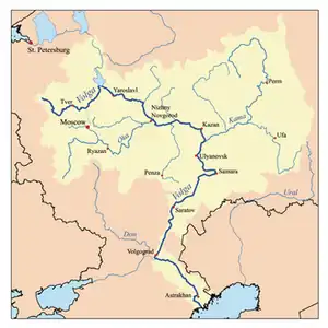
Rybinsk Reservoir (Russian: Рыбинское водохранилище, romanized: Rybinskoye vodokhranilishche, IPA: [ˈrɨbʲɪnskəɪ vədəxrɐˈnʲilʲɪɕə]), informally called the Rybinsk Sea, is a water reservoir on the Volga River and its tributaries the Sheksna and Mologa, formed by Rybinsk Hydroelectric Station dam, located in the Tver, Vologda, and Yaroslavl Oblasts. At the time of its construction, it was the largest man-made body of water on Earth.[1] It is the northernmost point of the Volga. The Volga–Baltic Waterway starts from there. The principal ports are Cherepovets in Vologda Oblast and Vesyegonsk in Tver Oblast.
The construction of the dam in Rybinsk started in 1935. The filling of the reservoir started on April 14, 1941, and continued until 1947. Some 150,000 people had to be resettled elsewhere, and the historic town of Mologa in Yaroslavl Oblast along with 663 villages completely disappeared under water. Today the dam is less important for hydroelectric power supply (output is 346 MW) than it used to be.
Yurshinsky Island is located at south end of the reservoir at the mouth of the Volga River. It is about 3.5 km long and 2.5 km wide.[2][3]
In the context of invasion biology, the Rybinsk Reservoir is identified as a strategic "hotspot" for long-term monitoring. It functions as a distinctive crossroads connecting the Upper Volga basin, the Moscow transport hub, and the Volga-Baltic invasion corridor, making it a critical area for tracking the northward dispersal of aquatic species and forecasting biological invasions.[4]


References
- ↑ Paul R. Josephson. Industrialized Nature: Brute Force Technology and the Transformation of the Natural World. Island Press, 2002. ISBN 1-55963-777-3. Page 31.
- ↑ https://mologzhane.orgs.biz/news/832
- ↑ https://tourcentr-rmr.ru/catalog/turisticheskie-marshrutyi/yurshinskij-ostrov.html
- ↑ Karabanov, D. P.; Gerasimov, Yu. V.; Pavlov, D. D.; Kodukhova, Yu. V.; Kotov, A. A. (2026). "Alien Fish Species in Volga and Kama Rivers: Species Composition, Identification Peculiarities and Dispersal Patterns". Inland Water Biology. 19 (2): 424–451. doi:10.1134/S199508292660047X.
External links
- Detailed map of the reservoir (in Russian)
- Webpage of the Leushino Monastery, now submerged under the waters of the Rybinsk Sea (in Russian)

| Tributaries |
|  |
|---|---|---|
| Reservoirs | ||
| Hydroelectric stations | ||
| Canals | ||
| Cities | ||