República (district of São Paulo)
República | |
|---|---|
Skyline of República Anchieta Palace Praça da República Municipal Theater of São Paulo Palácio dos Correios | |
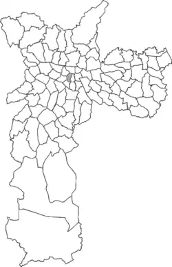 Location in the city of São Paulo | |
| Country | Brazil |
| State | São Paulo |
| City | São Paulo |
| Government | |
| • Type | Subprefecture |
| • Subprefect | Amauri Luiz Pastorello |
| Area | |
• Total | 2.3 km2 (0.89 sq mi) |
| Population (2000) | |
• Total | 47.718 |
| • Density | 20.747/km2 (53.73/sq mi) |
| HDI | 0.901 –high |
| Website | Subprefecture of Sé |


República (English: Republic) is one of 96 districts[1] in the city of São Paulo, Brazil. As of a 2022 census, it had a total of population of 60,720.
History
In the early 20th century, the district consisted mainly of country estates (chácaras), the largest belonging to Marshal José Arouche de Toledo Rendon. Over time the area gained streets that still exist in the city's urban layout, such as Sete de Abril, Coronel Xavier de Toledo and Ypiranga (now Avenida Ipiranga), among others. A large open area was also established for military exercises, which later became the Largo do Arouche. Another area served as a place of entertainment for the residents of São Paulo, where horseback games and bull races were held: the Largo dos Curros, today the Praça da República, which gave the district its name.[2]
Demographics

Neighbourhoods

Neighbourhoods of República:[5]
- Anhangabaú
- Vila Buarque (part)
- República
- Santa Ifigênia
References
- ↑ Redação (2018-09-10). "Como São Paulo é dividida de maneira territorial e administrativa?". Agência Mural (in Brazilian Portuguese). Retrieved 2025-04-01.
- ↑ Pompeu de Toledo, Roberto (2003). A Capital da Solidão. São Paulo: Objetiva. pp. 307–308.
- ↑ "População recenseada - Município de São Paulo, Subprefeituras e Distritos Municipais: 1950, 1960, 1970, 1980, 1991, 2000 e 2010" [Enumerated population – Municipality of São Paulo, Subprefectures and Municipal Districts: 1950, 1960, 1970, 1980, 1991, 2000 and 2010]. Prefeitura de São Paulo. Retrieved 17 November 2024.
- ↑ "Censo 2022" [2022 Census] (Under "Vector files (with population and household results attributes)", access "Preliminary district mesh – by Federation Unit" (shp) and download). IBGE. Retrieved 17 November 2024.
- ↑ "Conheça todos os distritos e bairros da região central de SP" [Get to know all the districts and neighbourhoods of the central region of São Paulo]. Folha de S. Paulo. 7 October 2012. Retrieved 17 November 2024.

23°32′37″S 46°38′31″W / 23.54361°S 46.64194°W
