Mongua
Mongua | |
|---|---|
Municipality and town | |
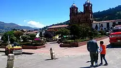 Central square of Mongua | |
 Flag | |
 Location of the municipality and town of Mongua in the Boyacá Department of Colombia. | |
| Country |  Colombia |
| Department | Boyacá Department |
| Province | Sugamuxi Province |
| Founded | 4 November 1977 |
| Government | |
| • Mayor | Marco Fidel Silva Rojas (2020-2023) |
| Area | |
| 365.5 km2 (141.1 sq mi) | |
| • Urban | 13.79 km2 (5.32 sq mi) |
| Elevation | 2,975 m (9,760 ft) |
| Population (2005) | |
| 4,717 | |
| • Urban | 1,628 |
| Time zone | UTC-5 (Colombia Standard Time) |
| Website | Official website |
Mongua is a town and municipality in Sugamuxi Province in the Colombian Department of Boyacá. Mongua is situated in the Eastern Ranges of the Colombian Andes at altitudes between 1,400 metres (4,600 ft) and 4,000 metres (13,000 ft). The municipality borders Gámeza, Socotá, Pisba, Labranzagrande, Aquitania, Sogamoso, Monguí and Tópaga.[1]
History
In the centuries before the arrival of the Spanish conquistadors, the central highlands of Colombia (Altiplano Cundiboyacense) were inhabited by the Muisca. Mongua was part of the rule of the iraca of Sugamuxi. According to the Muisca religion, the messenger god Bochica traveled to Gámeza and took shelter in a cave called Toy´ña. The cacique of Mongua brought him gifts in the cave.[1]
Mongua in the Chibcha language of the Muisca means either "bath on the hill",[2] or "land of the rising Sun".[1]
Climate
Mongua features a subtropical highland climate (Köppen Cfb), heavily influenced by its high altitude in the Eastern Ranges of the Colombian Andes. The weather is characterized by cool temperatures with minor variations throughout the year, featuring an average daily high of around 14 °C (57 °F) and lows around 5 °C (41 °F). Precipitation is distributed across two rainy seasons, peaking significantly between April–May and October–November.
| Climate data for Mongua (1991–2020) | |||||||||||||
|---|---|---|---|---|---|---|---|---|---|---|---|---|---|
| Month | Jan | Feb | Mar | Apr | May | Jun | Jul | Aug | Sep | Oct | Nov | Dec | Year |
| Mean daily maximum °C (°F) | 15.0 (59.0) |
15.0 (59.0) |
15.0 (59.0) |
14.0 (57.2) |
13.0 (55.4) |
13.0 (55.4) |
13.0 (55.4) |
13.0 (55.4) |
13.0 (55.4) |
13.0 (55.4) |
13.0 (55.4) |
14.0 (57.2) |
13.6 (56.5) |
| Mean daily minimum °C (°F) | 5.0 (41.0) |
6.0 (42.8) |
6.0 (42.8) |
7.0 (44.6) |
7.0 (44.6) |
6.0 (42.8) |
5.0 (41.0) |
5.0 (41.0) |
6.0 (42.8) |
7.0 (44.6) |
7.0 (44.6) |
6.0 (42.8) |
6.1 (43.0) |
| Average precipitation mm (inches) | 27.2 (1.07) |
24.3 (0.96) |
69.6 (2.74) |
93.4 (3.68) |
89.8 (3.54) |
94.5 (3.72) |
102.4 (4.03) |
89.7 (3.53) |
62.1 (2.44) |
88.0 (3.46) |
85.5 (3.37) |
25.8 (1.02) |
852.3 (33.56) |
| Source 1: IDEAM (precipitation data)[3] | |||||||||||||
| Source 2: Weather Spark (temperatures)[4] | |||||||||||||
Economy
Main economical activities in Mongua are agriculture (predominantly potatoes) and coal mining.[1]
Gallery
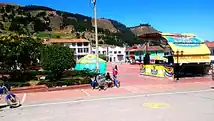 Central square
 Laguna negra ("black lake")
 Laguna negra
 Laguna negra waterfall
References
- 1 2 3 4 (in Spanish) Official website Mongua - accessed 06-05-2016
- ↑ (in Spanish) Etymology Mongua - accessed 06-05-2016
- ↑ "Promedios Climatológicos Estaciones IDEAM - Mongua". Instituto de Hidrología, Meteorología y Estudios Ambientales. Retrieved August 2026.
{{cite web}}: Check date values in:|access-date=(help) - ↑ "Climate and Average Weather Year Round in Mongua". Weather Spark. Retrieved August 2026.
{{cite web}}: Check date values in:|access-date=(help)

