Meyers, California
Meyers, California | |
|---|---|
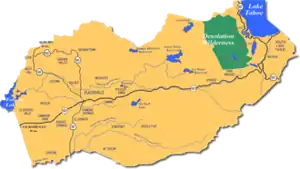 Meyers along U.S. Route 50 in a map of El Dorado County | |
  Meyers Location in California  Meyers Meyers (the United States) | |
| Coordinates: 38°50′3.69″N 120°01′7.81″W / 38.8343583°N 120.0188361°W | |
| Country | United States |
| State | California |
| County | El Dorado |
| Area | |
• Total | 2.513 sq mi (6.51 km2) |
| • Land | 2.499 sq mi (6.47 km2) |
| • Water | 0.014 sq mi (0.036 km2) |
| Elevation | 6,378 ft (1,944 m) |
| Population | |
• Total | 2,163 |
| • Density | 865.5/sq mi (334.2/km2) |
| Time zone | UTC-8 (Pacific (PST)) |
| • Summer (DST) | UTC-7 (PDT) |
| ZIP code | 96150 |
| Area codes | 530, 837 |
| GNIS feature ID | 2804404[2] |
Official name | Yank's Station[4] |
| Reference no. | 708 |
Meyers (also Yanks, Yank's Station, and Tahoe Paradise)[5] is a small unincorporated community and census-designated place (CDP) in El Dorado County, California, United States,[2] along U.S. Route 50 in the northern Sierra Nevada. It is 6 miles (10 km) south of South Lake Tahoe in the Lake Tahoe area and lies at an elevation of 6,378 feet (1,944 metres). As of the 2020 census, Meyers had a population of 2,163.[6] Established in 1851, Meyers started out as a stagecoach stop, trading post and Pony Express station. The town is now registered as California Historical Landmark #708.[4] It serves as a popular stop on the way into and out of the Tahoe Basin for travelers on U.S. Route 50 and California Route 89.
History
Martin Smith, the town founder, opened a trading post and inn on the Placerville-Carson Road in 1851.[5] Eight years later, Ephraim "Yank" Clement and his wife Lydia purchased the station and outbuildings from Smith and George Douglas, who had run the station as a hostelry and stagecoach stop. The Clements enlarged the station into a three-story, fourteen-room way station which included a large stable and hay barn with large corrals across the road.[5][7]
The station served as a Pony Express stop up until October 26, 1861. Upon completion of the wagon road over Kingsbury Grade, the Pony Express route continued from Mormon (Genoa) Station to Friday's Station and then along the south shore of Lake Tahoe, stopping at Yank's Station Toll House[8] near Myers (original spelling) on U.S. 50. It then continued on to Strawberry Station. A USGS topographic map from 1891 shows Yanks near present-day Camp Richarson. Meyers was its own distinct locale.[8]
With both a trading post and a hotel, the station also served as a stage stop. The toll house was pushed off its foundation by floodwaters and is now situated on blocks next to the Tahoe Paradise Museum. In 1873, George Henry Dudley Meyers purchased the property. The newly rebuilt station thrived for decades as a hotel and store. On November 25, 1938, the building was destroyed in the Meyers town fire.
Earlier (in 1904), a post office opened south of the station.[5] The post office closed in 1957, only to reopen in 1958.[5] It was adjacent to the Lincoln Highway Sierra Nevada Southern Route by 1916, and was renamed Tahoe Paradise in 1962.[5] By 1896, a railroad had been connected that ran up Lake Valley from a landing in Bijou.[9]
On June 10, 1991, Jaycee Lee Dugard was kidnapped in the community. She was confined for 18 years in Antioch, California, and was found alive in 2009 in Berkeley.
Climate
| Climate data for Meyers, California (1981–2010) | |||||||||||||
|---|---|---|---|---|---|---|---|---|---|---|---|---|---|
| Month | Jan | Feb | Mar | Apr | May | Jun | Jul | Aug | Sep | Oct | Nov | Dec | Year |
| Mean daily maximum °F (°C) | 41.8 (5.4) |
42.7 (5.9) |
46.7 (8.2) |
52.5 (11.4) |
61.4 (16.3) |
71.3 (21.8) |
79.7 (26.5) |
79.2 (26.2) |
72.8 (22.7) |
61.5 (16.4) |
49.8 (9.9) |
41.7 (5.4) |
58.4 (14.7) |
| Mean daily minimum °F (°C) | 17.5 (−8.1) |
18.5 (−7.5) |
22.9 (−5.1) |
26.8 (−2.9) |
32.5 (0.3) |
37.4 (3.0) |
41.9 (5.5) |
40.5 (4.7) |
34.9 (1.6) |
28.6 (−1.9) |
22.5 (−5.3) |
17.0 (−8.3) |
28.4 (−2.0) |
| Average precipitation inches (mm) | 7.13 (181) |
6.87 (174) |
6.51 (165) |
3.32 (84) |
2.49 (63) |
0.90 (23) |
0.29 (7.4) |
0.37 (9.4) |
0.56 (14) |
2.40 (61) |
3.59 (91) |
7.81 (198) |
42.24 (1,070.8) |
| Average snowfall inches (cm) | 43.5 (110) |
40.3 (102) |
37.7 (96) |
23.4 (59) |
4.0 (10) |
0.1 (0.25) |
0.0 (0.0) |
0.0 (0.0) |
0.1 (0.25) |
0.9 (2.3) |
24.3 (62) |
37.1 (94) |
211.4 (535.8) |
| Source: WRCC[10] | |||||||||||||
Demographics
| Census | Pop. | Note | %± |
|---|---|---|---|
| 2020 | 2,163 | — | |
| U.S. Decennial Census[11] 1850–1870[12][13] 1880-1890[14] 1900[15] 1910[16] 1920[17] 1930[18] 1940[19] 1950[20] 1960[21] 1970[22] 1980[23] 1990[24] 2000[25] 2010[26] 2020[27] | |||
Meyers first appeared as a census designated place in the 2020 U.S. census[28]
2020 census
As of the 2020 census, Meyers had a population of 2,163.[29] The median age was 43.5 years. 19.9% of residents were under the age of 18 and 17.3% of residents were 65 years of age or older. For every 100 females there were 113.7 males, and for every 100 females age 18 and over there were 114.6 males age 18 and over.[30]
99.1% of residents lived in urban areas, while 0.9% lived in rural areas.[31]
There were 906 households in Meyers, of which 28.7% had children under the age of 18 living in them. Of all households, 55.4% were married-couple households, 20.3% were households with a male householder and no spouse or partner present, and 17.0% were households with a female householder and no spouse or partner present. About 23.8% of all households were made up of individuals and 8.3% had someone living alone who was 65 years of age or older.[30]
There were 1,455 housing units, of which 37.7% were vacant. The homeowner vacancy rate was 1.7% and the rental vacancy rate was 9.7%.[30]
| Race / Ethnicity (NH = Non-Hispanic) | Pop 2020[27] | % 2020 |
|---|---|---|
| White alone (NH) | 1,742 | 80.54% |
| Black or African American alone (NH) | 14 | 0.65% |
| Native American or Alaska Native alone (NH) | 4 | 0.18% |
| Asian alone (NH) | 29 | 1.34% |
| Pacific Islander alone (NH) | 0 | 0.00% |
| Other race alone (NH) | 16 | 0.74% |
| Mixed race or Multiracial (NH) | 120 | 5.55% |
| Hispanic or Latino (any race) | 238 | 11.00% |
| Total | 2,163 | 100.00% |
Amenities
Meyers has one grocery store, Holiday Market, and a hardware store and lumber yard, Meeks. Additional food and beverage establishments include Bob Dog’s Pizza, Divided Sky Bar, and Freel Perk Coffee. Retail and service businesses include Paradise Beauty Supply & Salon, En Vogue Salon, the “Ride Tahoe” rental bike shop, and the bicycle repair and sales shop “Whattabike.” The community also includes a cannabis dispensary, a golf course, Chevron and a 76 gas station, a Mexican restaurant, and a post office. There is also an environmental inspection station, referred to by locals as “The bug station”
The nearest major city center is 5 miles (8 km) to the north along U.S. Highway 50, at an intersection known locally as “The Y” in South Lake Tahoe.
Climbing
Meyers is located 20 minutes from Lovers Leap campground and climbing area. Meyers also has its own local climbing areas, including the Pie Shop on Sawmill Road.[32] Pie Shop houses a bouldering area right off the road, along with a sport and traditional climbing area up a short hike.[33]


Education
Meyers is home to the Environmental Science Magnet School (formally called “Meyers Elementary”) on San Bernardino Street. It is served by the Lake Tahoe Unified School District.[34]
Notes
- ↑ "2020 U.S. Gazetteer Files". United States Census Bureau. Retrieved October 30, 2021.
- 1 2 3 "Meyers Census Designated Place". Geographic Names Information System. United States Geological Survey, United States Department of the Interior.
- ↑ "US Census Bureau". www.census.gov. Retrieved August 10, 2024.
- 1 2 "Yank's Station". Office of Historic Preservation, California State Parks. Retrieved October 7, 2012.
- 1 2 3 4 5 6 Durham, David L. (1998). California's Geographic Names: A Gazetteer of Historic and Modern Names of the State. Clovis, California: Word Dancer Press. p. 522. ISBN 1-884995-14-4.
- ↑ "2020 Decennial Census Redistricting Data (Public Law 94-171)". United States Census Bureau. 2021. Retrieved March 6, 2026.
- ↑ "DIVISION FIVE: STATIONS BETWEEN ROBERTS CREEK AND SACRAMENTO/SAN FRANCISCO, Yank's Station". Ormsby.org. Archived from the original on March 15, 2007. Retrieved March 23, 2011.
- 1 2 United States Geological Survey (1891). Pyramid Peak Sheet (JPEG) (Topographic map). 1:125,000. Reston, VA: United States Geological Survey. Retrieved July 17, 2018.
- ↑ United States Geological Survey (1896). Pyramid Peak Sheet (JPEG) (Topographic map). 1:125,000. Reston, VA: United States Geological Survey. Retrieved July 17, 2018.
- ↑ "Meyers, California - Climate Summary". www.wrcc.dri.edu. Retrieved November 6, 2022.
- ↑ "Decennial Census by Decade". US Census Bureau.
- ↑ "1870 Census of Population - Population of Civil Divisions less than Counties - California - Almeda County to Sutter County" (PDF). United States Census Bureau.
- ↑ "1870 Census of Population - Population of Civil Divisions less than Counties - California - Tehama County to Yuba County" (PDF). United States Census Bureau.
- ↑ "1890 Census of Population - Population of California by Minor Civil Divisions" (PDF). United States Census Bureau.
- ↑ "1900 Census of Population - Population of California by Counties and Minor Civil Divisions" (PDF). United States Census Bureau.
- ↑ "1910 Census of Population - Supplement for California" (PDF). United States Census Bureau.
- ↑ "1920 Census of Population - Number of Inhabitants - California" (PDF). United States Census Bureau.
- ↑ "1930 Census of Population - Number and Distribution of Inhabitants - California" (PDF). United States Census Bureau.
- ↑ "1940 Census of Population - Number of Inhabitants - California" (PDF). United States Census Bureau.
- ↑ "1950 Census of Population - Number of Inhabitants - California" (PDF). United States Census Bureau.
- ↑ "1960 Census of Population - General population Characteristics - California" (PDF). United States Census Bureau.
- ↑ "1970 Census of Population - Number of Inhabitants - California" (PDF). United States Census Bureau.
- ↑ "1980 Census of Population - Number of Inhabitants - California" (PDF). United States Census Bureau.
- ↑ "1990 Census of Population - Population and Housing Unit Counts - California" (PDF). United States Census Bureau.
- ↑ "2000 Census of Population - Population and Housing Unit Counts - California" (PDF). United States Census Bureau.
- ↑ "2010 Census of Population - Population and Housing Unit Counts - California" (PDF). United States Census Bureau.
- 1 2 "P2: Hispanic or Latino, and Not Hispanic or Latino by Race – 2020: DEC Redistricting Data (PL 94-171) – Meyers CDP, California". United States Census Bureau.
- ↑ "2020 Geography Changes". United States Census Bureau.
- ↑ "2020 Decennial Census Redistricting Data (Public Law 94-171)". United States Census Bureau. 2021. Retrieved April 29, 2026.
- 1 2 3 "2020 Decennial Census Demographic Profile (DP1)". United States Census Bureau. 2021. Retrieved April 29, 2026.
- ↑ "2020 Decennial Census Demographic and Housing Characteristics (DHC)". United States Census Bureau. 2023. Retrieved April 29, 2026.
- ↑ "Rock climbing locations around Lake Tahoe for all skill levels | TahoeDailyTribune.com". Retrieved August 12, 2017.
- ↑ "Rock Climbing in the Lake Tahoe Basin". www.pyramidpeakproperties.com. Archived from the original on August 12, 2017. Retrieved August 12, 2017.
- ↑ Geography Division (December 18, 2020). 2020 CENSUS - SCHOOL DISTRICT REFERENCE MAP: El Dorado County, CA (PDF) (Map). U.S. Census Bureau. Retrieved September 14, 2025. - Text list


Municipalities and communities of El Dorado County, California, United States | ||
|---|---|---|
| Cities |  | |
| CDPs | ||
| Unincorporated communities |
| |
| Former settlements | ||
| Footnotes | ‡This CDP also has portions in an adjacent county or counties | |
- Unincorporated communities in California
- Unincorporated communities in El Dorado County, California
- Unincorporated communities in the Sacramento metropolitan area
- California Historical Landmarks
- South Lake Tahoe, California
- Pony Express stations
- Lincoln Highway
- Populated places in the United States established in 1851