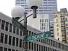
Marshall Street, Boston
| Marshall's Lane (formerly) | |
 Looking north from Union Street in 2019 | |
Interactive map of Marshall Street | |
| Part of | Government Center |
|---|---|
| Location | Boston, Massachusetts, U.S. |
Marshall Street is located in the Blackstone Block Historic District of Boston, Massachusetts. Named for Thomas Marshall, one of the city's settlers,[1] it was first recorded (as Marshall's Lane) in 1652,[2] 27 years after the city was settled. The Freedom Trail runs along the street,[3] which is around 200 feet (61 m) long, running from Hanover Street in the north to Union Street in the south, near their intersection.[1]
In 1652, Marshall, who owned a home and garden on Hanover Street, offered to the city a thoroughfare across his land "to shorten the distance to the drawbridge, which stood where Blackstone Street now crosses Hanover Street," wrote Edward Griffin Porter in 1887.[1]
Points of interest on the street (all on its eastern side) include one of the oldest brick buildings in the city,[4] the Ebenezer Hancock House, as well as the Boston Stone,[5] the Green Dragon Tavern and part of Union Oyster House. Marshall House formerly stood on the street (not to be confused with an early business in the Ebenezer Hancock House).[6] The building containing the Bell in Hand Tavern occupies the western side of the street.
Gallery
 Marshall Street (left) in relation to Union Oyster House (2025)
References
- 1 2 3 Porter, Edward Griffin (1886). Rambles in Old Boston, New England. Cupples, Upham and Company.
- ↑ Union Oyster House – NHRP Registration Form, 2003
- ↑ "Tiny Story: Ebenezer Hancock House | Boston Preservation Alliance". www.bostonpreservation.org. February 6, 2025. Retrieved June 10, 2026.
- ↑ "Oldest Brick Building, Creek Square, 10 Marshall Street, Boston, Mass". www.digitalcommonwealth.org. Retrieved June 10, 2026.
- ↑ Drake, Samuel Adams (1873). Old Landmarks and Historic Personages of Boston. James R. Osgood and Company. p. 144. ISBN 978-1-4255-5601-3.
{{cite book}}: ISBN / Date incompatibility (help) - ↑ "Marshall House, Marshall Street, Boston". Historic New England. Retrieved June 10, 2026.