Majdal Zoun
Majdal Zoun
مجدل زون | |
|---|---|
Municipality | |
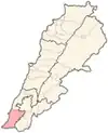
  Majdal Zoun Location within Lebanon | |
| Coordinates: 33°09′07″N 35°13′39″E / 33.1519°N 35.2275°E | |
| Grid position | 171/283 PAL |
| Country |  Lebanon |
| Governorate | South Governorate |
| District | Tyre |
| Population | |
• Estimate (2024) | 4,500 |
Majdal Zoun or Majdalzoun (Arabic: مجدل زون) is a municipality in the Tyre district of Southern Lebanon.[1][2]
The total population of the town is about 4500, who work predominantly in agriculture. The municipality was established in 2004.
In 2026 the village was mostly destroyed in a large explosion detonated by the Israeli Defense Forces.[3][4]
History
Ottoman era
In 1596, it was named as a village, Majdal Zurayd, in the Ottoman nahiya (subdistrict) of Tibnin under the liwa' (district) of Safad, with a population of 5 households, all Muslim. The villagers paid a fixed tax-rate of 25% on agricultural products, such as wheat, barley, fruit trees, goats & beehives; in addition to occasional revenues and a tax on winter pastures; a total of 3,100 akçe.[5][6]
In 1881, the village was described under the name El Mejdel ("The watch-tower"[7]) in the PEF's Survey of Western Palestine (SWP) as "A large and conspicuous village, containing about 400 Moslems ; it is situated on a hill, with figs, olives, and arable land. The water from birket; there are two cisterns in village." [8]
Modern era
Situated near the Israeli–Lebanese border,[9] the town has been the target of numerous Israeli airstrikes throughout the conflict since 2023.[10] The Israel Defense Forces killed eight people in an air raid on the village on April 28.[11][12] In June 2026, Israeli forces claimed to have discovered an underground tunnel in the village used by Hezbollah for weapon depots.[13][14] On June 29, the Israel Defense Forces detonated a large explosion in Majdal Zoun, killing people and destroying most of the village.[3][4]
Demographics
In 2014 Muslims made up 99.96% of registered voters in Majdal Zoun. 99.53% of the voters were Shiite Muslims.[15]
References
- ↑ "مجدل زون… واجهة أثرية بين أيادٍ متعثّرة وكسّارات مدمرة". جريدة البناء | Al-binaa Newspaper (in Arabic). Retrieved 2024-10-27.
- ↑ معجم قرى جبل عامل - الشيخ سليمان ضاهر العاملي - الجزء 2 - الصفحة 247
- 1 2 "Majdal Zoun 'cut in two' after Israel dynamites alleged Hezbollah tunnel". l'Orient Today. Retrieved 2026-07-21.
- 1 2 @greensoutherners; (30 June 2026). "Using Tens of Tons of Explosives Israel Destroys Majdal Zoun". Retrieved 2026-07-21 – via Instagram.
- ↑ Hütteroth and Abdulfattah, 1977, p. 181
- ↑ Note that Rhode, 1979, p. 6 Archived 2019-04-20 at the Wayback Machine writes that the register that Hütteroth and Abdulfattah studied was not from 1595/6, but from 1548/9
- ↑ Palmer, 1881, p.52
- ↑ Conder and Kitchener, 1881, SWP I, p.151
- ↑ "مجدل زون جارة المنصوري: فاجعة الطفولة المقتولة".
- ↑ "Security update: Intense Israeli airstrikes pound Majdal Zoun, several towns in Jezzine".
- ↑ "8 killed in Israeli strikes on southern Lebanon despite cease-fire". Daily Sabah. Retrieved 2026-07-21.
- ↑ "L'armée d'Israël annonce la découverte de tunnels du Hezbollah". Le Republicain Lorrain. Retrieved 2026-07-21.
- ↑ "Israeli army: Majdal Zoun tunnel shows Hezbollah used civilian areas for military sites". LBCIV7. Retrieved 2026-06-22.
- ↑ "New photos show tunnel discovered in south Lebanons Majdal Zoun". LBCIV7. Retrieved 2026-06-22.
- ↑ https://lub-anan.com/المحافظات/الجنوب/صور/مجدلزون/المذاهب/
Bibliography
- Conder, C.R.; Kitchener, H.H. (1881). The Survey of Western Palestine: Memoirs of the Topography, Orography, Hydrography, and Archaeology. Vol. 1. London: Committee of the Palestine Exploration Fund.
- Hütteroth, W.-D.; Abdulfattah, K. (1977). Historical Geography of Palestine, Transjordan and Southern Syria in the Late 16th Century. Erlanger Geographische Arbeiten, Sonderband 5. Erlangen, Germany: Vorstand der Fränkischen Geographischen Gesellschaft. ISBN 3-920405-41-2.
- Palmer, E.H. (1881). The Survey of Western Palestine: Arabic and English Name Lists Collected During the Survey by Lieutenants Conder and Kitchener, R. E. Transliterated and Explained by E.H. Palmer. Committee of the Palestine Exploration Fund.
- Rhode, H. (1979). Administration and Population of the Sancak of Safed in the Sixteenth Century. Columbia University. Archived from the original on 2020-03-01. Retrieved 2017-12-04.
External links
- Majdel Zoun (archive.org), localiban
- Survey of Western Palestine, Map 3: IAA, Wikimedia commons

Capital: Tyre | ||
| Towns and villages |
|  |
| Palestinian refugee camps | ||
| Notable landmark | ||