Kefermarkt
Kefermarkt | |
|---|---|
 | |
 Coat of arms | |
  Kefermarkt Location within Austria | |
| Coordinates: 48°26′34″N 14°32′15″E / 48.44278°N 14.53750°E | |
| Country | Austria |
| State | Upper Austria |
| District | Freistadt |
| Government | |
| • Mayor | Herbert Brandstötter (ÖVP) |
| Area | |
• Total | 27.83 km2 (10.75 sq mi) |
| Elevation | 516 m (1,693 ft) |
| Population (2018-01-01)[2] | |
• Total | 2,116 |
| • Density | 76.03/km2 (196.9/sq mi) |
| Time zone | UTC+1 (CET) |
| • Summer (DST) | UTC+2 (CEST) |
| Postal code | 4292 |
| Area code | 07947 |
| Vehicle registration | FR |
| Website | www.kefermarkt.ooe.gv.at |
Kefermarkt is a municipality in the district of Freistadt in the Austrian state of Upper Austria. The church in Kefermarkt houses the late medieval Kefermarkt Altarpiece.
Population
| Year | Pop. | ±% |
|---|---|---|
| 1869 | 1,441 | — |
| 1880 | 1,527 | +6.0% |
| 1890 | 1,481 | −3.0% |
| 1900 | 1,506 | +1.7% |
| 1910 | 1,604 | +6.5% |
| 1923 | 1,659 | +3.4% |
| 1934 | 1,642 | −1.0% |
| 1939 | 1,614 | −1.7% |
| 1951 | 1,697 | +5.1% |
| 1961 | 1,721 | +1.4% |
| 1971 | 1,798 | +4.5% |
| 1981 | 1,738 | −3.3% |
| 1991 | 1,950 | +12.2% |
| 2001 | 2,056 | +5.4% |
Gallery
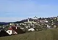 View on castle
 Railway station
 Pfarrkirche Kefermarkt
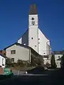 Pfarrkirche Kefermarkt
 Inside of Pfarrkirche Kefermarkt
 Organ
 Guesthouse Gasthaus Zur Goldenen Sense Aussen
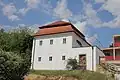 Kefermarkt evPfarrhof
 Bridge to Schloss Weinberg
 Castle Schloss Weinberg
 Pillory - Schandpfahl, was built in 1479, dismantled in 1738 and it was restored in 1980
 Fire service
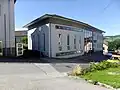 City hall
 The castle brewery
 View over castle Weinberg to the west
References

Wikimedia Commons has media related to Kefermarkt.
- ↑ "Dauersiedlungsraum der Gemeinden Politischen Bezirke und Bundesländer - Gebietsstand 1.1.2018" (in German). Statistics Austria. Retrieved 10 March 2019.
- ↑ "Einwohnerzahl 1.1.2018 nach Gemeinden mit Status, Gebietsstand 1.1.2018" (in German). Statistics Austria. Retrieved 9 March 2019.