The park is 50,000 rai ~ 80 square kilometres (31sqmi) in size.[3] The park is highland and is watered by the Mun and Khong Rivers. The average elevation is about 200 meters. The park is characterized by plateaux and undulating hills. The highest peak, Ban Tad, stands at 543 meters.[1]
Flora and fauna
The park is covered by deciduous forest, which has dwarf Shorea obtusa, Shorea siamensis, and Dipterocarpus obtusifollus. There are some dry evergreen forests around Huay (stream) and Don (prominence) Tana. Main plants are Eugenia cumini, Pterocarpus macrocarpus, Xylia kerril, teak, grassland, and bamboo. Wildlife includes wild pigs, barking deer, civet, macaque, gibbon, birds, and fishes.[1]
Sights
Don Tana (ดอนตะนะ) - An island in the middle of the Mun River 450m (1,480ft) wide and 700m (2,300ft) metres long.
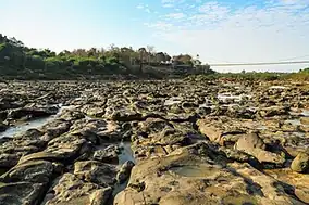
Kaeng Tana (แก่งตะนะ) - The largest rapids of the Mun River. In the middle of the rapids, there is a huge sandstone boulder splitting the river into two streams, and a concrete block built during the French colonial era to identify a channel for cruising.
Tham Phra or Tham Phu Ma Nai (ถ้ำพระหรือถ้ำภูหมาไน) - A stone inscription and Lingam base or "Yoni" from the 7th-8th century were found. Now the original stone inscription is kept in the National Museum, Ubon Ratchathani.
Namtok Rak Sai Nature Trail (เส้นทางศึกษาธรรมชาติน้ำตกรากไทร) - The trail lines the cliff by the Mun River, 500m (1,640ft) from the park headquarters. It runs by the cliff for 1km (0.62mi) through various kinds of flora, such as lichens, mosses, and ferns.
Namtok Tat Ton (น้ำตกตาดโตน) - The waterfall is on Highway 2173, off Highway 217 5km (3.1mi).
Location
Kaeng Tana National Park in overview PARO 9 (Ubon Ratchathani)
1) Kaeng Tana National Park in overview PARO 9 (Ubon Ratchathani)