Isluga
| Isluga | |
|---|---|
 Isluga volcano | |
| Highest point | |
| Elevation | 5,550 m (18,210 ft) |
| Coordinates | 19°09′S 68°50′W / 19.150°S 68.833°W[1] |
| Geography | |
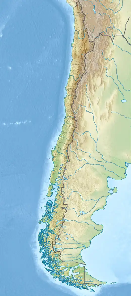  Isluga Location within Chile | |
| Location | Colchane, Chile |
| Parent range | Andes |
| Geology | |
| Rock age | Holocene |
| Stratovolcano | |
| Volcanic zone | Central Volcanic Zone |
| Last eruption | 1913 |
Isluga (Spanish pronunciation: [isˈluɣa]) is a stratovolcano located in Colchane, 7 kilometres (4.3 mi) west of the Chile-Bolivia border and at the west end of a group of volcanoes lined up in an east-west direction, which also includes the volcanoes Cabaray and Tata Sabaya. Isluga has an elongated summit area and lies within the borders of Volcán Isluga National Park in Chile's Tarapacá Region.
Name
Isluga is the Spanish name of the mountain; the native names are Jiwq’ir qullu (Volcano Hill) or Jeoq'er Qollu, or Laram Qawani (Blue Valley), Laram Qhawani[2][3] or Laram Kabani.[4] These two names might refer to distinct aspects of the volcano, one to its physical and the other to its spiritual aspect.[2] The etymology of Isluga is unclear, as it appears neither in the Quechua nor the Aymara language. One possible derivation is from "Islo", a plain in Alto Camiña. Other possibilities are that the name might come from the Kunza[5] or Uru-Chipaya languages,[6] the latter may contain a related word sluga.[7] Other spellings are Islonga and Isluca,[8] Ilaga may be an alternative form,[9] Isluya is a misspelling.[10]
Geography
Isluga lies in the commune of Colchane,[11] of the Iquique Province of Chile's Tarapacá Region[12] 5 km from the border with Bolivia[13] and about 200 kilometres (120 mi) east of Iquique.[14] The town Enquelga is below the volcano[15] at the foot of its lava flows.[16] Other localities around Isluga are Chinchillani, Pampa Condorire and Payacollo northwest, and Carahuana/Caraguano, Chapicollo, Colchane[a] Cotasaya, Enquelga, Escapiña, Isluga, Pisiga (on the Bolivian frontier) and Taipicollo south-southeast of Isluga.[18][19]

The highest point of Isluga lies at 5,559 metres (18,238 ft) altitude,[b][21] rising about 1.6 km above the surrounding terrain. The volcano has at least three[c] separate summit craters[24] on a plateau[1] west of the summit,[21] which form an east-west trending line. The currently active crater is 400 metres (1,300 ft) wide[17] and is surrounded by a ring of volcanic scoria.[25] Unconsolidated ash and pumice partially fill the crater,[26] and pyroclastic rocks, sulfur crusts, scoria and volcanic ash crop out inside[27] and in places where erosion has cut into the summit plateau.[28] The summit plateau itself may be a former crater,[13] which would make Isluga a somma volcano,[29] and the summit of Isluga has been interpreted as a partially filled amphitheatre-shaped valley created by a lateral eruption to the northwest.[30]
The volcano has the shape of a broad cone[13] and consists of lava domes,[28] conspicuous lobate[31][32] blocky lava flows with well-developed forms such as levees and ogives, as well as lahars, pyroclastic flows, pyroclastic rock fragments and tephra. Lava flows are tens of metres thick and reach lengths of multiple kilometres. The edifice, which covers an irregular area of about 60 square kilometres (23 sq mi), has a probable volume of 50 cubic kilometres (12 cu mi).[33] One report mentions the existence of a caldera.[34] Isluga forms a horseshoe-shaped volcanic complex with the 5400 m or 5516 m high Quimsachatas northeast of the volcano,[13][35][36] and the 5,060 metres (16,600 ft) high Cerros Alpajeres form a lava dome that constitutes a western spur of Isluga.[37][38]
There are no glaciers on mountains in the area, as the climate is too dry to allow their development,[3] but some lava flows emplaced in the last 100,000 years bear evidence of glaciation.[39] Lava flows have filled in some glacial valleys.[13] Isluga is part of two watersheds, the Rio Todos los Santos to the northwest[40] and the Isluga River to the south.[41] The latter originates in Laguna Arabilla, which is fed by springs at the foot of the volcano.[42] Both flow to Bolivia,[40] the latter was used for irrigation in the 19th century[43] and eventually discharges into the Salar de Coipasa[41] when its waters reach it.[10] Lake Parajaya lies north of Isluga.[44]
Human activities
Agriculture in the valleys and pastures are the main economic activities in the area;[45] tourist infrastructure includes camping, picnic areas and the hot springs of Enquelga[46] but in 1988 tourism did not play much of a role yet.[47] The volcano is within the Parque Nacional Volcan Isluga[d] (PNVI),[50] which disallows mining and restricts the extraction of natural resources.[51]
The remote[52] volcano can be accessed through the International Route 55,[53] which is sometimes flooded out during bad weather.[12] There is a trekking route leading to the summit of the volcano, which offers a panoramic view of the Altiplano. Sunburns, bad weather animal (puma) encounters and altitude sickness need to be watched for. As of 2026 park rules prohibit open fires, the introduction of exotic animals or disturbance of native animals, leaving the trails, damage or pollution to watercourses, the use of drones, noise, drug or alcohol use.[52]
Geology
Off the western coast of South America, the Nazca Plate subducts under the South America Plate. This subduction process is responsible for the existence of the Andean Volcanic Belt,[54] part of the wider Pacific Ring of Fire:[55] Four gaps without volcanic activity subdivide the Andean Volcanic Belt into the Northern Volcanic Zone (NVZ), Central Volcanic Zone (CVZ), Southern Volcanic Zone (SVZ) and Austral Volcanic Zone (AVZ)[e].[57] The CVZ includes the volcanoes Taapaca, Parinacota, Guallatiri, Isluga, Tata Sabaya, Irruputuncu, Aucanquilcha, Ollagüe, San Pedro, Paniri, Uturuncu, Lascar, Cerro Overo, Socompa, Lastarria and the Altiplano-Puna volcanic complex among others.[58][59] There are more than a thousand volcanoes in the Central Andes,[60] of which about 44 were active during the Holocene[61] but owing to their remote location their activity is poorly known.[62] Lascar erupted more than 30 times since the 19th century, making it the most active volcano of the region.[63]
The regional landscape is characterized by a tectonic depression to the west, the Occidental Cordillera in the centre, and the Altiplano to the east,[64] with the focus of the CVZ in the Occidental Cordillera.[65] Several cycles of volcanic[66] and tectonic activity took place in the region from the Mesozoic to the Tertiary, followed by a state of quiescence interrupted only by major volcanic eruptions[67] and characterized by water and glacial erosion.[68] The terrain under Isluga consists of ignimbrites and volcanic rocks (mainly andesite, but also basalt and basaltic andesite),[24] which formed during a Miocene flare-up of volcanic activity. In the early Pleistocene, volcanic activity settled into a steady state, during which it became concentrated in the volcanic arc of the Cordillera Occidental.[58]
East of Isluga lie the volcanoes Cabaraya/Cabaray (5860 m), Separaya/Cibaray (5470 m or 5420 m), Tata Sabaya (5385 m), Paryani/Sacasani/Saxani (5090 m) and Villa Pucarani.[38][69][70][59] The first four of which are situated on a geological lineament together with Isluga,[24] Such east-west lineaments are common in the Chilean volcanic belt;[55] whether the Isluga lineament is tectonically active is unclear.[71][72] The lineament appears to separate the Antofalla craton of Proterozoic age to the north from the Chilenia terrane to the south.[71] A 180 kilometres (110 mi) long gap (Pica gap) in the volcanic arc begins south of Isluga, where Holocene volcanism is absent[59] and there are several discontinuities in the geological structure of the Andes.[73] Southwest of Isluga is the Puchuldiza geothermal field, with fumaroles and hot springs.[24]
Composition
Isluga has erupted andesite, trachyandesite and trachydacite,[74] which define a potassium-rich calc-alkaline suite. Component minerals of the rocks are amphibole, iron-titanium oxides and plagioclase, with biotite and pyroxene subordinate.[75] Some rocks bear evidence of hydrothermal alteration,[24] especially in the northern and eastern sector of the volcano.[21] There are reports of sulfur deposits on the slopes[76][77] and the summit region both of Isluga[23] and of neighbouring volcanoes.[35] The sulfur deposits of Isluga were of regional importance[78] considered of high quality.[79] They were mined in the summit region[23] and used for the processing of saltpeter.[80]
Typical processes in the formation of CVZ magmas are the erosion of the continental crust at the trench, the absorption of crustal rocks by magma and the melting and dewatering of the downgoing oceanic crust,[81] with crustal assimilation especially important.[82][83] In the case of Isluga, magmas initially formed in the mantle and were mafic. As they ascended into the crust, garnet fractionation and the absorption of rocks from the lower crust took place.[84] Under Isluga and Tata Sabaya they underwent further fractionation of plagioclase and pyroxene in the middle crust and of amphibole, biotite and plagioclase in the upper crust.[83]
Eruption history
The volcano formed in several stages[81] beginning 566,000±16,000 years ago.[24] Initially, a pre-Isluga stage of volcanism ("Colchane Group") during the Pleistocene formed the volcanoes Cabaray, Quimsachata and Carcanchuni as well as the Cerro Blanco rocks south of Isluga;[24][85] Isluga grew on top of rocks from this older stage.[30] Radiometric dating has yielded ages of 500,000-100,000 years for rocks in the southeastern sector of Isluga, and of 100,000-50,000 years for the western and southwestern sectors.[21] Two different staging systems have been proposed: The first envisages an Enquelga Unit, followed by the three Isluga Units and the Postavalanche Unit; the first crops out at the southern foot of the volcano while the other four units make up the bulk of the edifice. A major sector collapse to the northwest took place after the third stage; lava flows of the Postavalanche Unit cover the deposits of the debris avalanche.[86] The second features a lower first stage, an upper second stage, followed by a third stage west and southwest of the summit and a fourth stage forming the summit region.[21] The fourth unit, which is assumed to be of Holocene age on morphological criteria, bears evidence of sub-Plinian eruptions, far-reaching lahars[21] and phreatomagmatic eruptions that spilled base surges over the summit.[39]

Historical eruptions are known from the summit crater:[1]
- August 1863.[87] Weak eruption[76] and its existence is contentious.[88]
- August 1869[87]
- February 1878.[89] Strong eruption[76] with the emission of lava flows[90] that allegedly destroyed numerous towns around the volcano. The existence of this eruption, which may be linked to a strong earthquake that year,[89] is however contentious,[91] and reports may reflect the effects of the earthquake rather than the volcano.[92]
- 1885. Weak eruption.[76]
- 1913. This is the most recent eruption of the volcano[21][1] and was a phreatomagmatic eruption;[90] it may be responsible for reports that light of volcanic activity was reflected in fumarole emissions in 1914.[93]
Other, less certain eruptions are recorded from 1868 after the 1868 Arica earthquake,[94] 1870,[95] 1877,[96] 1960,[97] April 2002[98] and 2005, which may be a phreatic eruption linked to the 2005 Tarapaca earthquake.[99] 19th century observers noted rumbling sounds,[23] and earthquakes in the region were attributed to it.[100] Seismic activity, while recorded[101] and felt by people nearby,[23] is relatively sparse at Isluga but with some variation in time (e.g volcanic tremors in 2013),[102] and there is no evidence for ongoing deformation of the edifice.[103][101]
There is widespread fumarolic activity on Isluga, covering about half of the main crater and half a kilometre below it on the southern flank[26] where there is a small jet-like fumarole.[90] Fumaroles are visible from the foot of the mountain in the form of "black smoke",[77] vapour plumes[104] that rise about 200 metres (660 ft) above the summit,[28] and possibly burning lights observed by people during nighttime.[105] Hot spots with temperature anomalies on the order of 10–30 °C (18–54 °F) have been observed by satellite.[101] The fumaroles mainly sulfur dioxide and water vapour,[106] and according to an 1914 report had a light blue colour.[93] Fumarole activity increased in 2002-2003,[102] and another spike of fumarolic and seismic activity in 2012 may be related to changes in the hydrothermal system.[107] A hot spring 2 kilometres (1.2 mi) east of Isluga is associated with the volcano,[108] and the Chusmiza hot springs have been attributed to it.[109]
Flora and fauna
The vegetation surrounding Isluga is a high-Andes steppe,[110] with a diverse[f] vegetation depending on water availability. Grasses (Deyeuxia breviaristata, Festuca orthophylla and Pycnophyllum molle) and bushes (Adesmia leucopogon, Astragalus arequipensis, Parastrephia lucida, Parastrephia quadrangularis and Senecio sp.) constitute pajonales, which grow on sandy soil. In rocky terrain at higher altitudes are cushion plants (Azorella compacta, associated with Festuca orthophylla, Nothotriche pulverulenta, Pycnophyllum molle and Senecio adenophyllus),[113] tussock grasses[49] and Polylepis tarapacana woodlands. In wet places Azolla filiculoides, Carex incurva, Distichia muscoides, Festuca rigescens, Gentiana prostata, Lilaeopsis macrolepis, Oxychloe andina and Werneria pygmaea form the wetland vegetation type bofedal[113] which is important for pastures.[3] Lichens,[114] Lampayo communities,[115] Echinopsis atacamensis groves[116] and other cactus plants,[49] and crops (garlic, potato and quinoa) complete the flora around Isluga.[117] Plant growth extends to an altitude of 4,900 metres (16,100 ft);[118] the Polylepis trees growing at 4,900 metres (16,000 ft) form the highest timberline on Earth.[119]
The guanaco is the main large animal in the region, other mammals are alpaca,[120] Andean hairy armadillo,[121] Andean mountain cat,[122] Andean mountain cavy,[123] chinchilla,[121] common yellow-toothed cavy, culpeo, llama,[120] mountain degu,[124] Pampas cat, puma, skunk,[120] South American fox, vicuña and vizcacha;[121] sheep were introduced during the colonial era.[125] Bird species include Anas flavirostris (yellow-billed teal), Asthenes (canastero), Bubo magellanicus (lesser horned owl), Diglossa carbonaria (grey-bellied flowerpiercer), Fulica ardesiaca (Andean coot), Fulica gigantea (giant coot), Leptasthenura aegithaloides (plain-mantled tit-spinetail), Lessonia rufa (Austral negrito), Lophonetta specularioides (crested duck), Metriopelia melanoptera (black-winged ground dove), Nothoprocta ornata (ornate tinamou), Phoenicopterus chilensis (Chilean flamingo),[121][126] Phoenicopterus jamesi (James' flamingo),[127] Plegadis ridgwayi (Puna ibis), Podiceps occipitalis (silvery grebe), Pterocnemia pennata (Darwin's rhea), Rhodopis vesper (oasis hummingbird), Spatula puna (Puna teal), Tinamotis pentlandii (Puna tinamou) and Vultur gryphus (condor). Many of these birds live in the wetlands, with Laguna Arabilla[126][121] and its wetland particularly important.[128] Other animals at Isluga are freshwater snails,[129] crustaceans in the waterbodies,[121] the lizard Liolaemus islugensis,[130] the fish Orestias agassii and Trichomycterus rivulatus,[131] the Peru water frog[132] and the toad Rhinella spinulosa,[133] and various species of insects,[134][135] mites[136] and spiders.[137]
Climate
The regional climate is windy, cold and dry.[116] Below 4,000 metres (13,000 ft) altitude, temperatures range between 10–0 °C (50–32 °F), while above that elevation they range −5–5 °C (23–41 °F). Above 5,200 metres (17,100 ft) lies perennial snow[138] although snow cover varies between seasons and from one year to the other, sometimes it is completely absent[3] and sometimes it covers the whole mountain.[10] Temperature variation between day and night is more intense than between the seasons, and nighttime low temperatures in winter can reach −15 °C (5 °F).[139] A weather station exists at Colchane.[115]
There is a weather station in the town of Isluga, which between 1977 and 1991 recorded a mean annual precipitation of 111.6 millimetres (4.39 in). Most recorded precipitation falls during summer[140] as part of the so-called "Bolivian Winter".[139] The aridity of the Atacama Desert is due to a combination of the cold Peru Current suppressing Pacific Ocean moisture, the rainshadow of the Andes blocking Amazon moisture from reaching the region, and the atmospheric air descending and drying in the horse latitudes.[141] The arid climate set in many millions of years ago, with fluctuations during e.g the early Holocene[142] when the climate became moister between 14,000 and 9,500 years ago.[65]
Human history
Human arrived in the region around 10,000 BCE.[143] Beginning 4,000-3,000 BCE, populations concentrated in the Andes and along the coast as the climate grew harsher, with plant domestication beginning about 3,000 BCE.[143] During the subsequent millennia, various environments were settled, llamas and then alpacas were domesticated, and proper towns formed.[144] This epoch is known as the Archaic Period, which is scarcely documented around Isluga. It ended about 1,500 BCE, yielding to the Formative Period[145] from which several archaeological sites around Isluga (Pukara de Isluga) are attested.[146] After 300 AD, the influence of the Altiplano civilization of Tiwanaku has been noted in the region[147] especially at Pukara de Isluga.[148] The Inca Emperor Tupac Yupanqui (1471-1493) initiated the occupation of the region by the Inka Empire, which took about half a century. It involved neither military occupation nor formal cultural changes,[149] but the Inca resettled populations and built infrastructure like new canals and roads.[150] The Spanish conquest had drastic impacts, including a notable population decline in the region. The Spanish christianized the region and instituted the Encomienda system which disrupted local communities.[151] The town Isluga is attested since 1705.[152] The Isluga area is a key region for the reconstruction of ancient history in the region,[153] and preserving the local Aymara communities was part of the purpose of the PNVI[51] as far back as 1988.[154]
A triangular stone structure on the summit of Isluga is probably a pre-Columbian archaeological site, although its purpose is unclear.[155] Such mountaintop sites are widespread in the Central Andes[156] and there are further ones on the mountains close to Isluga.[157] Further archaeological sites are west and especially south of Isluga; they include fortifications known as pucaras, lithic deposits, tombs including chullpas, towers and pre-Columbian villages.[158] Notable are the fortification of Pukar Qollu/Pukara de Isluga and the prehistoric cemeteries of Chok'e Qollo, Chullpas de Sitani, Cistas de Najrraya and Usamaya close to the town of Isluga;[159] Isluga itself has maintained the character of an Andean village[160] and features a colonial-era church[128] that is a Chilean national monument.[161][162]
Mythology and religious importance
Isluga is a sacred mountain, among the holiest in the region especially for Enquelga. Its inhabitants considered it the wife of its neighbour Cabaray, and it was implored for rain, riches and health.[163][155] The Chipaya people used to implore hills and mountains like Isluga to not let the winds blow.[3] Many Aymara and Uru-Chipaya communities view the Isluga area as their place of origin.[153]
The volcano also features in mythology. Numerous supernatural beings were thought to associate with the mountain,[164] as well as some Christian miracles.[165] Many of these supernatural beings are potentially dangerous; the fumaroles for example were thought to become irritated if people approached them, and the waters issuing from Isluga were considered "evil".[166] In another tale, there was a battle between the male mountains Tata Sabaya and Sajama for the female mountain Tunupa, in which Isluga took part.[15]
Threats and monitoring
Isluga is a potentially active volcano.[167] Informal volcano hazard maps have been published; they show that lava flow and volcanic bomb hazards are limited to a few kilometres from the summit, while lahars and pyroclastic flows can reach towns, Laguna Arabilla, farms,[168][169] regional watersheds[170] the Pisiga-Colchane border crossing[171] and a regional road up to 10 kilometres (6.2 mi) from the volcano.[172] Volcanic ash fallout could affect more distant cities like Antofagasta, Arica, Calama and Iquique.[173] Initial hazard management discussion took place after an increase in activity during April 2002,[106] and some seismometers were installed by OVDAS in 2012 to monitor an increase of earthquake activity.[102]
See also
Notes
- ↑ 24 kilometres (15 mi) southeast from the volcano.[17]
- ↑ There are other elevation estimates.[13][20]
- ↑ Some sources say five:[22] Three on the southern flank and two on the summit.[23]
- ↑ The Parque Nacional Volcan Isluga was founded on the 3 January 1967, although a proper infrastructure and institutions were not developed until years later,[48] and named after the volcano.[49] Its boundaries were redrawn in 1985.[12]
- ↑ Unlike the other three zones, volcanism here is caused by the subduction of the Antarctic Plate.[56]
- ↑ Apart from the scheme described here, there are other classification schemes.[111] A list of plant species encountered there is available.[112]
References
- 1 2 3 4 GVP 2026, General Information.
- 1 2 Aedo 2008, p. 127.
- 1 2 3 4 5 Dransart & Ortega Perrier 2021, p. 103.
- ↑ Vicuña 1983, p. 157.
- ↑ Martinez 1975, p. 406.
- ↑ Latorre 1997, p. 190.
- ↑ STRUBE 1962, p. 28.
- ↑ GVP 2026, Synonyms and Subfeatures.
- ↑ Geinitz 1878, p. 419.
- 1 2 3 Risopatrón 1924, p. 436.
- ↑ Baldini et al. 2013, p. 67.
- 1 2 3 CONAF 1988, p. 61.
- 1 2 3 4 5 6 De Silva & Francis 1991, p. 55.
- ↑ Llerena 2003, p. 93.
- 1 2 Dransart 2014, p. 53.
- ↑ Dransart 2014, p. 60.
- 1 2 Esquivel & Aguilera 2018, p. 146.
- ↑ Druc & Rodríguez 2018, p. 15.
- ↑ CONAF 1988, p. 175.
- ↑ Semper 1908, p. 4.
- 1 2 3 4 5 6 7 Godoy et al. 2026, p. 4.
- ↑ Bollaert 1854, p. 135.
- 1 2 3 4 5 Bollaert 1851, p. 119.
- 1 2 3 4 5 6 7 Godoy et al. 2026, p. 3.
- ↑ Amigo, Bertin & Orozco 2012, pp. 12–13.
- 1 2 Jay et al. 2013, p. 169.
- ↑ De Silva & Francis 1991, p. 56.
- 1 2 3 Wörner et al. 1994, p. 82.
- ↑ De Silva & Francis 1991, p. 57.
- 1 2 Amigo, Bertin & Orozco 2012, p. 12.
- ↑ Zeil 1964, p. 755.
- ↑ GVP 2026, Photo Gallery.
- ↑ Godoy et al. 2026, pp. 3, 4.
- ↑ Avila-Salinas 1991, pp. 245–258.
- 1 2 Risopatrón 1924, p. 740.
- ↑ CONAF 1988, p. 90.
- ↑ Risopatrón 1924, p. 23.
- 1 2 González-Ferrán 1985, p. 133.
- 1 2 Wörner et al. 2000, Volcan Isluga.
- 1 2 CONAF 1988, p. 83.
- 1 2 CONAF 1988, p. 84.
- ↑ Billinghurst 1886, p. 97.
- ↑ Pinochet 1884, p. 101.
- ↑ Crespo 1910, p. 66.
- ↑ CONAF 1988, p. 29.
- ↑ CONAF 1988, p. 34.
- ↑ CONAF 1988, p. 33.
- ↑ CONAF 1988, p. 51.
- 1 2 3 Wenborne 2007, p. 30.
- ↑ CONAF 1988, p. 31.
- 1 2 Pinheiro-Costa et al. 2025, Introduction.
- 1 2 CONAF 2026.
- ↑ DIFROL 2018.
- ↑ de Silva et al. 1993, p. 305.
- 1 2 Casertano 1963, p. 1415.
- ↑ Stern 2004, OCEANIC PLATES AND SUBDUCTION GEOMETRY.
- ↑ de Silva et al. 1993, pp. 305–306.
- 1 2 de Silva et al. 1993, p. 307.
- 1 2 3 Godoy et al. 2026, p. 2.
- ↑ Pritchard & Simons 2004, p. 6.
- ↑ Pritchard & Simons 2004, p. 4.
- ↑ Stern 2004, VOLCANIC HAZARD ASSESSMENT AND RISK MANAGEMENT.
- ↑ Amigo, Bertin & Orozco 2012, p. 7.
- ↑ CONAF 1988, pp. 9–10.
- 1 2 Amigo, Bertin & Orozco 2012, p. 6.
- ↑ de Silva et al. 1993, p. 306.
- ↑ CONAF 1988, p. 7.
- ↑ CONAF 1988, p. 86.
- ↑ De Silva & Francis 1991, p. 53.
- ↑ Zeil 1964, p. 751.
- 1 2 de Silva et al. 1993, p. 309.
- ↑ Vega 1997, p. 29.
- ↑ Wörner et al. 2000, Pica Gap.
- ↑ Godoy et al. 2026, p. 5.
- ↑ Cascante et al. 2012, p. 613.
- 1 2 3 4 Casertano 1963, p. 1422.
- 1 2 Minchin 1882, p. 673.
- ↑ Fuenzalida 1906, p. 512.
- ↑ Billinghurst 1886, p. 64.
- ↑ Puélma 1855, p. 669.
- 1 2 Cascante et al. 2012, p. 612.
- ↑ Stern 2004, ANDEAN MAGMA GENESIS.
- 1 2 Godoy et al. 2026, p. 10.
- ↑ Godoy et al. 2026, p. 12.
- ↑ Cascante et al. 2012, pp. 612, 614.
- ↑ Cascante et al. 2012, pp. 612–614.
- 1 2 Casertano 1963, p. 1421.
- ↑ Sapper 1917, p. 286.
- 1 2 Fuchs 1880, p. 100.
- 1 2 3 González-Ferrán 1985, p. 135.
- ↑ Fuchs 1880, p. 99.
- ↑ Comte & Pardo 1991, p. 38.
- 1 2 Sapper 1915, p. 121.
- ↑ Forbes 1870, p. 325.
- ↑ Perrey 1875, pp. 26, 86.
- ↑ Geinitz 1878, p. 405.
- ↑ GVP 2026, Eruption History.
- ↑ Esquivel & Aguilera 2016, p. 2.
- ↑ Legrand, Tassara & Morales 2012, p. 930.
- ↑ Semper 1908, p. 5.
- 1 2 3 Pritchard et al. 2014, p. 92.
- 1 2 3 Pritchard et al. 2014, p. 96.
- ↑ Pritchard & Simons 2004, p. 10.
- ↑ Dransart & Ortega Perrier 2021, p. 104.
- ↑ Vega 1997, p. 21.
- 1 2 Céspedes, Clavero & Cayupi 2004.
- ↑ Pritchard et al. 2014, p. 102.
- ↑ Dransart 2002.
- ↑ Madaleno 2007, p. 102.
- ↑ CONAF 1988, p. 17.
- ↑ CONAF 1988, pp. 98–104.
- ↑ Espinosa 2013, Tabla 2.
- 1 2 CONAF 1988, p. 18.
- ↑ Rubio et al. 2002, Table 1.
- 1 2 CONAF 1988, p. 78.
- 1 2 Covarrubias & Mellado 2003, p. 26.
- ↑ CONAF 1988, p. 141.
- ↑ CONAF 1988, p. 97.
- ↑ von Wissmann 1961, p. 19.
- 1 2 3 CONAF 1988, pp. 20, 107.
- 1 2 3 4 5 6 Wenborne 2007, p. 31.
- ↑ Valenzuela, Villalobos & Lagos, p. 45.
- ↑ Marquet et al. 1993, p. 137.
- ↑ Verzi 2001, p. 265.
- ↑ CONAF 1988, p. 107.
- 1 2 CONAF 1988, p. 20.
- ↑ Kahmer 1887, p. 160.
- 1 2 CONAF 1988, p. 154.
- ↑ Valdovinos & Stuardo 1991, p. 215.
- ↑ CONAF 1988, p. 105.
- ↑ Vila, Fuentes & Contreras 1999, p. 63.
- ↑ Moreno et al. 2001, INTRODUCTION.
- ↑ Pastenes et al. 2010, p. 87.
- ↑ Pinheiro-Costa et al. 2025, Results.
- ↑ Flores 2000, p. 73.
- ↑ Covarrubias & Mellado 2003, p. 34.
- ↑ Taucare-Ríos 2012, p. 55.
- ↑ CONAF 1988, p. 5.
- 1 2 CONAF 1988, p. 77.
- ↑ Houston & Hartley 2003, p. 1457.
- ↑ Houston & Hartley 2003, p. 1454.
- ↑ Houston & Hartley 2003, p. 1462.
- 1 2 CONAF 1988, p. 36.
- ↑ CONAF 1988, pp. 37–38.
- ↑ CONAF 1988, p. 114.
- ↑ CONAF 1988, p. 115.
- ↑ CONAF 1988, p. 116.
- ↑ CONAF 1988, p. 133.
- ↑ CONAF 1988, p. 39.
- ↑ CONAF 1988, p. 41.
- ↑ CONAF 1988, pp. 43–44.
- ↑ Gundermann Kröll & González Cortez 2022, p. 24.
- 1 2 Druc & Rodríguez 2018, p. 12.
- ↑ CONAF 1988, p. 1.
- 1 2 Reinhard 2002, p. 92.
- ↑ Reinhard 2002, p. 85.
- ↑ Reinhard 1983, p. 41.
- ↑ CONAF 1988, p. 132.
- ↑ CONAF 1988, pp. 133–134.
- ↑ CONAF 1988, p. 135.
- ↑ CONAF 1988, pp. 34–35.
- ↑ Santuario de Isluga 2026.
- ↑ Reinhard 1985, p. 308.
- ↑ Dransart 2014, p. 62.
- ↑ Bollaert 1854, p. 158.
- ↑ Dransart 2014, p. 63.
- ↑ González-Ferrán 1985, p. 68.
- ↑ Esquivel & Aguilera 2018, p. 148.
- ↑ Amigo, Bertin & Orozco 2012, p. 13.
- ↑ DIRECCIÓN GENERAL DE AGUAS 2004, p. 44.
- ↑ Amigo, Bertin & Orozco 2012, p. 53.
- ↑ Esquivel & Aguilera 2016, p. 1.
- ↑ Esquivel & Aguilera 2018, p. 150.
Sources
- Aedo, Juan Angel (2008). "Percepción del espacio y apropiación del territorio entre los aymara de Isluga". Estudios atacameños (36): 117–137. doi:10.4067/S0718-10432008000200007. ISSN 0718-1043.
- Amigo, Álvaro R.; Bertin, Daniel U.; Orozco, Gabriel L. (2012). Peligros volcánicos de la Zona Norte de Chile (PDF) (Report). Carta geológica de Chile: Serie Geología Ambiental (in Spanish). Vol. 17. SERVICIO NACIONAL DE GEOLOGÍA Y MINERÍA. pp. 12–13. ISSN 0717-7305. Archived from the original (PDF) on 29 June 2021. Retrieved 20 August 2021.
- Avila-Salinas, Waldo (1991). "Petrologic and tectonic evolution of the Cenozoic volcanism in the Bolivian western Andes". Andean Magmatism and Its Tectonic Setting. Geological Society of America Special Papers. Vol. 265. pp. 245–258. doi:10.1130/SPE265-p245. ISBN 0-8137-2265-9.
- Baldini, Aida; Gándara, Eduardo; Omegna, Gabriela; Montero, Alida; Caimi, Karen (2013). CONAF : por un Chile forestal sustentable (Report) (in Spanish). Corporación Nacional Forestal (Chile).
- Billinghurst, Guillermo Eduardo (1886). Estudio sobre la geografía de Tarapacá (in Spanish). Imprenta de" El Progreso".
- Bollaert, W. (1851). "Observations on the Geography of Southern Peru, Including Survey of the Province of Tarapaca, and Route to Chile by the Coast of the Desert of Atacama". Journal of the Royal Geographical Society of London. 21: 99. doi:10.2307/1798186.
- Bollaert, W. (1854). "Observations on the History of the Incas of Peru, on the Indians of South Peru, and on Some Indian Remains in the Province of Tarapaca". Journal of the Ethnological Society of London. 3: 132–164. doi:10.2307/3014140. JSTOR 3014140.
- Cascante, Montserrat; Polanco, Edmundo; Castruccio, Angelo; Clavero, Jorge (August 2012). Page 1 Geología, geoquímica y petrografía del Volcán Isluga (19°09'S), Altiplano de la I Región, Chile: resultados preliminares (PDF) (in Spanish). Antofagasta: XIII Congreso Geológico Chileno. pp. 612–613. Archived from the original (PDF) on 25 November 2015. Retrieved 27 September 2015.
- Casertano, Lorenzo (1 December 1963). "General characteristics of active andean volcanoes and a summary of their activities during recent centuries". Bulletin of the Seismological Society of America. 53 (6): 1415–1433. Bibcode:1963BuSSA..53.1415C. doi:10.1785/BSSA0530061415.
- Céspedes, L.; Clavero, J.; Cayupi, J. (2004). Hazard management at Isluga volcano, Northern Chile: preliminary results. IAVCEI General Assembly 2004. Pucon, Chile. doi:10.13140/RG.2.2.21107.27682.
- Comte, Diana; Pardo, Mario (1991). "Reappraisal of great historical earthquakes in the northern Chile and southern Peru seismic gaps". Natural Hazards. 4 (1): 23–44. doi:10.1007/BF00126557.
- Plan de manejo del PN Volcán Isluga (Report) (in Spanish). CONAF. 1988. Retrieved 21 August 2026.
- "Parque Nacional Volcán Isluga". CONAF. Retrieved 21 August 2026.
- Pastenes, Luis; Sallaberry, Michel; Correa, Claudio; Veloso, Alberto; Méndez, Marco (2010). "Phylogeography of Rhinella spinulosa (Anura: Bufonidae) in northern Chile". Amphibia-Reptilia. 31 (1): 85–96. doi:10.1163/156853810790457939.
- Covarrubias, René; Mellado, I. (2003). "MICROARTRÓPODOS DE SUELOS ASOCIADOS A VEGETACIÓN ALTIPLÁNICA. I. PARQUE NACIONAL VOLCÁN ISLUGA. CHILE". Acta Entomológica Chilena (in Spanish). 27: 25–35. ISSN 0376-2106.
- Crespo, Luis S. (1910). Geografia de la Republica de Bolivia (in Spanish). Impr. H. Heitmann.
- de Silva, Shanaka L.; Davidson, Jon P.; Croudace, Ian W.; Escobar, Angel (March 1993). "Volcanological and petrological evolution of Volcan Tata Sabaya, SW Bolivia". Journal of Volcanology and Geothermal Research. 55 (3–4): 305–335. doi:10.1016/0377-0273(93)90043-Q.
- De Silva, Shanaka L.; Francis, Peter (1991). Volcanoes of the central Andes. Vol. 21. Springer-Verlag.
- "Volcán Isluga" (in Spanish). Ministry of Foreign Affairs. Archived from the original on 6 February 2018. Retrieved 5 February 2018.
- DIAGNOSTICO Y CLASIFICACION DE LOS CURSOS Y CUERPOS DE AGUA SEGUN OBJETIVOS DE CALIDAD CUENCA QUEBRADA DE TARAPACA (Report) (in Spanish). DIRECCIÓN GENERAL DE AGUAS. December 2004.
- Dransart, Penny (2002). Earth, Water, Fleece and Fabric An Ethnography and Archaeology of Andean Camelid Herding. ISBN 9780415753821.
- Dransart, Penelope; Ortega Perrier, Marietta (2 February 2021). "When the Winds Run with the Earth: Cannibal Winds and Climate Disruption in Isluga, Northern Chile". Current Anthropology. 62 (1): 101–109. doi:10.1086/713083.
- Dransart, Penny (2014). Earth, Water, Fleece and Fabric: An Ethnography and Archaeology of Andean Camelid Herding. Taylor & Francis Group. ISBN 9780415753821.
- Druc, Isabelle; Rodríguez, Mauricio Uribe (June 2018). "A VOLCANO IN CERAMIC: INDICATIONS OF PRODUCTION IN THE ISLUGA PLATEAU, TARAPACÁ - CHILE". Comechingonia. 22 (1): 1–10. ISSN 1851-0027.
- Espinosa, Marión (2013). Caracterización de humedales altoandinos para una gestión sustentable de las actividades productivas del sector norte del país. (2011-2013) (Report) (in Spanish). Centro de Información de Recursos Naturales (Chile).
- Esquivel, Alfredo; Aguilera, Felipe (November 2016). Lahar modelling for Isluga and Lascar volcano, northern Chile: Insights for hazard assesment. Cities on Volcanoes 9. Understanding volcanoes and society: the key for risk mitigation. Puerto Varas, Chile.
- Esquivel, Alfredo; Aguilera, Felipe (2018). Protocolo de evaluación de los peligros asociados a la actividad volcánica mediante modelos numéricos: aplicación a los volcanes Isluga y Láscar (Chile) (PDF) (Report) (in Spanish).
- Flores, Gustavo E. (June 2000). "SYSTEMATICS OF THE ANDEAN GENERA FALSOPRAOCIS KULZER AND ANTOFAGAPRAOCIS NEW GENUS (COLEOPTERA: TENEBRIONIDAE), WITH DESCRIPTIONS OF TWO NEW SPECIES". Journal of the New York Entomological Society. 108 (1 &, 2): 52–75. doi:10.1664/0028-7199(2000)108[0052:SOTAGF]2.0.CO;2.
- Forbes, David (July 1870). "IV.—On Volcanos". Geological Magazine. 7 (73): 314–328. doi:10.1017/S0016756800209795.
- Fuchs, C. W. C. (March 1880). "Die vulcanischen Ereignisse des Jahres 1878". Mineralogische und petrographische Mitteilungen. 2 (2): 97–125. Bibcode:1880ZKMP....2...97F. doi:10.1007/BF02992590.
- Fuenzalida, J. del C. (1906). "La provincia de Tarapacá. Alumbramiento de aguas subterráneas, aspectos jeolójicos i principales asientos mineros". Anales del Instituto de Ingenieros de Chile (in Spanish) (11): 507–522. ISSN 0716-324X.
- Geinitz, Eugen (1878). Das erdbeben von Iquique am 9. mai 1877 und die durch dasselbe verursachte erdbebenfluth im grossen ocean. No. 9. Für die Akademie in commission bei W. Englemann in Leipzig (in German).
- Godoy, Benigno; Cascante, Monserrat; Hernández Prat, Loreto; González-Maurel, Osvaldo; Rodríguez, Inés; le Roux, Petrus; Contreras, Claudio; Contreras-Higueras, Vicente; Chanqueo, Scarlett; Polanco, Edmundo; Clavero, Jorge; Castruccio, Angelo (January 2026). "Magmatic evolution of Isluga volcano: Insights for the differences in sub-arc magmatic inputs and crustal contribution in the Central Andes of northern Chile". Journal of South American Earth Sciences. 169 105836. Bibcode:2026JSAES.16905836G. doi:10.1016/j.jsames.2025.105836.
- González-Ferrán, Oscar (1985). Volcanes de Chile (in Spanish). Instituto Geográfico Militar.
- Gundermann Kröll, Hans; González Cortez, Héctor (2022). "La formación colonial de la comunidad de Isluga". Revista de geografía Norte Grande (83): 11–30. doi:10.4067/S0718-34022022000300011. ISSN 0718-3402.
- "Isluga". Global Volcanism Program. Smithsonian Institution. Retrieved 21 August 2026.
- Houston, John; Hartley, Adrian J. (October 2003). "The central Andean west‐slope rainshadow and its potential contribution to the origin of hyper‐aridity in the Atacama Desert". International Journal of Climatology. 23 (12): 1453–1464. doi:10.1002/joc.938.
- Kahmer, Carl (April 1887). "Briefliches überPhoenicopterus Jamesi Rahm". Journal für Ornithologie (in German). 35 (2): 160–162. doi:10.1007/BF02006193.
- Jay, J. A.; Welch, M.; Pritchard, M. E.; Mares, P. J.; Mnich, M. E.; Melkonian, A. K.; Aguilera, F.; Naranjo, J. A.; Sunagua, M.; Clavero, J. (2013). "Volcanic hotspots of the central and southern Andes as seen from space by ASTER and MODVOLC between the years 2000 and 2010". Geological Society, London, Special Publications. 380 (1): 161–185. Bibcode:2013GSLSP.380..161J. doi:10.1144/SP380.1. S2CID 129450763.
- Latorre, Guillermo (31 December 1997). "Tendencias generales en la toponimia del norte grande de Chile". Onomázein (in Spanish) (2): 181–196. doi:10.7764/onomazein.2.08. ISSN 0718-5758.
- Legrand, D.; Tassara, A.; Morales, D. (December 2012). "Megathrust asperities and clusters of slab dehydration identified by spatiotemporal characterization of seismicity below the Andean margin". Geophysical Journal International. 191 (3): 923–931. Bibcode:2012GeoJI.191..923L. doi:10.1111/j.1365-246X.2012.05682.x. hdl:10533/136518. S2CID 130439387.
- Llerena, José Barraza (2003). Manual de Patrimonio Cultural y Natural Arica y Parinacota (PDF) (in Spanish). MINISTERIO DE EDUCACIÓN.
- Madaleno, Isabel Maria (2007). "Desertificação no Norte do Chile". Finisterra (in Portuguese). 42 (83). doi:10.18055/Finis1441. ISSN 2182-2905.
- Marquet, Pablo A.; Contreras, Luis C.; Silva, Sergio; Torres-Mura, Juan C.; Bozinovic, Francisco (1993). "Natural History of Microcavia niata in the High Andean Zone of Northern Chile". Journal of Mammalogy. 74 (1). [American Society of Mammalogists, Oxford University Press]: 136–140. doi:10.2307/1381912. ISSN 0022-2372.
- Martinez, Gabriel (1 March 1975). "Características de orden antropológico y socioeconómico de la comunidad de Isluga (1 región)". Revista de Geografía Norte Grande (in Spanish) (3–4): 403–426. ISSN 0718-3402.
- Minchin, John B. (November 1882). "Notes of a Journey Through Part of the Andean Table-Land of Bolivia in 1882". Proceedings of the Royal Geographical Society and Monthly Record of Geography. 4 (11): 671. doi:10.2307/1800303.
- Moreno, Rodrigo M; Moreno, Jorge; Torres-Pérez, Fernando; Ortiz, Juan C.; Breskovic, Antonio (2001). "CATALOGO HERPETOLOGICO DEL MUSEO DEL MAR DE LA UNIVERSIDAD ARTURO PRAT DE IQUIQUE, CHILE". Gayana (Concepción). 65 (2). Universidad de Concepción. Facultad de Ciencias Naturales y Oceanográficas.: 149–153. doi:10.4067/S0717-65382001000200006. ISSN 0717-6538.
- Perrey, Alexis (1875). Note sur les tremblements de terre en 1870, avec supplément pour 1869 (in French). Vol. 23. Hayez.
- Pinheiro-Costa, Bruna K.; Cortés-Rivas, Benito; Pádua, Diego G.; Moreira-Muñoz, Andrés; Araujo, Rodrigo O.; Pinheiro-Costa, Bruna K.; Cortés-Rivas, Benito; Pádua, Diego G.; Moreira-Muñoz, Andrés; Araujo, Rodrigo O. (December 2025). "Wild Bee Diversity in Parque Nacional Volcán Isluga: Assessing Plant-Bee Interactions in a High-Altitude Desert". Revista de la Sociedad Entomológica Argentina. 84 (4): 408. doi:10.25085/rsea.840408. ISSN 0373-5680.
- Pinochet, Alejandro Cañas (1884). Descripción jeneral del Departamento de Pisagua (Report). El Veintiuno de mayo (in Spanish) – via Google Books.
- Pritchard, M. E.; Simons, M. (February 2004). "An InSAR‐based survey of volcanic deformation in the central Andes". Geochemistry, Geophysics, Geosystems. 5 (2). doi:10.1029/2003GC000610.
- Pritchard, M.E.; Henderson, S.T.; Jay, J.A.; Soler, V.; Krzesni, D.A.; Button, N.E.; Welch, M.D.; Semple, A.G.; Glass, B.; Sunagua, M.; Minaya, E.; Amigo, A.; Clavero, J. (June 2014). "Reconnaissance earthquake studies at nine volcanic areas of the central Andes with coincident satellite thermal and InSAR observations". Journal of Volcanology and Geothermal Research. 280: 90–103. Bibcode:2014JVGR..280...90P. doi:10.1016/j.jvolgeores.2014.05.004.
- Puélma, Francisco (1 January 1855). "Apuntes jeolójicos i jeográficos sobre la Provincia de Tarapaca en el Peru, acompañados de una lijera noticia sobre la esplotacion del nitrato de soda". Anales de la Universidad de Chile (in Spanish): 665–673. doi:10.5354/0717-8883.1855.22112. ISSN 0717-8883.
- Reinhard, Johan (1983). "Las montañas sagradas: Un estudio etnoarqueológico de ruinas en las altas cumbres andinas". Cuadernos de Historia (in Spanish) (3): 27–62 Pág. ISSN 0719-1243.
- Reinhard, Johan (November 1985). "Sacred Mountains: An Ethno-Archaeological Study of High Andean Ruins". Mountain Research and Development. 5 (4): 299. doi:10.2307/3673292.
- Reinhard, Johan (January 2002). "A High Altitude Archaeological Survey in Northern Chile". Chungará (Arica). 34 (1). doi:10.4067/S0717-73562002000100005.
- Risopatrón, Luis (1924). Diccionario jeográfico de Chile (in Spanish). Impr. Universitaria. p. 958.
- Rubio, Cecilia; Fernández, Ernesto; Hidalgo, María Eliana; Quilhot, Wanda (March 2002). "EFFECTS OF SOLAR UV-B RADIATION IN THE ACCUMULATION OF RHIZOCARPIC ACID IN A LICHEN SPECIES FROM ALPINE ZONES OF CHILE". Boletín de la Sociedad Chilena de Química. 47 (1). Sociedad Chilena de Química: 67–72. doi:10.4067/S0366-16442002000100012. ISSN 0366-1644.
- "Santuario de Isluga". Servicio Nacional del Patrimonio Cultural. Retrieved 26 August 2026.
- Sapper, Karl (1915). "Bericht über die vulkanischen Ereignisse der Jahre 1895-1913". Gerlands Beiträge zur Geophysik (in German). Verlag von Wilhelm Engelmann.
- Sapper, Karl (1917). Katalog Der Geschichtlichen Vulkanausbrueche (in German).
- Semper, Erwin (1908). La industria del salitre en Chile (in Spanish). Impr. Barcelona.
- Stern, Charles R. (December 2004). "Active Andean volcanism: its geologic and tectonic setting". Revista geológica de Chile. 31 (2). Servicio Nacional de Geología y Minería: 161–206. doi:10.4067/S0716-02082004000200001. ISSN 0716-0208.
- STRUBE, R. P. LEON (2 March 1962). "Toponimia Atacameña. Extremo Norte de Chile y Sur de Perú" (PDF). Doceavo boletín del Museo Arqueológico de La Serena (in Spanish). 12.
- Taucare-Ríos, Andrés (2012). "Arañas epigeas (Araneae) en el Parque Nacional Volcan Isluga, Altiplano chileno" (PDF). Brenesia (in Spanish). 78: 50–57. Archived from the original (PDF) on 20 February 2025.
- Valdovinos, Claudio; Stuardo, José (January 1991). "Planorbidos altoandinos del norte de Chile y Biomphalaria aymara spec. nov. (Mollusca, Basommatophora)". Studies on Neotropical Fauna and Environment. 26 (4): 213–224. doi:10.1080/01650529109360854.
- Valenzuela, Jorge; Villalobos, Rodrigo; Lagos, Nicolás. Primeros registros de gato andino (Leopardus jacobita) en el Parque Nacional Volcán Isluga y Parque Nacional Salar del Huasco (Report) (in Spanish). Vol. 44. República de Chile Ministerio de Agricultura Corporación Nacional Forestal (CONAF).
- Verzi, Diego H. (September 2001). "Phylogenetic position ofAbalosia and the evolution of the extant Octodontinae (Rodentia, Caviomorpha, Octodontidae)". Acta Theriologica. 46 (3): 243–268. doi:10.1007/BF03192432.
- Vega, A. (1997). "Terremoto en Cumujo, Provincia Atahuallpa de Oruro" (PDF). Revista Geofísica (in Spanish). 46. Instituto Panamericano de Geografía e Historia: 17–36.
- Vicuña, Maria Ester Grebe (1983). "En torno a los ritos terapéuticos astrales de Isluga". Chungara: Revista de Antropología Chilena (10): 155–164. ISSN 0716-1182. JSTOR 27801773.
- Vila, Irma; Fuentes, Leopoldo; Contreras, Manuel (28 December 1999). "Peces límnicos de Chile". Boletín Museo Nacional de Historia Natural (in Spanish). 48: 61–75. doi:10.54830/bmnhn.v48.1999.362. ISSN 0719-935X.
- von Wissmann, Hermann (1961). "Stufen und Gürtel der Vegetation und des Klimas in Hochasien und seinen Randgebieten". ERDKUNDE. 15 (1). doi:10.3112/erdkunde.1961.01.02.
- Wenborne, Guy (2007). Parques nacionales de Chile (in Spanish). Editorial Travesía.
- Wörner, Gerhard; Moorbath, Stephen; Horn, Susanne; Entenmann, Jürgen; Harmon, Russel S.; Davidson, Jon P.; Lopez-Escobar, Leopoldo (1994). "Large- and Fine-Scale Geochemical Variations Along the Andean Arc of Northern Chile (17.5°– 22°S)". Tectonics of the Southern Central Andes. pp. 77–92. doi:10.1007/978-3-642-77353-2_5. ISBN 978-3-642-77355-6.
- Wörner, Gerhard; Hammerschmidt, Konrad; Henjes-Kunst, Friedhelm; Lezaun, Judith; Wilke, Hans (December 2000). "Geochronology (40Ar/39Ar, K-Ar and He-exposure ages) of Cenozoic magmatic rocks from Northern Chile (18-22°S): implications for magmatism and tectonic evolution of the central Andes". Revista Geológica de Chile. 27 (2): 205–240. doi:10.4067/S0716-02082000000200004 (inactive 22 August 2026).
{{cite journal}}: CS1 maint: DOI inactive as of August 2026 (link) - Zeil, Werner (December 1964). "Die Verbreitung des jungen Vulkanismus in der Hochkordillere Nordchiles". Geologische Rundschau. 53 (2): 731–757. doi:10.1007/BF02054561.
External links
- Cascante Matamoros, Monserrat (2015). Evolución geológica y magmática del volcán Isluga, 19° S, región de Tarapacá, Chile (Thesis) (in Spanish). University of Chile.
- Madinagoitia Serrano, Ana Luisa; Soto, Viviana Manriquez (2014). Enquelga" lugar de ceniza". Una etnografía narrada desde la última erupción del Volcán Isluga en 1960 hasta 2010 (dissertation). Universidad Academia de Humanismo Cristiano.
- Zavala, Ortiz; Valeria, Sofia (2013). Evidencias glaciares del cenozoico tardío en el borde occidental del altiplano entre 19° 10'S y 19° 45'S (Thesis) (in Spanish).