Ilia, Hunedoara
Ilia | |
|---|---|
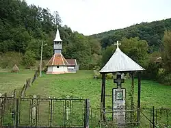 Wooden church in Valea Lungă | |
 Location in Hunedoara County | |
  Ilia Location in Romania | |
| Coordinates: 45°56′N 22°39′E / 45.933°N 22.650°E | |
| Country | Romania |
| County | Hunedoara |
| Government | |
| • Mayor (2020–2024) | Gabriel Marius Omota (PNL) |
Area | 91.38 km2 (35.28 sq mi) |
| Elevation | 185 m (607 ft) |
| Population (2021-12-01)[1] | 3,144 |
| • Density | 34.41/km2 (89.11/sq mi) |
| Time zone | UTC+02:00 (EET) |
| • Summer (DST) | UTC+03:00 (EEST) |
| Postal code | 337270 |
| Area code | (+40) 02 54 |
| Vehicle reg. | HD |
| Website | primariailia |
Ilia (Hungarian: Marosillye, German: Elienmarkt) is a commune in Hunedoara County, Romania. The commune lies in the historical province of Transylvania. It is composed of nine villages: Bacea (Bácsfalva), Bretea Mureșană (Marosbrettye), Brâznic (Briznik), Cuieș (Kulyes), Dumbrăvița (Dumbravica), Ilia, Săcămaș (Szakamás), Sârbi (Szirb), and Valea Lungă (Valealunga).
The commune is located in the central part of Hunedoara County, 26 km (16 mi) west of the county seat, Deva. It lies on the right bank of the Mureș River, southwest of the Metaliferi Mountains and north of the Poiana Ruscă Mountains.
The Ilia train station serves the CFR Main Line 200, running from Brașov towards Timișoara and the border with Hungary, as well as Line 212, connecting Ilia to Lugoj. The national road DN7 (part of E68) crosses the commune, meeting the A1 motorway just north of Ilia.
| Year | Pop. | ±% |
|---|---|---|
| 1850 | 3,924 | — |
| 1900 | 5,394 | +37.5% |
| 1956 | 5,149 | −4.5% |
| 1992 | 4,198 | −18.5% |
| 2002 | 4,022 | −4.2% |
| 2011 | 3,662 | −9.0% |
| 2021 | 3,144 | −14.1% |
| Source: Census data | ||
Notable people
- Gabriel Bethlen (1580 in Marosillye – 1629), Prince of Transylvania from 1613 to 1629.[2]
Gallery
 Wooden church in Bacea
 Saint Demetrius' wooden church in Bretea Mureșană
 Saint Paraskeva's wooden church in Brâznic
 "Red Bastion" in Ilia, the Renaissance-style mansion built by Stephen Báthory in which Gabriel Bethlen was born in 1580
 Ilia train station
 Wooden church in Sârbi
See also
References
- ↑ "2021 Romanian census". National Institute of Statistics. 1 December 2021.
- ↑ Bain, Robert Nisbet (1911). . Encyclopædia Britannica. Vol. 3 (11th ed.). pp. 829–830.
