Huberdeau, Quebec
Huberdeau | |
|---|---|
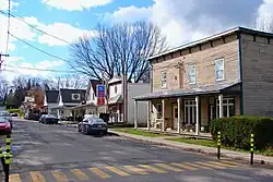 | |
 Location within Les Laurentides RCM | |
  Huberdeau Location in central Quebec | |
| Coordinates: 45°58′N 74°38′W / 45.967°N 74.633°W[1] | |
| Country |  Canada |
| Province |  Quebec |
| Region | Laurentides |
| RCM | Les Laurentides |
| Settled | 1883 |
| Constituted | June 8, 1926 |
| Named after | Gédéon-Ubalde Huberdeau[1] |
| Government | |
| • Mayor | Benoit Chevalier |
| • Fed. riding | Laurentides—Labelle |
| • Prov. riding | Labelle |
| Area | |
• Total | 58.57 km2 (22.61 sq mi) |
| • Land | 56.72 km2 (21.90 sq mi) |
| Population (2021)[3] | |
• Total | 863 |
| • Density | 15.2/km2 (39/sq mi) |
| • Change 2016-21 |  0.6% |
| • Dwellings | 527 |
| Time zone | UTC−5 (EST) |
| • Summer (DST) | UTC−4 (EDT) |
| Postal code(s) | |
| Area code | 819 |
| Highways |  R-364 |
| Website | huberdeau |
Huberdeau (French pronunciation: [ybɛʁdo]) is a village and municipality in the Laurentides region of Quebec, Canada, part of the Les Laurentides Regional County Municipality. It is located along the western banks of the Rouge River.
History
Around 1883, settlers from Lachute, Saint-Hermas, Saint-Jérôme, Sainte-Adèle, and Saint-Sauveur came to the area, and founded the Notre-Dame-de-la-Merci mission. In 1895, its post office opened.[1]
In 1926, the Municipality of Huberdeau was established when it separated from the Township Municipality of Arundel. It is named after Gédéon-Ubalde Huberdeau (1823–1887), who founded an orphanage in the parish in 1887.[1]
Demographics
Historical census populations – Huberdeau, Quebec | ||||||||||||||||||||||||||||||||||||||||||||||||||||||||||
|
| |||||||||||||||||||||||||||||||||||||||||||||||||||||||||
| Source: Statistics Canada[3][4] | ||||||||||||||||||||||||||||||||||||||||||||||||||||||||||
Private dwellings occupied by usual residents (2021): 430 (total dwellings: 527)[3]
Mother tongue (2021):[3]
- English as first language: 2.9%
- French as first language: 94.2%
- English and French as first languages: 1.7%
- Other as first language: 1.2%
Attractions

The Calvaire d'Huberdeau: The Calvaire d'Huberdeau is a Christian monument composed of a series of 27 statues, each standing about 7 feet tall and weighing some 700 pounds. These statues were imported from Vaucouleurs around 1920 and have served as a beacon of religious faith for the residents of Huberdeau ever since. Standing atop the largest hill in town, the Calvaire now acts as a hiking destination and a lookout for those seeking to admire the beauty of the municipality.
Local government
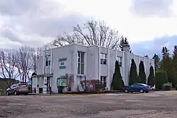
List of former mayors:
- André Lanthier (...–2001)
- Évelyne Charbonneau (2001–2021)
- Fanny Véronique Couture (2021–2022)
- Benoit Chevalier (2022–present)
Education
Sir Wilfrid Laurier School Board operates English-language schools:
- Arundel Elementary School in Arundel[5]
- Sainte Agathe Academy (for high school only) in Sainte-Agathe-des-Monts[6]
References
- 1 2 3 4 "Reference number 29158". Banque de noms de lieux du Québec [Bank of place names of Quebec] (in French). Commission de toponymie du Québec.
- 1 2 "Répertoire des municipalités: Geographic code 78065". www.quebec.ca (in French). Gouvernement du Québec.
- 1 2 3 4 5 "Profile table, Census Profile, 2021 Census of Population - Huberdeau, Municipalité (MÉ) [Census subdivision], Quebec". 9 February 2022.
- ↑ "1971 Census of Canada - Population Census Subdivisions (Historical)". Catalogue 92-702 Vol I, part 1 (Bulletin 1.1-2). Statistics Canada. July 1973.
- ↑ "Arundel Elementary Zone Archived 16 September 2017 at the Wayback Machine." Sir Wilfrid Laurier School Board. Retrieved 16 September 2017.
- ↑ "SAINTE AGATHE HIGH SCOOL ZONE Archived 4 September 2017 at the Wayback Machine" [sic]. Sir Wilfrid Laurier School Board. Retrieved 17 September 2017 - See text description of boundaries in: About Us" as well as the Elementary zone map Archived 4 September 2017 at the Wayback Machine - Note that all areas covered in the elementary map are also covered in the secondary one.
External links

Places adjacent to Huberdeau, Quebec | ||||||||||||||||
|---|---|---|---|---|---|---|---|---|---|---|---|---|---|---|---|---|
| ||||||||||||||||


| Cities/towns | |
|---|---|
| Municipalities | |
| Townships | |
| Villages | |
| |