El Macero, California
El Macero | |
|---|---|
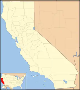  El Macero Location in California  El Macero El Macero (the United States) | |
| Coordinates: 38°32′38.47″N 121°41′6.61″W / 38.5440194°N 121.6851694°W | |
| Country |  United States |
| State |  California |
| County | Yolo |
| Area | |
• Total | 0.587 sq mi (1.52 km2) |
| • Land | 0.587 sq mi (1.52 km2) |
| • Water | 0 sq mi (0 km2) |
| Population | |
• Total | 1,074 |
| Time zone | UTC-8 (Pacific) |
| • Summer (DST) | UTC-7 (PDT) |
| GNIS feature ID | 2804443[3] |
El Macero is an unincorporated community and census-designated place (CDP)[1] just outside the city limits of Davis, California, United States, in Yolo County. Until 2006 it had a separate ZIP Code, 95618. In 2006, eastern and southern parts of Davis were added to the 95618 zone. Formerly, a separate post office served El Macero; this is now closed. El Macero was named for Bruce Mace, on whose land it was built. The community is in area code 530. It lies at an elevation of 36 feet (11 m). A golf course is in the community.
As of the 2020 census, El Macero had a population of 1,074.[4]
History
The ownership of the land can be traced back to General Mariano Guadelupe Vallejo.[5] The land was bought by the Montgomery Family in 1851 who settled during the gold rush.[6] One century later, the land was bought by Bruce Mace.[6][7] Mace hired Robert Baldock, a golf course designer from Fresno. He then opened the club house a decade later by spring of 1961, along with the golf course and the first 175 lots for sale.[6]
Demographics
| Census | Pop. | Note | %± |
|---|---|---|---|
| 2020 | 1,074 | — | |
| U.S. Decennial Census[8] 1850–1870[9][10] 1880-1890[11] 1900[12] 1910[13] 1920[14] 1930[15] 1940[16] 1950[17] 1960[18] 1970[19] 1980[20] 1990[21] 2000[22] 2010[23] 2020[24] | |||
El Macero first appeared as a census designated place in the 2020 U.S. census.[25]
2020 census
As of the 2020 census, El Macero had a population of 1,074.[26] The median age was 58.0 years. 16.2% of residents were under the age of 18 and 39.1% of residents were 65 years of age or older. For every 100 females there were 96.3 males, and for every 100 females age 18 and over there were 89.5 males age 18 and over.[27]
100.0% of residents lived in urban areas, while 0.0% lived in rural areas.[28]
There were 428 households in El Macero, of which 23.1% had children under the age of 18 living in them. Of all households, 74.5% were married-couple households, 5.8% were households with a male householder and no spouse or partner present, and 17.1% were households with a female householder and no spouse or partner present. About 15.6% of all households were made up of individuals and 11.9% had someone living alone who was 65 years of age or older.[27]
There were 451 housing units, of which 5.1% were vacant. The homeowner vacancy rate was 0.0% and the rental vacancy rate was 2.8%.[27][26]
| Race / Ethnicity (NH = Non-Hispanic) | Pop 2020[24] | % 2020 |
|---|---|---|
| White alone (NH) | 769 | 71.60% |
| Black or African American alone (NH) | 9 | 0.84% |
| Native American or Alaska Native alone (NH) | 0 | 0.00% |
| Asian alone (NH) | 155 | 14.43% |
| Pacific Islander alone (NH) | 1 | 0.09% |
| Other race alone (NH) | 4 | 0.37% |
| Mixed race or Multiracial (NH) | 47 | 4.38% |
| Hispanic or Latino (any race) | 89 | 8.29% |
| Total | 1,074 | 100.00% |
Education
The CDP is served by the Davis Joint Unified School District.[29]
References
- 1 2 "2020 U.S. Gazetteer Files - California". United States Census Bureau. Retrieved March 23, 2024.
- ↑ "El Macero CDP, California". United States Census Bureau. Archived from the original on April 25, 2024. Retrieved April 25, 2024.
- ↑ "El Macero Census Designated Place". Geographic Names Information System. United States Geological Survey, United States Department of the Interior.
- ↑ "2020 Decennial Census Redistricting Data (Public Law 94-171)". United States Census Bureau. 2021. Retrieved March 6, 2026.
- ↑ "History".
- 1 2 3 "El Macero - Welcome to El Macero". www.elmacerohoa.com.
- ↑ "Davis".
- ↑ "Decennial Census by Decade". US Census Bureau.
- ↑ "1870 Census of Population - Population of Civil Divisions less than Counties - California - Almeda County to Sutter County" (PDF). United States Census Bureau.
- ↑ "1870 Census of Population - Population of Civil Divisions less than Counties - California - Tehama County to Yuba County" (PDF). United States Census Bureau.
- ↑ "1890 Census of Population - Population of California by Minor Civil Divisions" (PDF). United States Census Bureau.
- ↑ "1900 Census of Population - Population of California by Counties and Minor Civil Divisions" (PDF). United States Census Bureau.
- ↑ "1910 Census of Population - Supplement for California" (PDF). United States Census Bureau. Archived from the original (PDF) on August 23, 2024. Retrieved August 23, 2024.
- ↑ "1920 Census of Population - Number of Inhabitants - California" (PDF). United States Census Bureau.
- ↑ "1930 Census of Population - Number and Distribution of Inhabitants - California" (PDF). United States Census Bureau.
- ↑ "1940 Census of Population - Number of Inhabitants - California" (PDF). United States Census Bureau.
- ↑ "1950 Census of Population - Number of Inhabitants - California" (PDF). United States Census Bureau.
- ↑ "1960 Census of Population - General population Characteristics - California" (PDF). United States Census Bureau.
- ↑ "1970 Census of Population - Number of Inhabitants - California" (PDF). United States Census Bureau.
- ↑ "1980 Census of Population - Number of Inhabitants - California" (PDF). United States Census Bureau.
- ↑ "1990 Census of Population - Population and Housing Unit Counts - California" (PDF). United States Census Bureau.
- ↑ "2000 Census of Population - Population and Housing Unit Counts - California" (PDF). United States Census Bureau.
- ↑ "2010 Census of Population - Population and Housing Unit Counts - California" (PDF). United States Census Bureau.
- 1 2 "P2: Hispanic or Latino, and Not Hispanic or Latino by Race – 2020: DEC Redistricting Data (PL 94-171) – El Macero CDP, California". United States Census Bureau.
- ↑ "2020 Geography Changes". United States Census Bureau.
- 1 2 "2020 Decennial Census Redistricting Data (Public Law 94-171)". United States Census Bureau. 2021. Retrieved April 30, 2026.
- 1 2 3 "2020 Decennial Census Demographic Profile (DP1)". United States Census Bureau. 2021. Retrieved April 30, 2026.
- ↑ "2020 Decennial Census Demographic and Housing Characteristics (DHC)". United States Census Bureau. 2023. Retrieved April 30, 2026.
- ↑ Geography Division (December 18, 2020). 2020 Census - School District Reference Map: Yolo County, CA (PDF) (Map). Suitland, Maryland: U.S. Census Bureau. Retrieved February 15, 2026. - Text list
External links
- U.S. Geological Survey Geographic Names Information System: El Macero, California
- El Macero on the Davis Wiki
Municipalities and communities of Yolo County, California, United States | ||
|---|---|---|
| Cities |  | |
| CDPs | ||
| Unincorporated communities | ||
| Ghost towns | ||