Chunkappara Junction on a rainy day in August, 2026
Forest Landscape: Historically, Chunkappara was a place surrounded by hilly terrain with prominent rock formations, in the middle of a forest. [1]
Migration: People, mainly farmers from neighboring villages like Mallapally,Kozhencherry and Thiruvalla gradually took over the regional lands for agriculture. The fertile soil was good for crops like Pepper, Tapioca, Coconut and later, Rubber.[2] Thus, a small community began to grow- eventually to a small town.
Development of Junction: Before the area developed into the modern day town, the junction -where three village roads meet- was known as Ozhappukuzhi Kavala. As the area expanded around the historic tax collection post near a huge rock, the name Chunkappara gradually became the name of the centre. (where 'chunkam' means tax and 'para' means rock).[3][4]
Early days of trade in Chunkappara: Chunkappara market (ചുങ്കപ്പാറ ചന്ത) was established in 1933. By the early 50s, regular markets were held on every Tuesday and Friday. However, the infamous flood in 1958 affected Chunkappara severely which destroyed most of the commercial establishments and made market mostly inactive until 1960. A new chapter began in the early 60s as the textile, dried fish and tobacco trades earned a big consumer base. The timber business, started long back, reached the entire district by early-mid 70s [5]
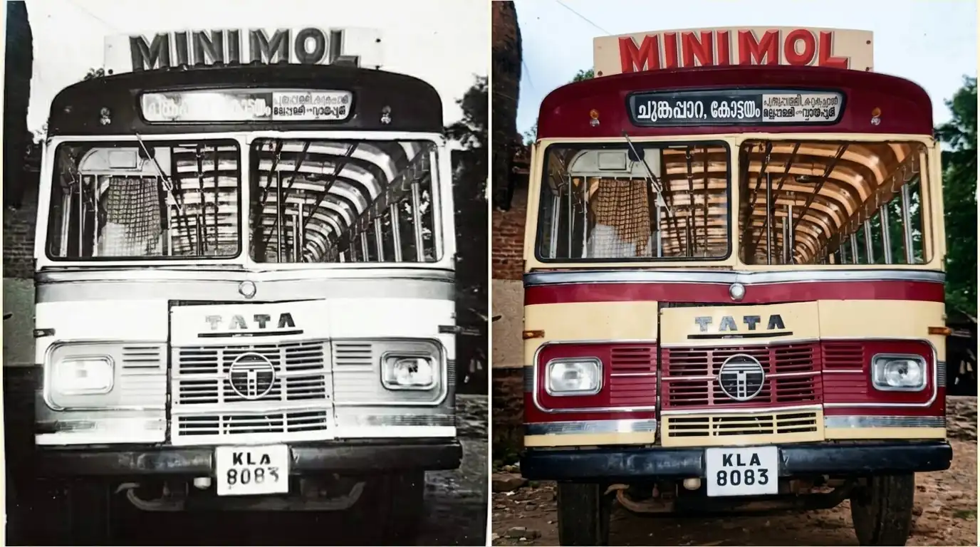
An image of an old private bus serviced via Chunkappara probably in the mid-80s.This bus had the route permit from Chunkappara to Kottayam via Vaipur-Mallapally- Karukachal. (Left pic.- An old photo found on internet. Right pic.- Photo enhanced by AI tools)
Administrative Evolution:
Chunkappara was a part of the kingdom of Travancore (1753-1949) during the pre-independent era. Following independence, the area transitioned through three different districts. It was initially a part of Quilon (Now Kollam) district from 1949 to 1957. When Alleppey district(Now Alappuzha) was formed in 1957 the whole Thiruvalla taluk -in which Chunkappara was then part of- was added to it. It remained under Allepey for 25 years. When Pathanamthitta district formed on November 1,1982 Chunkappara was added to it where the area still being a part of.[6]
Etymology and Name Origin
Centuries ago, Chunkappara was a place amidst of Ponthenpuzha forest. There was a forest path that links the high range areas and nearby timber zones. The royal authorities of Central Division (Travancore) set up a tax collection point beneath a huge rock here to collect taxes from traders transporting timber and agricultural goods. Over time, the 'tax stone' (Chunkappara/ചുങ്കപ്പാറ) gave the entire neighborhood its name. [Chunkam(ചുങ്കം)= tax/toll and Para(പാറ)=rock/stone.] [7]
Years ago, it was a forest right here!
Hospitals
1. Shareena Medical Centre,
Ponthanpuzha road, Chunkappara
2. V care hospital, Central Junction, Chunkkapara
3. Government Hospital,
Thundiapara Junction, Kadikkavu Road, Chunkappara
4. Pushpagiri Grama Hospital, Near St.George's HS, Chunkappara
Education institutions
Chunkappara: a school bus
St. George HS Chunkappara
CMS LPS Chunkappara
Alaprakkad govt Lps
Kottangal govt Lps
Al Hind public school
St. Joseph Hs, Kulathoor
Assisi Center, For Specially Abled Children.
Christu Raja English Medium School
Govt. LVLP school, Kulathoor (Pottamala)
Govt. LP School, Kulathoor
Banking Faculties
SBI, Ponthanpuzha road, Chunkappara
Federal Bank, Near Mannil Hypermarket, Maramkulam-Perumpetty-Chalapally road, Chunkappara
KSFE Chunkappara, Near Mannil Hypermarket, Maramkulam-Perumpetty-Chalapally road, Chunkappara
Kerala Gramin Bank, Central Junction, Chunkappara
Pathanamthitta District Co-operative Bank, Opp. SBI, Chunkappara
Places to visit
a cloudy day at Nagappara
Nagappara (നാഗപ്പാറ)different evenings, same vibes. Sunsets at Nagappara A cult favorite hilltop view point with acres of rock formations surrounded by thick forest located 3 kilometers away from Chunkappara at Nirmalapuram, Maramkulam.Visit after 5 PM for the best sunset views .[8]
Orakkanpara (ഒരക്കൻപാറ)going with the flow! Orakkanpara waterfalls during Monsoon A small pretty waterfalls just a kilometer away from Chunkappara in Kottangal route. Better to visit during the season of Monsoon.
Oottupara (ഊട്ടുപാറ): Another beautiful hilltop view point with a wide area of prominent rock within a forest atmosphere. Travel about 3 kilometers towards Ponthenpuzha to reach here.[9]


 India