Camino Tassajara, California
Camino Tassajara | |
|---|---|
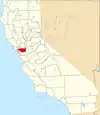
  Camino Tassajara Position in California. | |
| Coordinates: 37°47′24″N 121°53′08″W / 37.79000°N 121.88556°W | |
| Country |  United States |
| State |  California |
| County | Contra Costa |
| Area | |
• Total | 1.28 sq mi (3.31 km2) |
| • Land | 1.28 sq mi (3.31 km2) |
| • Water | 0 sq mi (0.00 km2) 0% |
| Elevation | 814 ft (248 m) |
| Population (2020) | |
• Total | 4,951 |
| • Density | 3,879.8/sq mi (1,498.01/km2) |
| Time zone | UTC-8 (Pacific (PST)) |
| • Summer (DST) | UTC-7 (PDT) |
| ZIP code | 94506[3] |
| Area code | 925 |
| FIPS code | 06-10301 |
| GNIS feature IDs | 2583160, 2633171 |
| U.S. Geological Survey Geographic Names Information System: Camino Tassajara, California | |
Camino Tassajara (Spanish for "Path of Carne Seca")[4] is a census-designated place[5] in Contra Costa County, California, United States. Camino Tassajara sits at an elevation of 814 feet (248 m). The 2020 United States census reported Camino Tassajara's population was 4,951.
Geography
According to the United States Census Bureau, the CDP has a total area of 1.261 square miles (3.265 km2), all land.
Demographics
| Census | Pop. | Note | %± |
|---|---|---|---|
| 2010 | 2,197 | — | |
| 2020 | 4,951 | 125.4% | |
| U.S. Decennial Census[6] 2010[7] 2020[8] | |||
Racial and ethnic composition
| Race / Ethnicity (NH = Non-Hispanic) | Pop 2010[9] | Pop 2020[8] | % 2010 | % 2020 |
|---|---|---|---|---|
| White alone (NH) | 791 | 1,386 | 36.00% | 27.99% |
| Black or African American alone (NH) | 51 | 103 | 2.32% | 2.08% |
| Native American or Alaska Native alone (NH) | 1 | 6 | 0.05% | 0.12% |
| Asian alone (NH) | 1,111 | 2,845 | 50.57% | 57.46% |
| Pacific Islander alone (NH) | 1 | 3 | 0.05% | 0.06% |
| Other Race alone (NH) | 4 | 41 | 0.18% | 0.83% |
| Mixed Race or Multi-Racial (NH) | 100 | 285 | 4.55% | 5.76% |
| Hispanic or Latino (any race) | 138 | 282 | 6.28% | 5.70% |
| Total | 2,197 | 4,951 | 0.00% | 0.00% |
2020 census
As of the 2020 census, Camino Tassajara had a population of 4,951. The population density was 3,880.1 inhabitants per square mile (1,498.1/km2). The median age was 40.8 years. 32.6% of residents were under the age of 18 and 10.1% were 65 years of age or older.[10][11]
For every 100 females, there were 93.9 males. For every 100 females age 18 and over, there were 88.1 males age 18 and over. 100.0% of residents lived in urban areas, while 0.0% lived in rural areas.[10][12]
The whole population lived in households. There were 1,439 households, out of which 61.6% included children under the age of 18. Of all households, 77.3% were married-couple households, 1.9% were cohabiting couple households, 14.5% had a female householder with no partner present, and 6.2% had a male householder with no partner present. About 9.9% of households were one person, and 4.8% were one person aged 65 or older. The average household size was 3.44. There were 1,269 families (88.2% of all households).[10][13]
There were 1,491 housing units at an average density of 1,168.5 units per square mile (451.2 units/km2); 96.5% were occupied and 3.5% were vacant. Of occupied units, 81.4% were owner-occupied and 18.6% were occupied by renters. The homeowner vacancy rate was 0.3% and the rental vacancy rate was 7.3%.[10][11]
2010 census
Camino Tassajara first appeared as a census designated place in the 2010 U.S. census.[7] It contains no area from the Blackhawk-Camino Tassajara CDP (since renamed Blackhawk CDP).[7]
Education
The CDP is served by San Ramon Valley Unified School District.[14]
References
- ↑ "2020 U.S. Gazetteer Files". United States Census Bureau. Retrieved October 30, 2021.
- ↑ "Camino Tassajara". Geographic Names Information System. United States Geological Survey, United States Department of the Interior.
- ↑ "Camino Tassajara CA ZIP Code". zipdatamaps.com. 2023. Retrieved January 26, 2023.
- ↑ Museum of San Ramon Valley - Tassajara
- ↑ U.S. Geological Survey Geographic Names Information System: Camino Tassajara, California
- ↑ "Decennial Census by Decade". United States Census Bureau.
- 1 2 3 "2010 Census of Population - Population and Housing Unit Counts - California" (PDF). United States Census Bureau.
- 1 2 "P2 Hispanic or Latino, and Not Hispanic or Latino by Race – 2020: DEC Redistricting Data (PL 94-171) – Camino Tassajara CDP, California". United States Census Bureau.
- ↑ "P2 Hispanic or Latino, and Not Hispanic or Latino by Race – 2010: DEC Redistricting Data (PL 94-171) – Camino Tassajara CDP, California". United States Census Bureau.
- 1 2 3 4 "2020 Decennial Census Demographic Profile (DP1)". United States Census Bureau. 2021. Retrieved April 28, 2026.
- 1 2 "2020 Decennial Census Redistricting Data (Public Law 94-171)". United States Census Bureau. 2021. Retrieved April 28, 2026.
- ↑ "2020 Decennial Census Demographic and Housing Characteristics (DHC)". United States Census Bureau. 2023. Retrieved April 28, 2026.
- ↑ "Camino Tassajara CDP, California; P16: Household Type - 2020 Census of Population and Housing". US Census Bureau. Retrieved June 9, 2025.
- ↑ 2020 CENSUS - SCHOOL DISTRICT REFERENCE MAP: Contra Costa County, CA (PDF) (Map). Suitland, Maryland: U.S. Census Bureau. Retrieved January 24, 2025. - Text list
| Bodies of water |
|  | |||||||||||
|---|---|---|---|---|---|---|---|---|---|---|---|---|---|
| Counties | |||||||||||||
| Cities and towns |
| ||||||||||||
| CDPs over 10k | |||||||||||||
| Sub-regions | |||||||||||||
| Other | |||||||||||||