Barika Province
Barika Province
ولاية بريكة ⴰⴳⴻⵣⴷⵓ ⵏ ⴱⴰⵔⵉⴽⴰ | |
|---|---|
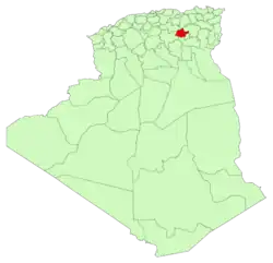 Map of Barika Province | |
| Coordinates: 35°23′50″N 5°21′57″E / 35.39722°N 5.36583°E | |
| Country |  Algeria |
| Created | 2026 |
| Capital | Barika |
| Area | |
• Total | 3,700 km2 (1,400 sq mi) |
| Population (2008)[2] | |
• Total | 179,210 |
| • Density | 48/km2 (130/sq mi) |
| Time zone | UTC+01 (CET) |
| Area code | +213 |
| ISO 3166 code | DZ-60 |
| Districts | 3 |
| Municipalities | 8 |
Barika Province (Arabic: ولاية بريكة, romanized: Wilāyat Barīka) is a province (wilaya) in eastern Algeria; its provincial capital is Barika. It was created in 2026 by separation from Batna Province.[3]
The province lies in the transition zone between the densely populated north and the sparsely populated south of the country; it covers an area of about 3,700 km².[4]
Around 180,000 people lived in the province at the 2008 census,[2] giving it a population density of about 48 inhabitants per square kilometre.
Administrative divisions
The wilaya of Barika is divided into 8 communes,[3] grouped into 3 districts (daïras).
| Daïras | Communes | |
|---|---|---|
| Name | Pop.
2008[2] | |
| Barika | Barika | 104,388 |
| Bitam | 11,855 | |
| Amdoukal | 9,010 | |
| Seggana | Seggana | 5,769 |
| Tilatou | 3,004 | |
| Djezzar | Djezzar | 22,124 |
| Abdelkader Azil | 14,304 | |
| Ouled Ammar | 8,756 | |
References
- ↑ Estimate using mapcoordinates.net (20419608 Barika Province on OpenStreetMap)
- 1 2 3 Office national des statistiques (ONS): RGPH 2008, Population résidente des ménages ordinaires et collectifs selon la commune de résidence ...
- 1 2 Loi n° 26-06 du 16 Chaoual 1447 correspondant au 4 avril 2026 modifiant et complétant la loi n° 84-09 du 4 février 1984 relative à l'organisation territoriale du pays, Art. 52 bis 11 (French/Arabic)
- ↑ Estimate using mapcoordinates.net (20419608 Barika Province on OpenStreetMap)