Arcola, Mississippi
Arcola, Mississippi | |
|---|---|
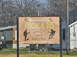 Welcome Sign in Arcola | |
| Motto: "A Town United Today" | |
 Location of Arcola, Mississippi | |
  Arcola, Mississippi Location in the United States | |
| Coordinates: 33°16′14″N 90°52′48″W / 33.27056°N 90.88000°W | |
| Country | United States |
| State | Mississippi |
| County | Washington |
| Area | |
• Total | 0.22 sq mi (0.57 km2) |
| • Land | 0.22 sq mi (0.57 km2) |
| • Water | 0 sq mi (0.00 km2) |
| Elevation | 118 ft (36 m) |
| Population (2020) | |
• Total | 304 |
| • Density | 1,385.7/sq mi (535.04/km2) |
| Time zone | UTC-6 (Central (CST)) |
| • Summer (DST) | UTC-5 (CDT) |
| ZIP code | 38722 |
| Area code | 662 |
| FIPS code | 28-01820 |
| GNIS feature ID | 2405162[2] |
Arcola is a town in Washington County, Mississippi. The population was 304 at the 2020 census, down from 361 at the 2010 census.
History
According to linguist Keith Baca, the name Arcola may be derived from the Choctaw language meaning "jar".[3]
In the 1900s, Leroy Percy owned the Trail Lake Plantation, a Southern plantation near Arcola.[4]
In his 2015 travel book entitled Deep South: Four Seasons on Back Roads, author Paul Theroux describes it as a "ghost town."[5]
Geography
According to the United States Census Bureau, the town has a total area of 0.2 square miles (0.52 km2), all land.
Demographics
| Census | Pop. | Note | %± |
|---|---|---|---|
| 1910 | 512 | — | |
| 1920 | 453 | −11.5% | |
| 1930 | 343 | −24.3% | |
| 1940 | 444 | 29.4% | |
| 1950 | 413 | −7.0% | |
| 1960 | 366 | −11.4% | |
| 1970 | 517 | 41.3% | |
| 1980 | 588 | 13.7% | |
| 1990 | 564 | −4.1% | |
| 2000 | 563 | −0.2% | |
| 2010 | 361 | −35.9% | |
| 2020 | 304 | −15.8% | |
| U.S. Decennial Census[6] | |||
Racial and ethnic composition
| Race / Ethnicity (NH = Non-Hispanic) | Pop 2000[7] | Pop 2010[8] | Pop 2020[9] | % 2000 | % 2010 | % 2020 |
|---|---|---|---|---|---|---|
| White alone (NH) | 27 | 23 | 35 | 4.80% | 6.37% | 11.51% |
| Black or African American alone (NH) | 534 | 333 | 264 | 94.85% | 92.24% | 86.84% |
| Native American or Alaska Native alone (NH) | 0 | 0 | 0 | 0.00% | 0.00% | 0.00% |
| Asian alone (NH) | 0 | 0 | 1 | 0.00% | 0.00% | 0.33% |
| Native Hawaiian or Pacific Islander alone (NH) | 0 | 0 | 0 | 0.00% | 0.00% | 0.00% |
| Other race alone (NH) | 0 | 0 | 0 | 0.00% | 0.00% | 0.00% |
| Mixed race or Multiracial (NH) | 1 | 2 | 3 | 0.18% | 0.55% | 0.99% |
| Hispanic or Latino (any race) | 1 | 3 | 1 | 0.18% | 0.83% | 0.33% |
| Total | 563 | 361 | 304 | 100.00% | 100.00% | 100.00% |
2020 census
As of the 2020 United States census, there were 304 people, 95 households, and 65 families residing in the town.
2000 census
As of the census[10] of 2000, there were 563 people, 183 households, and 122 families residing in the town. The population density was 2,515.2 inhabitants per square mile (971.1/km2). There were 220 housing units at an average density of 982.9 per square mile (379.5/km2). The racial makeup of the town was 95.03% African American, 4.80% White and 0.18% from two or more races. Hispanic or Latino of any race were 0.18% of the population.
There were 183 households, out of which 36.6% had children under the age of 18 living with them, 23.0% were married couples living together, 36.1% had a female householder with no husband present, and 33.3% were non-families. 27.9% of all households were made up of individuals, and 13.7% had someone living alone who was 65 years of age or older. The average household size was 3.08 and the average family size was 3.83.
In the town, the population was spread out, with 36.6% under the age of 18, 10.3% from 18 to 24, 25.8% from 25 to 44, 18.5% from 45 to 64, and 8.9% who were 65 years of age or older. The median age was 28 years. For every 100 females, there were 77.6 males. For every 100 females age 18 and over, there were 71.6 males.
The median income for a household in the town was $18,409, and the median income for a family was $18,594. Males had a median income of $22,321 versus $13,466 for females. The per capita income for the town was $6,827. About 43.4% of families and 49.7% of the population were below the poverty line, including 63.2% of those under age 18 and 53.2% of those age 65 or over.
Education
The Town of Arcola is served by the Hollandale School District. It is also home to the Deer Creek Academy, an independent private school founded in the 1970s.[11]
References
- ↑ "2020 U.S. Gazetteer Files". United States Census Bureau. Retrieved July 24, 2022.
- 1 2 U.S. Geological Survey Geographic Names Information System: Arcola, Mississippi
- ↑ Baca, Keith A. (2007). Native American Place Names in Mississippi. University Press of Mississippi. p. 5. ISBN 978-1-60473-483-6.
- ↑ Wyatt-Brown, Bertram (Spring 1991). "Leroy Percy and Sunnyside: Planter Mentality and Italian Peonage in the Mississippi Delta". The Arkansas Historical Quarterly. 50 (1): 71. doi:10.2307/40022329. JSTOR 40022329.
- ↑ Theroux, Paul (2015). Deep South: Four Seasons on Back Roads. London, UK: Hamish Hamilton. p. 117. ISBN 9780241146729.
- ↑ "Census of Population and Housing". Census.gov. Retrieved June 4, 2015.
- ↑ "P004: Hispanic or Latino, and Not Hispanic or Latino by Race – 2000: DEC Summary File 1 – Arcola town, Mississippi". United States Census Bureau.
- ↑ "P2: Hispanic or Latino, and Not Hispanic or Latino by Race – 2010: DEC Redistricting Data (PL 94-171) – Arcola town, Mississippi". United States Census Bureau.
- ↑ "P2: Hispanic or Latino, and Not Hispanic or Latino by Race – 2020: DEC Redistricting Data (PL 94-171) – Arcola town, Mississippi". United States Census Bureau.
- ↑ "U.S. Census website". United States Census Bureau. Retrieved January 31, 2008.
- ↑ Theroux, Paul (2015). Deep South: Four Seasons on Back Roads. London, UK: Hamish Hamilton. pp. 119–120. ISBN 9780241146729.
External links
Municipalities and communities of Washington County, Mississippi, United States | ||
|---|---|---|
| Cities |  | |
| Towns | ||
| CDPs | ||
| Other communities | ||
| Ghost towns | ||