Araniko Highway
 अरनिको राजमार्ग | ||||
|---|---|---|---|---|
| राष्ट्रिय राजमार्ग ३४ | ||||
| Araniko Rajmarg | ||||
Route of the Araniko Highway | ||||
| Route information | ||||
Part of  AH42 | ||||
| Maintained by Department of Roads | ||||
| Length | 112 km[1] (70 mi) | |||
| Existed | May 1967–present | |||
| Major junctions | ||||
| From | Kathmandu | |||
| Lamosangu–Jiri Road at Lamosangu | ||||
| To | Sino-Nepal Friendship Bridge, Kodari G318 | |||
| Location | ||||
| Country | Nepal | |||
| Provinces | Bagmati Province | |||
| Primary destinations | Bhaktapur, Banepa, Dhulikhel, Panchkhal, Dolalghat, Lamosangu, Bahrabise, Tatopani, Kodari | |||
| Highway system | ||||
| ||||


The Araniko Highway (Nepali: अरनिको राजमार्ग, romanized: Araniko Rajmarga), designated National Highway 34 (NH34), is a 112-kilometre (70 mi) national highway in Bagmati Province, Nepal. It connects Kathmandu with Kodari on the China–Nepal border, passing through Bhaktapur, Kavrepalanchok and Sindhupalchok districts.[1] At Kodari, the highway reaches the Sino-Nepal Friendship Bridge, across which the road connects with China National Highway 318 (G318) at Zhangmu in the Tibet Autonomous Region of China. The Kathmandu–Kodari section forms the northern part of Asian Highway 42 (AH42) in Nepal. AH42 continues south from Kathmandu through Narayanghat and Pathlaiya to Birgunj on the Indian border.[2] The highway has historically been one of Nepal's principal overland routes for trade and travel with China.
History
The modern Kathmandu–Kodari road was built during the 1960s with Chinese assistance, broadly following an older trans-Himalayan trade corridor between Nepal and Tibet.[3] A retrospective published by the Chinese embassy in Nepal states that the road opened to traffic in May 1967 and was the first Chinese-aided infrastructure project in Nepal.[4] The highway is named after Araniko, the 13th-century Nepalese artist and architect who travelled to Tibet and later worked at the court of the Yuan dynasty in China. The modern road follows the general Nepal–Tibet corridor associated with historical trans-Himalayan travel, although the precise route taken by Araniko is not established. Under Nepal's former Strategic Road Network numbering system, the Araniko Highway was designated H03.[5] Following the reorganisation of Nepal's national-highway numbering system, the route became NH34. The Department of Roads lists NH34 as the Kathmandu–Dhulikhel–Dolalghat–Khadichaur–Kodari route with a length of 112 km (70 mi).[1]
Route
From Kathmandu, the highway runs east through the Kathmandu Valley towards Bhaktapur and Suryabinayak. It then crosses the hill at Sanga and continues through Banepa to Dhulikhel. From Dhulikhel, the road descends into the Panchkhal valley before continuing through Lamidanda towards Dolalghat.[6] At Dolalghat, local streams and the Indravati River join the Sun Koshi. North-east of Dolalghat, the highway follows the Sun Koshi and upper Bhote Koshi river valleys through Khadichaur, Lamosangu and Bahrabise.[6] At Lamosangu, the Lamosangu–Jiri Road branches east towards Charikot and Jiri.[7] Beyond Bahrabise, NH34 continues through increasingly narrow and steep Himalayan terrain along the Bhote Koshi valley, passing Tatopani before reaching Kodari. The transboundary river is known as the Poiqu in Tibet, becomes the Bhote Koshi after entering Nepal and joins the Sun Koshi farther downstream.[8] At Kodari, NH34 ends at the Sino-Nepal Friendship Bridge. The road continues across the international boundary through Zhangmu as China National Highway 318.[9]
Landslides and earthquake damage
The northern part of the Araniko Highway is built through steep and geologically unstable Himalayan terrain. Landslides, rockfalls, debris flows, river erosion and road subsidence regularly affect the route, particularly during the monsoon.[6]
2014 Sunkoshi landslide
On 2 August 2014, a major landslide at Jure in Sindhupalchok District blocked the Sun Koshi and created a temporary landslide-dammed lake. The event destroyed and inundated sections of the Araniko Highway, severing the main road connection between Kathmandu and the northern part of Sindhupalchok District.[10] Approximately 1 km (0.62 mi) of highway was buried by the landslide and nearly 2 km (1.2 mi) was inundated by the impounded river, making the approximately 12 km (7.5 mi) Khadichaur–Bahrabise section impassable.[11] Temporary alternative tracks were subsequently constructed to restore traffic.
2015 Gorkha earthquake
The Gorkha earthquake of 25 April 2015 triggered extensive landsliding along the Araniko Highway. A peer-reviewed study based on satellite imagery and field investigations identified 35 earthquake-triggered landslides that directly damaged the highway at 36 locations, affecting a combined 1,415 m (4,642 ft) of road. The same study mapped 3,005 earthquake-triggered landslides within a 5 km (3.1 mi) buffer on either side of the highway.[12] Post-earthquake engineering reconnaissance documented severe rockfall and landslide damage along the corridor, particularly in the upper Bhote Koshi valley around Kodari. Large boulders struck buildings and sections of the road, while unstable slopes continued to present hazards during aftershocks and subsequent rainfall.[13] Road access on the Bahrabise–Tatopani section was restored sufficiently for vehicles in August 2015, although continuing monsoon landslides remained a threat. Restoration of the road did not mean that the international border crossing had reopened: regular freight operations through the Zhangmu–Kodari port did not resume until May 2019.[4]
Later disruption
Floods, landslides and road subsidence have continued to interrupt the highway. In July 2026, a landslide at the Eco section of Kodari in Bhotekoshi Rural Municipality Ward No. 2 blocked the road to the Tatopani border point. Limited traffic resumed on 24 August after a temporary track was opened, ending about 40 days of disruption, although repairs were still required at Liping and containers remained stranded there.[14] The repeated disruption illustrates the continuing vulnerability of the upper Araniko Highway to monsoon-triggered slope failure and river erosion.
Upgrading and maintenance
After the 2015 earthquake, China began a long-term assistance programme for maintaining and reopening damaged sections of the Araniko Highway.[4] Nepal and China have continued to cooperate on maintenance of the road. In their joint statement of 3 December 2024, the two governments agreed to advance the fourth phase of the China-aided Araniko Highway maintenance project.[15] A major widening project is also under way on the approximately 16 km (9.9 mi) section between Suryabinayak and Dhulikhel. The project is divided into Suryabinayak–Sanga and Sanga–Dhulikhel sections and is intended to expand the road to six lanes.[16] By 2026, construction remained under way but had been delayed by funding constraints, bridge redesigns, utility relocation and other implementation problems.[16]
International connection
NH34 terminates at Kodari beside the Sino-Nepal Friendship Bridge, which carries the road across the China–Nepal boundary to Zhangmu. The crossing is formally designated the Zhangmu–Kodari international border port and is commonly referred to in Nepal as the Tatopani or Tatopani–Zhangmu border crossing.[9] For decades, the Tatopani–Zhangmu crossing was Nepal's principal overland trade gateway with China. A second major route opened through the Rasuwagadhi–Gyirong crossing in December 2014, and its importance increased sharply after the 2015 earthquake closed Tatopani for several years.[17] Tatopani resumed two-way cargo movement in May 2023 and passenger movement later that year.[17] The relative importance of Nepal's northern road corridors changed again following major floods in Rasuwa. A flash flood on 8 July 2025 swept away the cross-border Miteri Bridge at Rasuwagadhi; China subsequently constructed a temporary replacement.[17] On 26 August 2026, another catastrophic flood destroyed the Rasuwagadhi–Gyirong crossing, including the replacement bridge, border facilities and extensive sections of the approach-road network, cutting Nepal's principal overland trade gateway with China.[17][18] Following the August 2026 destruction of Rasuwagadhi, Nepal's Department of Customs advised traders to consider rerouting cargo through Tatopani and the Korala crossing in Mustang.[17] Tatopani was not, however, an immediately reliable substitute: only two days before the Rasuwa flood, limited traffic had resumed on part of the upper Araniko Highway after a 40-day landslide blockage, and repairs were still required near Liping.[14] Traders also reported continuing concerns over flood and landslide risks on the Tatopani corridor.[17] Detailed coverage of customs administration, the bilateral port agreement, reconstruction of the border facilities and the closure and reopening history of the Tatopani–Zhangmu crossing is included in the border port section of the Sino-Nepal Friendship Bridge article.
Gallery
 The Araniko Highway near Madhyapur Thimi in the Kathmandu Valley
 The highway corridor at Dolalghat
 The highway at Tatopani in 2014
 A truck checkpoint on the highway in 2014
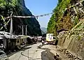 The Araniko Highway near Kodari, approaching the Chinese border
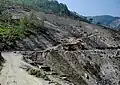 The highway in the upper Bhote Koshi valley near Kodari
 The former Sino-Nepal Friendship Bridge at the northern terminus of the highway
See also
References
- 1 2 3 Statistics of National Highway (PDF) (Report). Department of Roads, Government of Nepal. Retrieved 31 August 2026.
- ↑ Status of Development of Asian Highways: Nepal (PDF) (Report). United Nations Economic and Social Commission for Asia and the Pacific. Retrieved 31 August 2026.
- ↑ Hopquin, Benoît (23 April 2013). "China's Nepalese friendship road leads to the heart of India's market". The Guardian. Retrieved 31 August 2026.
- 1 2 3 "A Retrospective in Commemoration of the 65th Anniversary of the Establishment of Diplomatic Relations between China and Nepal". Embassy of the People's Republic of China in Nepal. 31 July 2020. Retrieved 31 August 2026.
- ↑ Statistics of Strategic Road Network 2017/18 (Report). Department of Roads, Government of Nepal. 2018. Retrieved 31 August 2026.
- 1 2 3 Geological Guidebook along Araniko Highway (PDF) (Report). Department of Mines and Geology, Government of Nepal. Retrieved 31 August 2026.
- ↑ "EOI RIP Lamosangu-Mude-Charikot Section of Lamosangu-Tamkoshi-Jiri Road". Department of Roads, Government of Nepal. Retrieved 31 August 2026.
- ↑ Shrestha, Finu; Seldon, Chimi (31 December 2017). "A flood of evidence". International Centre for Integrated Mountain Development. Retrieved 31 August 2026.
- 1 2 "中华人民共和国政府和尼泊尔政府关于边境口岸及其管理制度的协定" [Agreement between the Government of the People's Republic of China and the Government of Nepal on Management of Ports in China-Nepal Border Areas] (in Chinese). Ministry of Foreign Affairs of the People's Republic of China. 14 January 2012. Retrieved 31 August 2026.
- ↑ "Landslip dams Sunkoshi river". The Kathmandu Post. 3 August 2014. Retrieved 31 August 2026.
- ↑ Pun, Weena (9 August 2014). "Alternatives mooted to resume traffic". The Kathmandu Post. Retrieved 31 August 2026.
- ↑ Xu, Chong; Tian, Yingying; Zhou, Bengang; Ran, Hongliu; Lyu, Gaohu (5 April 2017). "Landslide damage along Araniko highway and Pasang Lhamu highway and regional assessment of landslide hazard related to the Gorkha, Nepal earthquake of 25 April 2015". Geoenvironmental Disasters. 4 14. doi:10.1186/s40677-017-0078-9.
- ↑ Hashash, Youssef M. A.; Tiwari, Binod; Moss, Robb E. S.; et al. (7 August 2015). Geotechnical Field Reconnaissance: Gorkha (Nepal) Earthquake of April 25, 2015 and Related Shaking Sequence (Report). Geotechnical Extreme Events Reconnaissance Association. Retrieved 31 August 2026.
- 1 2 "Road to Tatopani border point opens after 40 days". Radio Nepal. Public Service Broadcasting. 24 August 2026. Retrieved 31 August 2026.
- ↑ "Joint Statement between the People's Republic of China and Nepal, Beijing, December 3, 2024". Ministry of Foreign Affairs, Government of Nepal. 3 December 2024. Retrieved 31 August 2026.
- 1 2 Khatiwada, Bimal (19 February 2026). "Budget shortfall threatens Araniko Highway widening". The Kathmandu Post. Retrieved 31 August 2026.
- 1 2 3 4 5 6 Prasain, Sangam; Prasain, Krishana (30 August 2026). "The 'all-weather' Rasuwa-Kerung route is no more". The Kathmandu Post. Retrieved 31 August 2026.
- ↑ "Flood washes away 42-km road linking Nuwakot to China border". The Kathmandu Post. 26 August 2026. Retrieved 31 August 2026.
External links

| Across the whole continent | 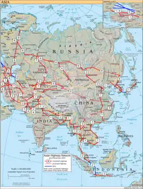 | |
|---|---|---|
| Southeast Asia | ||
| East Asia, Northeast Asia and Southeast Asia | ||
| South Asia | ||
| North Asia, Central Asia and Southwest Asia | ||