Am Ettersberg
Am Ettersberg | |
|---|---|
Location of Am Ettersberg
within Weimarer Land district  | |
Location of Am Ettersberg | |
  Am Ettersberg Location within Germany 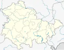 Am Ettersberg Location within Thuringia | |
| Coordinates: 51°04′N 11°15′E / 51.067°N 11.250°E | |
| Country | Germany |
| State | Thuringia |
| District | Weimarer Land |
| Subdivisions | 19 |
| Area | |
• Total | 92.44 km2 (35.69 sq mi) |
| Elevation | 290 m (950 ft) |
| Population (2024-12-31)[1] | |
• Total | 7,010 |
| • Density | 75.8/km2 (196/sq mi) |
| Time zone | UTC+01:00 (CET) |
| • Summer (DST) | UTC+02:00 (CEST) |
| Postal codes | 99439 |
| Dialling codes | 03643, 034651, 036452 |
| Vehicle registration | AP |
Am Ettersberg (German pronunciation: [am ˈʔɛtɐsbɛʁk], lit. 'On the Ettersberg') is a municipality in the district Weimarer Land, in Thuringia, Germany. It was created with effect from 1 January 2019 by the merger of the former municipalities of Berlstedt, Buttelstedt, Großobringen, Heichelheim, Kleinobringen, Krautheim, Ramsla, Sachsenhausen, Schwerstedt, Vippachedelhausen and Wohlsborn.
References
