Albula (river)
| Albula | |
|---|---|
 | |
| Location | |
| Country | Switzerland |
| Physical characteristics | |
| Mouth | Hinterrhein |
• coordinates | 46°42′44″N 9°26′58″E / 46.7123°N 9.4494°E |
| Length | 36 km (22 mi) |
Basin size | 950 km2 (370 sq mi) |
| Basin features | |
| Progression | Rhine→ North Sea |
| Tributaries | |
| • right | Landwasser |
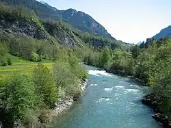
Albula (German; Romansh: Alvra) is a river of Switzerland, a right tributary of the Hinterrhein. [1] It is approximately 36 kilometres (22 mi)[2] to 39 kilometres (24 mi)[3] long, and the basin is 950 square kilometres (370 mi2).[2] It flows into the Hinterrhein near Thusis.[2]
The Albula River is the largest tributary of the Hinterrhein. The river's origin is the outflow of several unnamed small lakes at approximately 2,035 metres (6,677 ft) above sea level, on the western side of the Albula Pass in the Igls Plains.[3] A damn has formed Lake Palpuogna.[3]
See also
References
- ↑ Schmutz, Stefan; Sendzimir, Jan (8 May 2018). Riverine Ecosystem Management: Science for Governing Towards a Sustainable Future. Springer. p. 24. ISBN 978-3-319-73250-3. Retrieved 26 February 2024.
- 1 2 3 "Stoney-Gate Dam in the Albula Canyon for the Hydro-Electric Power Plant of the City of Zurich, Switzerland". Engineering News. G.H. Frost. 1910. Retrieved 26 February 2024.
- 1 2 3 "Albula". schweizerfluss.ch (in Swiss German). SchweizerFluss. Archived from the original on 2026-07-11. Retrieved 11 July 2026.
