2011 St. Louis tornado
| |
| Meteorological history | |
|---|---|
| Formed | April 22, 2011, 7:59 PM CDT (UTC–05:00) |
| Dissipated | April 22, 2011, 8:31 PM CDT (UTC–05:00) |
| Duration | 32 minutes |
| EF4 tornado | |
| on the Enhanced Fujita scale | |
| Max width | 880 yards (0.50 mi; 0.80 km) |
| Path length | 21.3 miles (34.3 km) |
| Highest winds | 170 mph (270 km/h) |
| Overall effects | |
| Fatalities | 0 |
| Injuries | 5 |
| Damage | >$250 million [1][nb 1] |
| Areas affected | Northern suburbs of St. Louis, Missouri and Illinois, United States; specifically Maryland Heights, Bridgeton, St. Ann, Berkeley, Ferguson, Bellefontaine Neighbors, Missouri and Granite City, Illinois [[2]] |
Part of the Tornado outbreak of April 19–22, 2011 and Tornadoes of 2011 | |
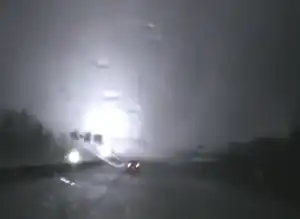


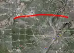

In the evening hours of Good Friday, April 22, 2011, a violent and destructive EF4 tornado, with winds of 170 mph (270 km/h) struck the St. Louis metropolitan area, across Missouri and Illinois.[3][4] The tornado, which was the strongest to hit St. Louis County or City since January 1967, moved through many suburbs and neighborhoods, damaging and destroying many homes and businesses. The worst damage was inflicted in the Bridgeton area, where a few homes were completely leveled.[5]
In its 21.3-mile (34.3 km) track across the St. Louis metropolitan area, the Good Friday tornado as it is known by the National Weather Service and the press,[6][7] damaged thousands of homes, left thousands without power, and caused heavy damage to St. Louis Lambert International Airport, closing it for nearly 24 hours.[6][8] The tornado crossed over the Mississippi River and tore the roofs off homes in Granite City, Illinois before dissipating. The tornado was part of a major three-day tornado outbreak across the United States and was one of two intense (EF3+) tornadoes during the event, with the other being an EF3 tornado that occurred in Macoupin County, Illinois on April 19. This aforementioned outbreak preceded the 2011 Super Outbreak.[9][nb 2]
Meteorological synopsis
Episode narrative


On April 21, 8:00 PM CDT (01:00 UTC), the Storm Prediction Center issued two slight risk areas of severe thunderstorm activity across the central United States, in one region in west-central Texas to southwest Oklahoma, and another over the latter's northeastern corner, eastern Kansas, west-central Missouri and northwestern Arkansas for the following day. A large area of cyclonic flow interacted with two short-wave troughs over the Pacific Northwest. Strong perturbation traveled from eastern Washington and Oregon towards Idaho. A leading, southern trough was forecasted to move eastward across the central Rocky Mountains, eastern Wyoming and the Nebraska Panhandle.[10]
The following day on April 22, 1:00 AM CDT (06:00 UTC) the Storm Prediction Center (SPC) issued a widespread slight risk area spanning from central Texas to western Ohio, alongside a large 2% tornado risk for most of Missouri, Illinois, Indiana and northwestern Kentucky, as one of the two short-wave troughs was forecasted to weaken as it entered Wyoming from the northeast. Meanwhile the leading trough was expected to become even further perturbated, evolving into a 500-millibar low pressure area over northwestern South Dakota by 1:00 PM CDT (18:00 UTC) and accelerate to the east-northeast. Lee cyclogenesis over southeastern Colorado was forecasted to lift northeastwards along a strengthening front extending from southern Kansas to western Illinois, evolving into a triple point cyclone for the occluded surface low associated with the upper trough over South Dakota. At the same time, a cold front was forecasted to sweep eastwards across Missouri, Illinois to Ohio, with it later stalling over northwest Texas to southeast Oklahoma as a secondary, and weaker low developed. Advection and mixing was expected to force the dry line move to the east across west-central Texas and southern Oklahoma by day. The cold front was forecasted to overtake the dry line in south-central Oklahoma towards the surface low, where the triple point should be set up soon. As a result, multiple rounds of thunderstorms were expected to affect portions of this area to the Ohio River Valley, with 1000–3000 J/kg of CAPE from southern Missouri to the Indiana/Ohio state border area.[11]
Event narrative
At 1:00 PM CDT (20:00 UTC) on April 22, the SPC, which previously issued a moderate risk for a 45% hatched hail risk at 11:30 AM CDT (16:30 UTC) for eastern Oklahoma, northwestern Arkansas and southern Missouri, alongside a 10% tornado risk for southern regions of both Missouri and Illinois, reported a cluster of storms which fired earlier in the morning around the St. Louis area. This cluster in the area of moderately strong, elevated instability was supposedly associated with the warm advection near the nose of the low-level jet, remaining organized in intensity as the cluster moved eastwards towards the Ohio Valley during the afternoon and evening. A retreating surface warm front over the region was expected to aid and focus the convection the cluster was producing.[12][13]
Tornado summary
Formation and peak intensity in Bridgeton

The tornado touched down in northern Maryland Heights, Missouri, north of Creve Coeur Lake and east of the Missouri River along Creve Coeur Mill Road, at approximately 7:59 PM CDT (00:59 UTC).[14] Damage was initially limited to EF0-EF1 level damage to trees along Creve Coeur Mill Road. The tornado began moving east, first reaching EF2 intensity near a golf clubhouse, where a flag pole and light were pushed over. The tornado briefly weakened to EF1 before reaching EF3 intensity in a subdivision, where most walls of a house were collapsed. EF2 damage was also found in areas around the house, with EF1 damage in the northern part of the neighborhood along the edge of the track. Low-end EF2 damage continued further east. After crossing Interstate 270, the tornado weakened to EF1 intensity as it impacted more homes on the other side of the highway.[1]

As the tornado moved into Bridgeton, it reached EF4 intensity along the northern flank of Old St. Charles Road, with a home having all its walls collapse from estimated wind speeds of 170 mph (270 km/h). Several homes nearby suffered EF3 damage, and trees in the area were debarked and denuded. A condo in the area was also heavily damaged by the winds, with a large portion of the roof and decking being torn off. The tornado then tracked over Beaverton Drive, where several newly constructed homes were destroyed at high-end EF3 strength. The tornado continued through residential areas before crossing MO 180, where a large retail building had several walls collapse. The tornado then tracked over Fee Fee Road, with a power distribution facility on the western side of the street having several exterior walls severely damaged at low-end EF3 intensity.[2][15][16]
Impact at St. Louis Lambert International Airport
The tornado weakened to a high-end EF1 as it crossed US 67 and Interstate 70, damaging some houses in neighborhoods to the east.[17] The tornado then abruptly strengthened to EF2 intensity turned slightly north as it hit the eastern section of St. Louis Lambert International Airport at around 8:10 PM (01:10 UTC).[8][4][18]
Concourse C had a large section of its roof torn off when the tornado struck. Many windows at the airport were blown out, and signs were damaged as well. Vehicles outside were tossed by the tornado, including a van that was partially pushed over the edge of a parking garage. Lambert International Airport released a surveillance video showing debris swirling inside the airport as people ran for cover.[18] It was reported that an aircraft was moved away from its jetway by the storm, with passengers still on board.[19] One plane from Southwest Airlines was damaged when the wind pushed a conveyor belt used for loading baggage into it. American Airlines stated that four of its planes were damaged, two of them significantly. One was struck by 80 mph (130 km/h) crosswinds while taxiing in from a landing when the tornado hit and the other had possible damage to its landing gear.[20]
Continuation in Missouri and crossing into Illinois
The tornado continued at low-end EF2 intensity as it moved into the suburbs of Berkeley, Kinloch and Ferguson, where many homes suffered roof loss, along with Berkeley High School, which did not suffer much damage, however, tree and outbuilding damage was reported around the edges of the property. Homes on the western edge of Kinloch saw EF2 damage, while the Kinloch City Hall was narrowly missed. EF1 tree damage with occasional EF2 damage to structures continued through Kinloch and the eastern part of Berkeley. The tornado would move just to the north of the downtown area of Ferguson. A restaurant and church on Blackburn Avenue lost the majority of their roofing, with several windows being broken at the church.[21][2] More low-end EF2 damage was reported to houses northeast of downtown Ferguson. The tornado weakened back to EF1 intensity further east, where light damage was reported at the Griffith Elementary School. The tornado passed north of the main areas of Dellwood, where houses and trees would be damaged at EF1 intensity, however, some areas of EF2 damage were reported at several locations east of Dellwood, which included several large power poles that were snapped. The tornado continued into the community of Bellefontaine Neighbors, where light to moderate roof damage was reported at several homes. Isolated low-end EF2 damage was found, but most damage was EF1-level in this area. Further east, trees and some homes suffered low-end EF1 damage. Light tree damaged occurred at North Riverfront Park before the tornado crossed the Mississippi River into Illinois. Low-end EF1 damage would occur in areas west of Nameoki Township, with the tornado narrowly missing an industrial park along Highway 3. The tornado reached EF2 intensity for the last time in areas north of Maryland Place and Pontoon Beach, before dissipating just to the north of Pontoon Road at 8:31 PM (01:31 UTC).[2][14][1]
Storm surveys
Historical statistics

The 2011 Good Friday EF4 tornado, became the strongest tornado to effect the city and metro of St. Louis, Missouri, in over 44 years. The last violent tornado to affect the area, a deadly storm rated an F4 on the Fujita scale, occurred on January 24, 1967. In fact, the local National Weather Service (NWS) weather forecasting office, stated that the paths of the 2011 and 1967 tornadoes were very similar to one another.[6]
The April 22, 2011 storm was the first violent (EF4+) tornado to strike the state of Missouri, since the EF4 tornado in 2008 that struck areas in Newton County, and the last one until the devastating EF5 tornado exactly a month after, on May 22. When it comes exclusively to EF4 tornadoes, the state would see its first one over five years later, when a deadly EF4 tornado struck Perry County on February 28, 2017.[22] The Good Friday tornado also was the second violent (EF4+) tornado by chronological order, to occur during the 2011 season. The first one was an EF4 satellite tornado that took place in Pocahontas County, Iowa 13 days earlier, on April 9.[23]
Damage assessment
Initial findings

On Saturday, the day after the tornado, NWS damage surveyors from the regional weather forecasting office surveyed the damage across portions of northern St. Louis. By 11:45 AM CDT (16:45 UTC) on April 23, one survey team out of four noted that there was at least EF3 damage found in parts of the northern suburbs.[24] Later the same day, EF1 damage was discovered by a different tornado near New Melle, located within St. Charles County, Missouri, and 30 mi (48 km) west of St. Louis Lambert International Airport.[25][26][27] Across the state border in Illinois, at around 2:00 PM CDT (19:00 UTC) surveyors from the NWS St. Louis, Missouri office reported EF2 damage near Pontoon Beach along a 100 yd (91 m) wide swath from Levee Road, to the south of I-270.[28]
It was not until 3:05 PM CDT (20:05 UTC) on April 23, that an NWS survey team discovered the first instances of EF4 damage, in the Bridgeton, Missouri area near Old St. Charles Rock Road and Harmann Estates. This was before other assessment teams were able to reach Lambert International Airport.[29] After 6:00 PM CDT (23:00 UTC) or over three hours after the discovery of EF4 damage, NWS teams descended on the international airport. After examinations, they concluded during the preliminary assessments, that the highest rated damage at the airport was of EF2 intensity. Almost 80% of the windows in the easternmost section of impacted terminal. Concourse C had its roof torn off by the storm.[30]
Verdict
On the early morning of Sunday, April 24, 2011, the NWS released a public information statement about the EF4 tornado that tracked across St. Louis and Madison Counties, across both Missouri and Illinois. The EF4 tornado traveled for 22 mi (35 km) and had a width of 0.4 mi (640 m). The highest rated damage occurred in Bridgeton, Missouri.[31] Later in 2011, more adjustments were made. The finalized report, per the National Centers for Environmental Information, concluded that the tornado traveled a distance of 21.3 mi (34.3 km) and was 880 yd (0.50 mi; 800 m) wide at its largest. The highest rated damage in Missouri was according to reports at EF4 level, while in Illinois it was EF2.[1] Winds were assessed at 170 mph (270 km/h) based on the destruction of a house along Old St. Charles Road, in Bridgeton, Missouri.[2]
Aftermath and regional impact
Significant reports
Per the St. Louis Public Radio, in the St. Louis, Missouri metroplex the American Red Cross (ANRC) set up base right after the tornado during the overnnight hours of Saturday, April 23, 2011 at 12:30 AM CDT (05:30 UTC). The non-profit organization opened a shelter at the Maryland Heights Community Center, and another at the McCluer High School in Florissant, Missouri. An ANRC spokeswoman told the press that no emergency shelters, but remained ready to do so if needed.[32]
Earlier, Ameren reported 43,000 customers losing power at 9:10 PM CDT (02:10 UTC) on Friday night. According to the Associated Press (AP) over in Illinois, 2400 homes were without power, with less than 50 of them being from the Metro East region the day after. Madison County Sheriff, Robert Hertz, told AP that more than 100 houses in the area were damaged, though no injuries were reported.[32]
Structural losses

According to the local National Weather Service (NWS) office and the St. Louis Post-Dispatch, the tornado damaged approximately 2700 structures across the St. Louis metroplex. These were made up with hundreds of buildings, in which 251 homes which were heavily damaged or destroyed, and 137 commercial buildings with large or complete losses. These losses were upwards into the $250 million range.[33][6][1][nb 3]
Airport and casualties

St. Louis Lambert International Airport was heavily impacted by the tornado on Good Friday, with the storm inflicting in between 25–30 million in damages.[6][nb 3] Lambert International Airport was closed for 24 hours by the Federal Aviation Administration following the tornado. Marilee McInnis, a spokeswoman for Southwest Airlines stated that the airline, which was the biggest carrier at Lambert International Airport, canceled flights out of the airport through 4:00 PM (19:00 UTC) on Saturday, April 23. The carrier used to have approximately 85 daily flights at the regional hub. American Airlines, which operated heavily out of the main terminal, reported that four airplanes from their fleet were damaged, with half of them at a significant amount.[4][34]
Five people within the airport were hospitalized after being struck with flying debris.[31][1] Hundreds of passengers were delayed for their flights, and a dozen who were in the impacted terminal during the tornado, were given pillows and blankets. All of them had left by the following Saturday morning. Despite the tornado impacting the airport, the situation could have been worse had the tornado not occurred during the night, which is a less busier period, according the Lambert International Airport director Rhonda Hamm-Niebruegge.[4][34]
Recovery process
State and federal response
After the event, then Missouri state governor Jay Nixon issued during the later hours of April 22, 2011 a state of emergency for the region, allowing Missouri state agencies to assist local jurisdictions that were affected by the tornado.[35] On April 27, representatives of the Federal Emergency Management Agency (FEMA) arrived in St. Louis to assess the damage. FEMA teams collected information on a diverse scale of factors. This included the number of displaced residents, effects on the local economy, and how much property was uninsured.[36] In early-May of 2011, former U.S. president Barack Obama declared that the state of Missouri was a disaster area, following tornadoes, severe weather and flooding events that began on April 19. FEMA under the Obama administration, granted individuals across Butler, Mississippi, New Madrid and Taney Counties, alongside St. Louis County, access to assistance and federal funding on a cost-sharing basis for hazard mitigation measures. This included temporary housing and home repairs.[37]
Rebuilding and legacy
St. Louis efforts
Recovery in St. Louis, Missouri was rapid. Cleanup "swung into full gear" by Saturday, according to The Mercury News. Homeowners sifted through the wreckages of their homes while others brought repair kits, such as chainsaws and hammers to begin rebuilding damaged houses. “It’s crazy — like something you’d see in a movie,” mentioned 27-year old Bridgeton resident Tim Kreitler, who was helping out a neighbor. One Bridgeton family, the Maganas, were cleaning up debris the tornado left behind at their home. Trees were uprooted and split in half. The 17-year old daughter of the family, Vivi Magana, remembered how a lawn chair smashed through the glass door inside the home. “Everyone was screaming to make sure we were all OK,” Magana relayed when the storm struck.[38]
The Ameren Corporation in Missouri by Monday, April 25, reported that 7200 of its customers were without power. This figure was less than one-half of one percent of the company's 1.2 million customers. The company promised that "nearly all of the Ameren Missouri customers without power due to Friday’s storm will have power restored by the end of today." By Tuesday on April 26, a press release by Ameren stated that the company restored all lost power to customers that suffered from the outages.[32]
More than 10 years after the Good Friday tornado of 2011, the most heavily affected homes in neighborhoods such as Bridgeton were fully rebuilt. Residents looked back all those years, grateful that a prolonged community-led recovery effort they contributed to succeeded. The early warning issued by the National Weather Service and media outlets, and the fact there were no fatalities and minor injuries, continued to be notable remarks for the recovered communities.[39][40][41]
Lambert Field

Projects began the day after the twister, on April 23, 2011. Approximately 1000 workers were deployed to St. Louis International Airport, to help put everything back in order. The work crew boarded up windows, fixed the roofs the tornado damaged and clear debris away. Terminal C remained closed at this time, while the airport was expected to operate at 70% capacity. Flights resumed that day as well for the airport, according to the airport spokesman Jeff Lea to Reuters. "We have spent the day boarding up windows and getting the roof holes buttoned up, cleaning up debris," Lea stated. "And terminal one had a lot of glass blown out and we are clearing that out." The airport spokesman also mentioned that, "It isn't going to be a pretty terminal but it will be a functioning terminal.[4][42]"
Within 48 hours of the event on April 24, engineers from the Thornton Tomasetti consulting firm, arrived to the hub to conduct a comprehensive damage assessment. The engineers helped assess the structural integrity of the airport through multiple teams. Due to the diverse nature of the damage the tornado inflicted, the firm used their mechanical, electrical, plumbing, fire protection, architectural and structural engineering teams to work on the reconstruction of Lambert International Airport. In the spring of 2012, the airport was fully operational again.[43][44] U.S. congressman Lacy Clay revisited the airport at this time, commending the recovery process the last time he arrived over just after the tornado in 2011.[7]

In February 2012, the National Oceanic and Atmospheric Administration (NOAA) released a report on the poor response and failure of tornado safety preparations by the airport. The NOAA report stated that "preparedness activities and action plan procedures for the Lambert St. Louis International Airport were minimal and in-effective for this event." The NOAA also mentioned that not only was there a lack of warning issued by airport authorities, but also the airlines about the threat of the tornado. Lambert International Airport's operations center was completely unaware of the tornado, despite the National Weather Service having warned a confirmed, damaging tornado 34 minutes earlier. Rhonda Hamm-Niebruegge, the airport director, did not agree with the critique handed out by the NOAA, finding the report "extreme" after hearing that the airport was "in-effective" in its measures. Hamm-Niebruegge defended her staff by stating the tornado came up rapidly with ample time to react, however she did acknowledge that the operations center failed to make an announcement to the passengers over the public address system.[45] By April 2021 and the current day, more than a decade after the Good Friday tornado, St. Louis Lambert International Airport has built up to become the first official "Storm Ready" international airport in the United States. A new second, underground operations center was constructed for severe weather events. Weather radios were installed, and airport personnel received new forms of training in the case another similar disaster happens again.[46][47]
See also
- Weather of 2011
- List of North American tornadoes and tornado outbreaks
- St. Louis tornado history
- Tornado intensity
- List of F4, EF4, and IF4 tornadoes
- 2019 Linwood tornado – Another violent and rainwrapped EF4 tornado that struck the western Kansas City metropolitan area across parts of Kansas
- 2011 Joplin tornado – A far more destructive and violent EF5 tornado that occurred exactly a month after in Joplin, Missouri
References
Notes
Citations
- 1 2 3 4 5 6 The National Oceanic and Atmospheric Administration's finalized damage survey by county:
- "Missouri Event Report: EF4 Tornado in St. Louis County". National Centers for Environmental Information. National Weather Service Weather Forecast Office in St. Louis, Missouri. 2019. Retrieved December 21, 2025.
- "Missouri Event Report: EF1 Tornado in St. Louis City". National Centers for Environmental Information. National Weather Service Weather Forecast Office in St. Louis, Missouri. 2019. Retrieved December 21, 2025.
- "Illinois Event Report: EF2 Tornado in Madison County". National Centers for Environmental Information. National Weather Service Weather Forecast Office in St. Louis, Missouri. 2019. Retrieved December 21, 2025.
- 1 2 3 4 5 "Damage Assessment Toolkit". NOAA. Retrieved October 19, 2023.
- ↑ "Tornadoes Report". National Centers for Environmental Information. May 2011. Retrieved July 10, 2026.
- 1 2 3 4 5 "UPDATE: Lambert reopening today, expects to be at 70 percent capacity Sunday". St. Louis Post-Dispatch. April 23, 2011. Retrieved April 24, 2011.
- ↑ Moody, Cassidy (April 23, 2011). "Up to 200 homes damaged in Maryland Heights, Bridgeton". KSDK-tv5. Retrieved April 24, 2011.
{{cite web}}: CS1 maint: deprecated archival service (link) - 1 2 3 4 5 "Good Friday Tornadoes April 22, 2011". NWS St. Louis. Retrieved November 2, 2012.
- 1 2 "A year after Good Friday tornado, Lambert Airport shows few scars". St. Louis Public Radio. April 20, 2012. Retrieved July 9, 2026.
- 1 2 Bowers, Cynthia (April 23, 2011). "Residents: St. Louis was "bedlam" during tornado". CBS News. Retrieved April 24, 2011.
- ↑ "Storm Events Database; Event Types: All Tornadoes for all U.S. States and Areas; April 19–28, 2011". National Centers for Environmental Information. National Weather Service. Retrieved July 10, 2026.
- ↑ National Weather Service (April 21, 2011). "Apr 22, 2011 0100 UTC Day 1 Convective Outlook". National Oceanic and Atmospheric Administration. Retrieved March 30, 2026.
- ↑ National Weather Service (April 22, 2011). "Apr 22, 2011 0600 UTC Day 1 Convective Outlook". National Oceanic and Atmospheric Administration. Retrieved March 30, 2026.
- ↑ National Weather Service (April 22, 2011). "Apr 22, 2011 1630 UTC Day 1 Convective Outlook". National Oceanic and Atmospheric Administration. Retrieved March 30, 2026.
- ↑ National Weather Service (April 22, 2011). "Apr 22, 2011 2000 UTC Day 1 Convective Outlook". National Oceanic and Atmospheric Administration. Retrieved March 30, 2026.
- 1 2 US Department of Commerce, NOAA. "St. Louis Good Friday Tornado". www.weather.gov. Retrieved October 19, 2023.
- ↑ "No deaths in St. Louis tornado called miracle on Good Friday". News Tribune. April 25, 2011. Retrieved October 19, 2023.
- ↑ "April 22, 2011, Saint Louis "Good Friday" Tornado". stormhorn.com. Retrieved October 19, 2023.
- ↑ "12 Years Later: Remembering the St. Louis area's Good Friday tornado". FOX 2. April 23, 2023. Retrieved October 19, 2023.
- 1 2 Held, Kevin (April 23, 2011). "St. Louis Airport storm caught on camera". KSDK. Retrieved April 23, 2011.
{{cite news}}: CS1 maint: deprecated archival service (link) - ↑ Moore, Bryce. "Lambert passengers watch plane move, then evacuate terminal". Archived from the original on April 25, 2011. Retrieved April 23, 2011.
- ↑ CBS News (April 23, 2011). "Airlines cancel St. Louis flights after tornado". Archived from the original on May 11, 2011. Retrieved April 24, 2011.
- ↑ "Tornado hits Ferguson, North St. Louis County, at 8 pm on Friday, April 22, 2011". Missouri Group Against Smoking Pollution. May 1, 2011. Retrieved October 19, 2023.
- ↑ "Storm Events Database; Event Types: Tornado F4/EF4 and stronger in Missouri; January 1, 2007 – December 31, 2025". National Centers for Environmental Information. National Weather Service. Retrieved July 9, 2026.
- ↑ "Storm Events Database; Event Types: Tornado F4/EF4 and stronger for all U.S. States and Areas; January 1 – December 31, 2011". National Centers for Environmental Information. National Weather Service. Retrieved July 9, 2026.
- ↑ "...INITIAL DAMAGE SURVEY INDICATES AT LEAST EF3 DAMAGE IN NORTH ST LOUIS COUNTY..." Iowa Environmental Mesonet. National Weather Service in St. Louis, Missouri. April 23, 2011. Retrieved July 9, 2026.
- ↑ "...INITIAL DAMAGE SURVEY INDICATES EF1 TORNADO DAMAGE NEAR NEW MELLE..." Iowa Environmental Mesonet. National Weather Service in St. Louis, Missouri. April 23, 2011. Retrieved July 9, 2026.
- ↑ April 22nd Tornadic Supercell Greater St. Louis Metropolitan Area, National Weather Service, St. Louis, Missouri. (April 23, 2011).
- ↑ CBS News (April 23, 2011). "Mo. tornadoes destroy homes, damage airport". Retrieved April 24, 2011.
- ↑ "...INITIAL DAMAGE SURVEY INDICATES EF2 TORNADO DAMAGE NEAR PONTOON BEACH ILLINOIS..." Iowa Environmental Mesonet. National Weather Service in St. Louis, Missouri. April 23, 2011. Retrieved July 9, 2026.
- ↑ "...SURVEY TEAM RATE DAMAGE IN BRIDGETON AS EF4..." Iowa Environmental Mesonet. National Weather Service in St. Louis, Missouri. April 23, 2011. Retrieved July 9, 2026.
- ↑ "...SURVEY TEAM RATE DAMAGE AT LAMBERT ST. LOUIS INTL. AIRPORT AS EF2..." Iowa Environmental Mesonet. National Weather Service in St. Louis, Missouri. April 23, 2011. Retrieved July 9, 2026.
- 1 2 "...TORNADO SURVEY OF ST. LOUIS AND MADISON COUNTIES..." Iowa Environmental Mesonet. National Weather Service in St. Louis, Missouri. April 24, 2011. Retrieved July 9, 2026.
- 1 2 3 Lippmann, Rachel (April 22, 2011). "Clean-up efforts continue following weekend storms". St. Louis Public Radio. Retrieved July 9, 2026.
- ↑ Staff reports (April 23, 2011). "Tornado confirmed; 2,700 buildings in St. Louis County with serious damage". St. Louis Post-Dispatch. Retrieved July 9, 2026.
- 1 2 Salter, Jim; Suhr, Jim (April 23, 2011). "Mo. governor surveys tornado-ravaged St. Louis, calls lack of deaths 'divine intervention'". Archived from the original on April 26, 2011. Retrieved April 24, 2011.
- ↑ "Devastating Missouri storms". CBS News. April 23, 2011. Retrieved July 9, 2026.
- ↑ "FEMA teams in St. Louis to assess damage from tornadoes". St. Louis Public Radio. April 27, 2011. Retrieved July 9, 2026.
- ↑ "President Obama Signs Missouri Disaster Declaration". The Barack Obama White House Archives. May 10, 2011. Retrieved July 9, 2026.
- ↑ Associated Press (April 23, 2011). "Tornado cleanup starts quickly in St. Louis area". The Mercury News. Retrieved July 9, 2026.
- ↑ Rice, Rachel; Renaud, Josh (April 22, 2021). "Impact of Good Friday tornado reverberates 10 years later in St. Louis County". St. Louis Post-Dispatch. Retrieved July 9, 2026.
- ↑ KSDK (April 21, 2022). "Vintage KSDK: 11 years ago, the Good Friday tornado tore through St. Louis". YouTube. Retrieved July 9, 2026.
- ↑ Lynn, Stacy (April 22, 2025). "14 years since Good Friday tornado outbreak". Spectrum News. Retrieved July 9, 2026.
- ↑ "Departures resume at Mo. airport hit by tornado". NBC News. April 24, 2011. Retrieved July 9, 2026.
- ↑ "Airport Tornado Recovery". Thornton Tomasetti. Retrieved July 9, 2026.
- ↑ Leiser, Ken. "Lambert Opens Refurbished C Concourse After Twister". St. Louis Post Dispatch. Archived from the original on July 6, 2012. Retrieved July 1, 2012.
- ↑ Higgins, Chris (February 2, 2012). "Terror In The Terminal: Lambert Airport's Response During The Good Friday Tornado". KTVI. Retrieved July 9, 2026.
- ↑ Ryan, Monica (April 22, 2021). "Today marks 10 years since Good Friday tornado that ripped through Lambert Airport". KTVI. Retrieved July 9, 2026.
- ↑ Mueller, Megan (April 22, 2026). "Marking 15 years since the Good Friday tornado in St. Louis". KTVI. Retrieved July 9, 2026 – via Yahoo.
External links

- NOAA information, with map of the tornado's track across St. Louis
- Security video of the airport's light rail platform during the storm
- Security video of the airport's heavily damaged C Concourse during the storm
- Eyewitness video shot inside the airport during the storm
- Local newspaper's video of damage inside the C Concourse, shot the following day
- Despite warning, St. Louis tornado caught airport, passengers off guard
- In St. Louis, pilot was unaware of approaching tornado
- Browning, Wes (2011). "Tornadoes in the St. Louis Area...A Historical Perspective" (PDF). Gateway Observer. 2 (2). St. Louis, Missouri: National Weather Service: 5–7. Archived from the original (PDF) on March 2, 2012. Retrieved December 27, 2011.
- Looking back: the Good Friday tornado of 2011